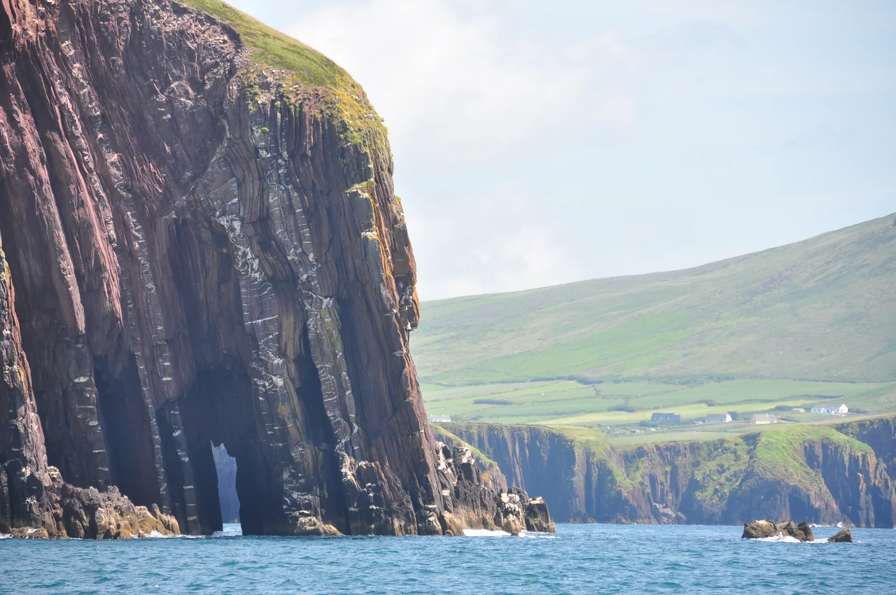

Dingle Bay
On the morning of 21 May 1927, after thirty-three and a half hours of flight from New York, Charles Lindbergh looked down through the windscreen of the Spirit of St. Louis and saw land. It was Dingle Bay. He had crossed the Atlantic alone. The bay below him — forty kilometres long, twenty wide at the mouth, flanked by two peninsulas reaching west into the ocean — was the first European feature he saw, and the moment was preserved later in the 1957 film The Spirit of St. Louis, where Jimmy Stewart, playing Lindbergh, dips a wing and waves down at the villagers. The reality was probably less dramatic. The bay would have looked grey and immense, the cliffs of Kerry sliding into shadow as the sun climbed behind him.
Two Peninsulas, One Bay
Dingle Bay is what geographers call a drowned river valley — a long inlet from the Atlantic, with the Dingle Peninsula reaching out along its north shore and the Iveragh Peninsula doing the same to the south. The bay runs roughly forty kilometres from its head, where the River Maine empties in at Castlemaine, out to the Atlantic mouth between Slea Head and Bolus Head. At its wide entrance it spans twenty kilometres of open water; at the head, only three. The shape funnels Atlantic swells inland, where they break across long sandy strands. Inch Strand alone stretches more than five kilometres into the bay, a tongue of dune-backed sand that has appeared in films and on countless postcards.
Birds and Estuaries
Part of Dingle Bay is a protected lowland estuary with tidal flats — exposed at low water in a vast plain of mud and worm-cast sand, covered again as the tide returns. The flats feed huge populations of wintering wildfowl and waders: brent geese arriving from the Arctic, golden plover wheeling in tight flocks, curlews probing the wet sand with their long curved bills. On the Iveragh side, the cliffs at the southern entrance support a bird sanctuary that is an important breeding site for the red-billed chough — a glossy black corvid with crimson legs and beak, increasingly rare across much of its European range. Above the cliffs lie grasslands and heath, where the choughs forage for insects.
The Towns Around the Edge
Dingle town sits on the north shore, the only town on its peninsula and the main settlement of the bay. Smaller villages dot the coastline: Ventry, with its long crescent strand; Annascaul, where the polar explorer Tom Crean ran a pub called the South Pole Inn after returning from Shackleton's expedition; Kinard and Beenbane on the headlands between. On the south shore, Glenbeigh and Killorglin look out across the water from the Iveragh side. Killorglin sits at the very head of the bay where the River Laune meets the salt water, and once a year it hosts Puck Fair — three days in August when a wild mountain goat is crowned king of the town. The bay is a stage for all of it.
Lindbergh Overhead
It was a quiet farming community in 1927, with no expectation that aviation history was happening overhead. Lindbergh had been alone in the cockpit for over a day, fighting sleep, eating little, navigating by dead reckoning and a glimpse of the stars when clouds permitted. When the Irish coast resolved out of the morning haze, he was south of his intended route — Dingle Bay was not where he had aimed for, but it was unmistakeably Europe. Some accounts say he flew low over fishing boats and that crews looked up, startled. He carried on east, over Cornwall, France, and into Le Bourget that evening, where one hundred and fifty thousand people waited to mob the plane. The bay below him kept fishing.
From the Air
Centred at 52.07°N, 10.20°W, the bay opens westward into the Atlantic. Length roughly 40 km, width up to 20 km at the entrance. Nearest airports are Kerry (EIKY) about 35 km east-northeast, and Cork (EICK) about 110 km east. Recommended viewing altitude 4,000–8,000 feet for a clear sense of both peninsulas framing the bay. Inch Strand and the estuary at the head are most photogenic at low tide; the cliffs at the southern entrance reward closer inspection at lower altitude.
Nearby Stories
- Ballyheigue Castle 1 km away
- Killemlagh Church 2.8 km away
- Pouldergaderry Sinkhole 6.8 km away
- Derreen Garden 11 km away
- Kilkee 59 km away
- The Laki Eruption: The Volcano That Changed World History 1366 km away
- The Northern Lights: The Sky Show That Vikings Thought Was Bridge to the Gods 1469 km away
- Sao Miguel 1935 km away