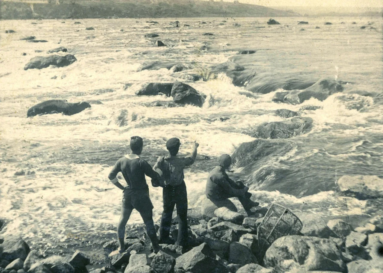

Dnieper Rapids
The loudest of them was called the Insatiable, and locals had a blunter name still: Peklo, Hell. For most of recorded history the Dnieper did not flow gently through this stretch of Ukraine. Below the site of present-day Dnipro the river turned south and hurled itself over a barrier of ancient granite, dropping fifty meters across sixty-six kilometers in a chaos of cataracts and whirlpools. Nine major rapids, dozens of smaller ones, sixty islands: for millennia this was a place that broke boats and drowned travelers, and its roar could be heard from kilometers away. The city downstream is called Zaporizhzhia, a name that means, simply, 'beyond the rapids.' Today you cannot see any of it. The rapids are gone.
A Barrier of Ancient Stone
The rapids were the work of the Ukrainian Shield, one of the oldest pieces of crust on the continent, whose granites and gneisses broke the surface here and refused to yield to the river. Where softer ground let the Dnieper run smooth for hundreds of kilometers, this ridge of hard rock forced it into a churning descent. Ukrainian tradition counted nine great cataracts, each with its own name and character. The largest, Nenasytets, the Insatiable, ran more than two kilometers long and over a kilometer wide, a roaring wall of white water. Another was named Lyshnii, the superfluous one, because it was so tame it hardly troubled a boat at all. Together they made the river almost impossible to navigate, a natural fortress wall of moving water guarding the approaches to the lower Dnieper.
The Road of the Vikings
Danger did not stop the traffic; it only shaped it. The rapids formed a crucial link in the medieval trade route 'from the Varangians to the Greeks,' the artery down which Scandinavian and Rus merchants carried goods from the Baltic toward Constantinople. In the tenth century the Byzantine emperor Constantine VII described the passage in detail, recording the names of the rapids in both the Slavic and the Norse tongues, testimony to the mingled peoples who ran this river. Traders had to unload and portage their ships overland around the worst cataracts, and here, exposed and burdened, they were easy prey. The Pecheneg nomads of the steppe lay in wait. Around 972 the Rus prince Sviatoslav ignored a warning to avoid the rapids and was ambushed and killed by them near the island of Khortytsia. The Pechenegs, chronicles report, made his skull into a gilded drinking cup.
Drowned in a Decade
What countless centuries of water had carved, one generation of engineers erased. Between 1927 and 1932 the Soviet Union built the great Dnieper Hydroelectric Station at Zaporizhzhia, damming the river just below the cataracts. The reservoir that rose behind it lifted the Dnieper by dozens of meters and closed over the rapids entirely, turning the once-impassable stretch into a placid navigable waterway. The Insatiable fell silent. The islands vanished. The trade route's ancient obstacle course, the ground where Sviatoslav died and Vikings hauled their boats, slid beneath a manmade lake and stayed there. The Dnieper rapids survive now only in old maps, in the chronicles of emperors, and in the name of a city that still calls itself the place beyond a set of rapids no living person has ever seen.
From the Air
The drowned rapids lie along the Dnieper between Dnipro and Zaporizhzhia, centered near 48.183 N, 35.189 E, now beneath the Dnieper Reservoir. From 2,000 to 4,000 feet AGL the broad reservoir, the granite banks, and the DniproHES dam and island of Khortytsia near Zaporizhzhia are the landmarks. Nearest airports are Dnipro International (UKDD) to the north and Zaporizhzhia (UKDE) to the south.
Nearby Stories
- Trinity Cathedral, Samar 13 km away
- 1979 Dniprodzerzhynsk Mid-Air Collision 14 km away
- Zaporizhzhia 22 km away
- Battle of Dibrivka 46 km away
- Aeroflot Flight 3630 77 km away
- Kryvyi Rih 106 km away
- Azov Upland 116 km away
- Second Battle of Kharkov 122 km away