
Doris (Greece)
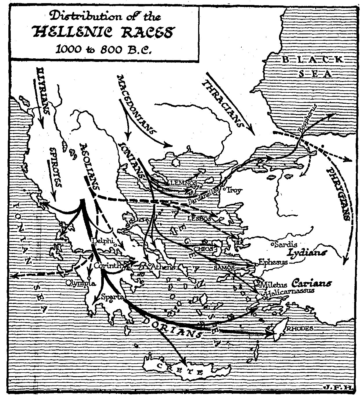
Herodotus measured it at 30 stadia across at its widest point — roughly three miles. It was walled in by Mount Oeta to the north and Mount Parnassus to the south, drained by a small river now called the Apostolia, and home to four towns so minor that most Greeks had probably never visited any of them. Yet tradition insisted that Doris was the Metropolis: the original homeland of the Dorian Greeks, the mother-country of Sparta, Corinth, and a colonial empire that stretched from Sicily to the coast of Asia Minor. Whether you believe the myth or the scholars who dispute it, the valley's claim remains extraordinary.
Four Towns and a Big Claim
The Doric Tetrapolis — the four-city league of Doris — consisted of Erineus, Boium, Cytinium, and Pindus (also called Akyphas). Erineus was the most important, sometimes called Dorium. Herodotus, writing in the fifth century BC, placed the district between Malis and Phocis, which matches the valley of the Apostolia river, a tributary of the Cephissus, perfectly. The valley's opening faces south toward Phocis but sits higher than the Cephissus lowlands, giving it a cool, enclosed character that the ancient geographers consistently noted. Strabo, describing the region centuries later, found Dorian settlements spread along Mount Oeta beyond the valley itself — the Dorians, it seemed, had never been strictly confined within these narrow limits. A mountain pass led across Parnassus from Doris to Amphissa in Ozolian Locris; at its head stood Cytinium, which suggests the district had genuine strategic value despite its small size.
The People Before the Dorians
Doris, the tradition held, was not always called Doris. Before the Dorians arrived, the valley was called Dryopis, named for its earlier inhabitants the Dryopes. According to the mythological accounts, Heracles and the Malians expelled the Dryopes from the valley, making room for the people who would eventually give the district their name. Whether this reflects any historical memory or is simply origin-story layering is impossible to say. Herodotus recorded a migration narrative of his own: the Dorians had previously lived in Phthiotis, then at the foot of Ossa and Olympus, then on Mount Pindus, then in Dryopis, before finally arriving in Doris. Each migration is attributed to expulsion by someone else — the Cadmeans, then circumstances that are left vague. Herodotus himself was careful to note that his account rested on tradition rather than historical evidence.
From This Valley to Peloponnesus
The Lacedaemonians took their responsibility to their metropolis seriously. On more than one occasion, Sparta sent military assistance to Doris when the Phocians or other neighbors threatened. Thucydides notes that Doris was a flashpoint for tension between Sparta and Phocis a full generation before the Peloponnesian War. During the invasion of Xerxes, the towns of Doris submitted to the Persians — and, as a result, were spared the destruction that Phocian towns suffered. In the third century BC, the Doric Tetrapolis joined the Aetolian League, a pragmatic alliance that reflected the valley's need for protection. The wars of the Phocians, Aetolians, and Macedonians took their toll. By the time Strabo wrote in the Roman period, he marveled that any trace of the old towns remained at all.
A Name That Outlasted Its Cities
Today the modern municipality of Dorida covers roughly the same geographic area as the ancient district. The name survived everything — the Phocian wars, the Macedonian conquest, the Roman absorption, the Byzantine centuries, the Ottoman occupation — and it still sits on maps of central Greece, just south of Mount Oeta, between the same mountains that Herodotus described. The valley of the Apostolia river is quiet now, without the political weight it once carried. But the word Dorian still appears in every history of ancient Greece, every account of architecture, dialect, and colonization that spread Doric culture across the Mediterranean. All of it traces back, at least in the ancient telling, to this small mountain valley that a passing traveler could cross in an afternoon.
From the Air
Ancient Doris lies at approximately 38.68°N, 22.43°E, in the valley of the Apostolia river between Mount Oeta to the north and Mount Parnassus to the south. From the air the valley is visible as a narrow corridor of lower ground between the two massifs, opening southward toward the Cephissus basin. The nearest major airport is LGBL (Nea Anchialos / Volos), approximately 100 km to the northeast; LGAV (Athens) lies roughly 170 km to the south. The modern settlement of Delphi on Mount Parnassus makes a useful visual reference to the south. Terrain is rugged throughout this region; maintain safe cruising altitude when transiting between the Thessalian plain and the Boeotian lowlands.
Nearby Stories
- Boeotia 6.7 km away
- Prousou Monastery 12 km away
- Crissa 13 km away
- Abae 14 km away
- Amaliapolis 16 km away
- Agrafa 18 km away
- Rio–Antirrio Bridge 20 km away
- The 1954 Sofades Earthquake 27 km away