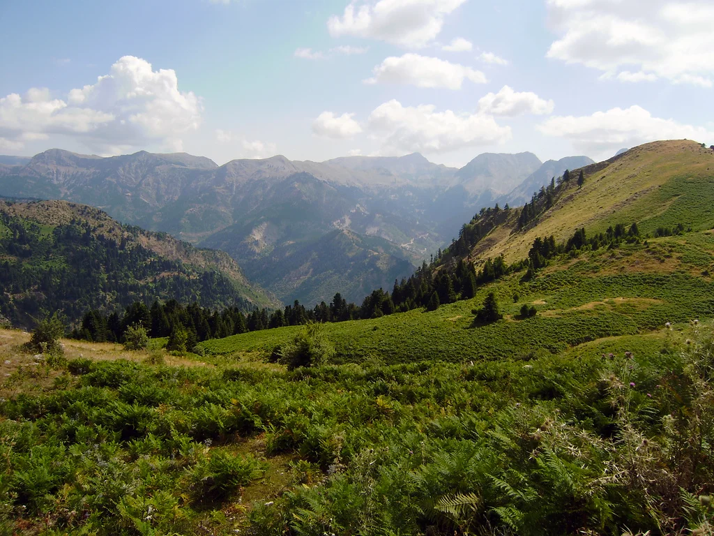

Agrafa
The name is the story. Agrafa means 'the unwritten' in Greek, and the reason is administrative: the Ottoman Empire, which controlled the rest of Greece for roughly four centuries following its expansion into the region around 1450, could not get its record-keepers into these mountains. The terrain — a central valley enclosed on three sides by walls of rock rising to 2,000 meters, draining to the south through gorges that were often impassable — defeated the bureaucratic machinery of one of history's most effective empires. The Ottomans recognized this formally in a treaty of 1525, acknowledging the Agrafa's right to its own militias and dispute-resolution systems. In the calculus of conquest, the mountains were more trouble than they were worth. The people who lived in them, known as Agrafiotes, took the unwritten status as a point of pride and a way of life.
A Landscape That Negotiated Its Own Terms
The physical reality of the Agrafa makes the history legible. The Agrafiotis River runs through a central valley hemmed in on three sides by a steep mountain wall. To the south, the river finds its way out through a series of narrow, often impassable gorges before draining into Lake Kremasta, a man-made reservoir. The Tavropos River — also known as the Megdovas — feeds two other reservoirs: Lake Plastiras to the north and Kremasta to the south. Before those dams were built in the 20th century, the rivers were wild and the gorges were natural barriers more effective than any fortification. The region occupies parts of two administrative units: the Evrytania regional unit to the south and the Karditsa regional unit to the north. It represents the southernmost portion of the Pindus range, where those mountains make their last complicated stand before the terrain begins to open toward the plains.
Four Hundred Years of Self-Governance
Most of the forests surrounding Agrafa's villages were controlled for centuries by Greek Orthodox monasteries — a common arrangement in regions where the Church provided the only institutional continuity across regime changes. The Agrafiotes purchased tracts of that forest land from the monasteries generations ago, and those forests remain in communal hands today. This pattern of communal ownership reflects something deeper about how the region organized itself during the long Ottoman period. Without tax rolls, without administrative incorporation, the Agrafa developed its own social structures: local militias, community arbitration, collective management of shared resources. Agrafa also functioned as a refuge for Greeks from more accessible regions, fleeing Ottoman authority or simply seeking a place where their language and culture could be maintained without interference. It became, paradoxically, one of the centers of Greek literacy during a period when the empire was not investing in Greek education.
The Road Out, and the Roads Back
In the 20th century, the same isolation that had protected the Agrafa became a reason to leave. Starting in the 1920s, Agrafiotes began migrating — to Athens, to Thessaloniki, to the United States, Canada, Australia, and Germany. The abject poverty of mountain subsistence farming, combined with the near-total absence of economic opportunity, drove generations away. Migration slowed after the fall of the Greek military junta in 1974, which brought political and economic changes to the country, but it never stopped. The largest community of Agrafiotes outside Greece today is in Charlotte, North Carolina — a fact that sits oddly beside the image of these remote stone villages perched on Pindus ridgelines, but makes complete sense in the logic of chain migration, where one family's departure becomes another family's route out.
Plastiras and the Dam That Changed Everything
The most consequential person to emerge from the Agrafa was Nikolaos Plastiras, a colonel who became prime minister of Greece after the Civil War. His ambition for the region was practical and transformational: he envisioned a hydroelectric dam that would supply electricity to nearly all of mainland Greece, excluding the Peloponnese, while simultaneously creating an irrigation system for the agricultural plains of Thessaly. The Plastiras Dam was built beginning in the 1950s, and the lake that formed behind it — Lake Plastiras — has since become a tourist destination in its own right, with a shoreline of unusual beauty for an artificial reservoir. The majority of the workers who built the dam were Agrafiotes themselves, which means the people the mountains had made self-sufficient enough to survive without the empire were also the people who brought the electrical age to the rest of the country.
What the Mountains Keep
Traditional life in the Agrafa involved orchards, farming, shepherding, and textile production — cold-weather crops on poor soils, supplemented by whatever the forests could provide. Before modernization, this was a complete economy if not a comfortable one. The forests that the communities purchased from the monasteries continue to generate timber revenue that benefits the villages collectively, a centuries-old arrangement still functioning today. The Agrafa is not heavily visited; the roads that now connect it to the outside world are mountain roads, slow and winding, subject to snow. What visitors find when they arrive is one of the more authentically unaltered corners of Greece: small stone villages, old bridges over fast rivers, a landscape that earned its name by making itself difficult to reach, and a population that has been, by necessity and by choice, largely the authors of its own story.
From the Air
The Agrafa region centers on approximately 39.140°N, 21.649°E, in the Evrytania and Karditsa highlands of central Greece. From altitude, the terrain appears as an unbroken mass of forested ridges and deep river valleys with almost no visible roads or settlements — which reflects the reality on the ground. Lake Plastiras and Lake Kremasta are identifiable landmarks from the air, framing the Agrafa region to the north and south respectively. Recommended viewing altitude for regional orientation is 10,000–14,000 feet. The nearest major airport is LGBL (Nea Anchialos National Airport, near Volos), approximately 80–90 km to the northeast. Athens Eleftherios Venizelos (LGAV) is roughly 190 km to the southeast. The Pindus ridgelines in this area reach 2,000 meters; IFR conditions and icing can develop rapidly in winter months.
Nearby Stories
- Battle of Peta 8.3 km away
- Acarnania 11 km away
- Prousou Monastery 11 km away
- Mount Oeta 12 km away
- The 1954 Sofades Earthquake 13 km away
- Dodona 33 km away
- Meteora: The Monasteries Built on Impossible Pillars 39 km away
- Tempi Train Crash 61 km away