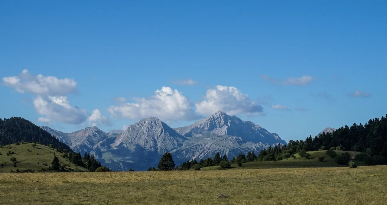

Mount Oeta
Heracles, the story goes, climbed this mountain to die. Poisoned, in unbearable pain, he ascended through the fir forests to a high plateau, built a pyre from timber, lay down upon it with his club as a pillow and his lion skin spread over him, and told his companion Philoctetes to light the fire. Roman poets called him Oetaeus — the man of Oeta — and a third-century BC temple built on the plateau at 1,800 meters honored the spot where the hero burned and became a god. The temple ruins survive near the village of Pavliani. The mountain is still standing too, at 2,152 meters — Greece's sixth national park since 1966 — draped in fir forest and threaded with gorges, as untamed as mythology requires.
A Mountain of Gorges and Water
Oeta's northern face drops steeply into the Spercheios rift valley, cutting a series of deep gorges as it falls. The most famous of these, the Gorgopotamos gorge, is matched by the Asopos gorge to the east, which historically provided the main passage between the Spercheios valley to the north and the Boeotian Cephissus valley to the south — its northern exit emerging close to Thermopylae. The mountain's hydrology is complex: limestone and flysch create a network of sinkholes and caverns, feeding springs and seasonal ponds on three high plateaus — Livadies, Amaliolaka, and Katavothra. From these plateaus spring three major rivers: Gorgopotamos and Asopos from the east, Vistriza from the west, all flowing eventually into the Spercheios. The tallest peak, Pyrgos, reaches 2,152 meters; the second, Greveno, stands at 2,117 meters. Twenty-two villages are scattered across the mountain's flanks, from Ypati in the north to Pavliani in the south.
The Mountain of Flowers
Botanists have recorded 1,149 plant species on Oeta — roughly 20 percent of all flora found in Greece. The mountain hosts two endemic species found nowhere else on Earth: Veronica oetaea, a critically endangered plant found only on the Livadies plateau, and Allium lagarophyllum, documented in the Gorgopotamos and Asopos gorges. Greek fir (Abies cephalonica) dominates the slopes, covering more than a third of the mountain between specific altitude bands. Black pine grows in an isolated patch on the northeast. Lower down, oak forests mix with strawberry tree and mastic. In the gorges, planes and willows line the riverbanks. The meadows above the treeline — covering slightly more than ten percent of the mountain, an unusually high proportion — burst with lilies, crocuses, orchids, irises, and violas in spring, which is why the mountain earned the nickname that locals still use: "the mountain of flowers." Brown bears, wolves, and Balkan chamois inhabit the higher zones; the chamois is the park's symbol. Golden eagles and peregrine falcons patrol the updrafts above the gorges.
Sorceresses, Emperors, and Catalans
The women of ancient Hypate, at the mountain's northern base, had a reputation for witchcraft. Two sorceresses named Mycale and Agaonice — called the Pharmacidae — were said to inhabit the area in antiquity. The tradition persisted: even in relatively recent times, a precipice near the town called Anemotrypa was held to be the haunt of a supernatural crone. History came and went across the mountain in more documented forms as well. The Agathonos Monastery, dating at least to the fifteenth century, sits on the northern slopes near Ypati, watching the valley below. In the thirteenth century, Hypate was the capital of the independent Greek rulers of Thessaly — John I Doukas, Constantine Doukas, and John II Doukas — before the Catalan Company seized it in 1319, forming the Duchy of Neopatras as a vassal of the Duchy of Athens. The Ottomans took it in 1394. On the eastern slopes stood the fortress town of Siderokastron in the thirteenth and fourteenth centuries, its stones now scattered.
The Night the Bridge Came Down
On 25 November 1942, at 1:30 in the morning, explosions shook the Gorgopotamos gorge. A combined force of British Special Operations Executive sappers, Greek ELAS fighters, and Greek EDES fighters had spent hours fighting their way through an Italian garrison and improvising explosive charges when the bridge's steel girders turned out to be the wrong shape for the pre-cut demolitions. The central pier collapsed, two spans fell into the gorge, and a second explosion at 2:21 brought down the remaining span. By 4:30, the entire attacking force — 150 men, with only four wounded — had pulled back into the mountains. The railway line between Athens and Thessaloniki was cut. The original strategic objective — disrupting supplies to Rommel's forces in North Africa — had already been overtaken by events at El Alamein. But the operation demonstrated to the Allies what Greek resistance could accomplish, and it has been remembered in Greece ever since as one of the most significant acts of the occupation years. The gorge below Oeta still carries the river named Gorgopotamos, still as dark and narrow as it was on that November night.
From the Air
Mount Oeta lies at approximately 38.82°N, 22.28°E in central Greece, straddling the boundary of Phocis (south) and Phthiotis (north). The summit Pyrgos reaches 2,152 meters — a significant terrain obstacle. The mountain is identifiable from altitude by its broad forested mass contrasting with the deep-cut Gorgopotamos and Asopos gorges on its eastern and northern flanks. The Spercheios river valley is the major landmark to the north; Thermopylae lies approximately 15 km to the northeast. Nearest major airport: LGBL (Nea Anchialos / Volos), approximately 70 km northeast. Athens LGAV is roughly 180 km to the south. Mountain wave turbulence is a factor in strong northwesterly or northerly flow. Approach from the Spercheios valley for best orientation; the Kremastos waterfall on the northern slopes is one of the tallest in central Greece.
Nearby Stories
- Boeotia 6.7 km away
- Prousou Monastery 12 km away
- Crissa 13 km away
- Abae 14 km away
- Amaliapolis 16 km away
- Agrafa 18 km away
- Rio–Antirrio Bridge 20 km away
- The 1954 Sofades Earthquake 27 km away