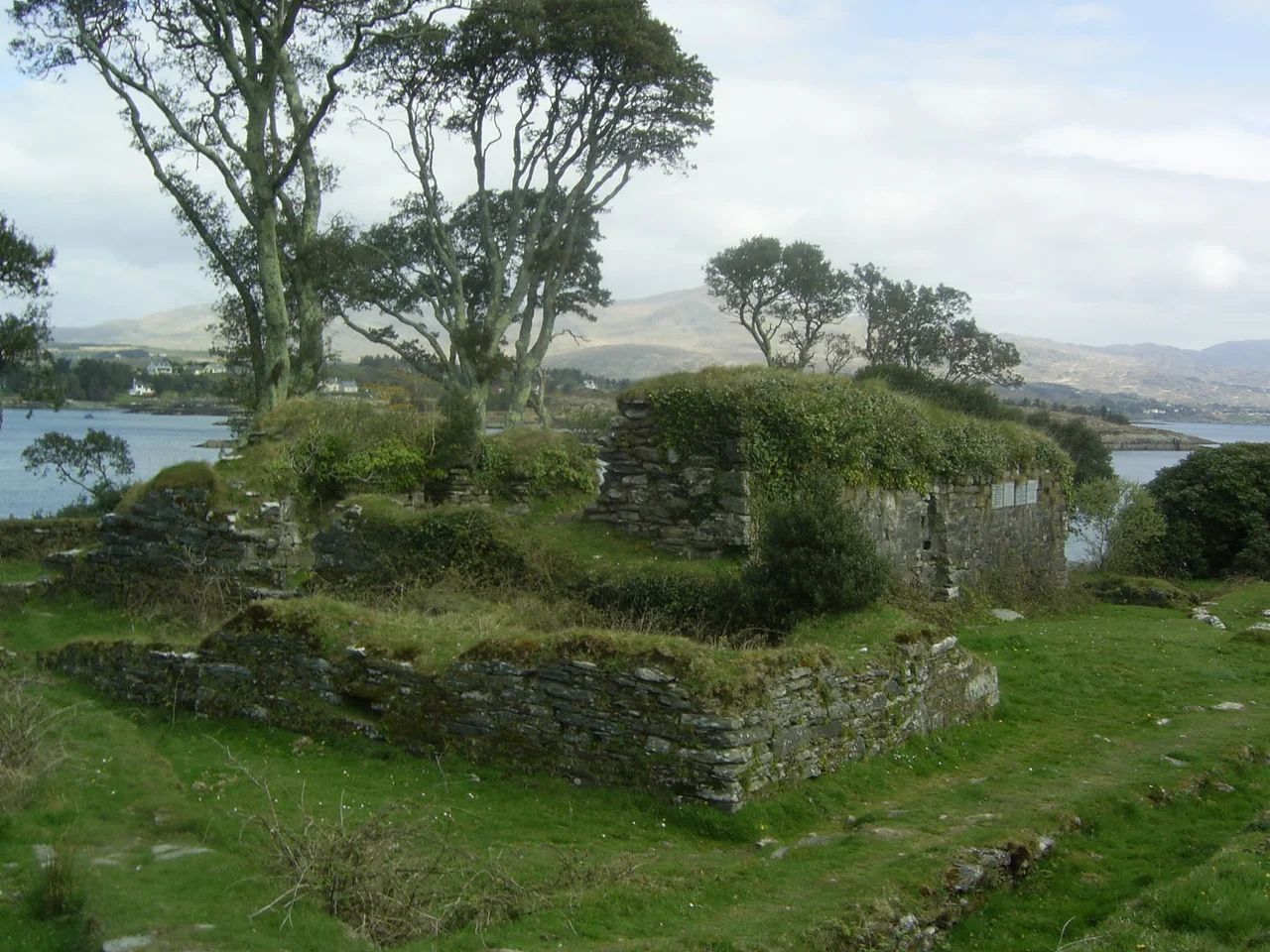

Dunboy Castle
The walls of Dunboy do not so much stand as refuse to fall over. Sea wind has been working on them for four centuries since they were last cared about by anyone with a hammer, and the masonry that the English guns broke in 1602 has weathered into something between a building and a tideline. From the rough headland above Berehaven you can still trace the rectangle of the bawn, the footings of the tower house, and the gap where the cannonball found the stairwell.
Built for the Harbour
The castle went up in the fifteenth century because whoever held this stone held the harbour, and whoever held the harbour controlled who came and went from southwest Munster. The O'Sullivan Bere clan built it as a tower house with a defensive courtyard - a bawn - around the base, the standard form for a Gaelic Irish stronghold of the late medieval period. The location was chosen with care. Berehaven Sound is sheltered between the Beara mainland and Bere Island; ships could ride out the worst Atlantic weather inside it, and the castle's guns commanded the channel. For most of two centuries the O'Sullivans drew tolls from the fishing boats and the trade ships that passed under their walls, and the tower was the visible expression of who, in this corner of Ireland, gave the orders.
The Last Stand
In June 1602, Dunboy became the scene of one of the most desperate engagements of the Nine Years' War. Donal Cam O'Sullivan Beare had rebelled against Elizabeth I in alliance with the other Gaelic lords and with Spanish backing. After the alliance collapsed at Kinsale, he refused to surrender. Queen Elizabeth sent a five-thousand-strong army under Sir George Carew to take the castle. The garrison numbered one hundred and forty-three. They thought the walls impregnable. The walls were not. Carew's gunners, told where the weak point in the masonry lay, smashed an entry over ten days of bombardment. The defenders fought hand to hand among the rubble. The fifty-eight men captured alive were taken two miles east to Castletownbere and hanged in the market square.
What the English Left
After the siege, the English had no use for a Gaelic stronghold that had given them so much trouble, and the ruins were left where they lay. In the middle of the seventeenth century a small bastion fort - one of the angular, gunpowder-era designs replacing medieval walls all over Europe - was raised on the same site for a different purpose, but it too fell into disuse. When the late nineteenth-century mining boom brought the Puxley family to the Beara Peninsula on the strength of the Allihies copper, they built a vast Gothic Revival mansion close to the old castle and called it, confusingly, Dunboy Castle. The IRA burned the Puxley mansion in 1920. It stood as a roofless shell for most of the twentieth century before a brief and ultimately bankrupt resort restoration left it sold again in 2022.
The Plaque and the Grass
What remains of the original Dunboy is a low irregular outline of dressed stone laced through with wild grass and sea pinks. A plaque set into the standing wall reads, in Irish and English, in memory of the heroes who fell at Dunboy in June 1602 for country and faith - may their souls rest in peace. The site was surveyed in the late 1960s by Edward M. Fahy, an arachnologist whose careful drawings recorded what was left of both the medieval tower and the seventeenth-century fort. Visitors walk out from Castletownbere along a quiet road, follow the path through the trees, and find the ruins exactly where the O'Sullivans built them - low to the water, watching the channel, still holding the line they were built to hold.
From the Air
Dunboy Castle at 51.633 N, 9.924 W, on the south coast of the Beara Peninsula two miles west of Castletownbere. The ruins sit just above the shoreline of Berehaven Sound; Bere Island lies opposite. Cork Airport (EICK) is approximately 90 nm east; Kerry Airport (EIKY) is 35 nm north. Coastal weather is changeable - clear mornings often give way to afternoon cloud rolling in from the Atlantic over the Slieve Miskish range. Recommended viewing altitude 1,000-2,000 ft AGL for both castle ruins and the Puxley mansion shell nearby.
Nearby Stories
- Iveragh Peninsula 4.6 km away
- Ballydehob 5 km away
- Battle of Callann 5.2 km away
- HMHS Llandovery Castle 8.9 km away
- Inishvickillane 21 km away
- SM U-68 41 km away
- RMS Lusitania 66 km away
- Sao Miguel 1909 km away