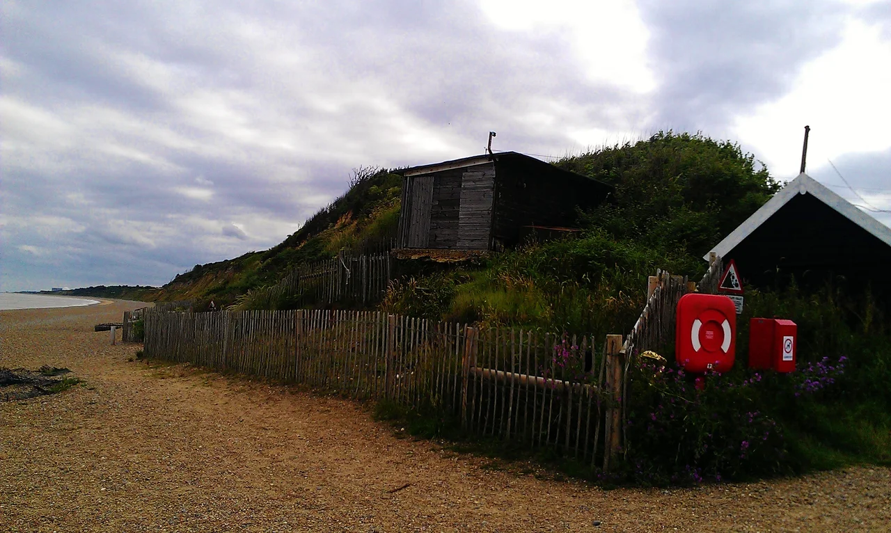

Dunwich
On 1 January 1286 a storm surge reached the eastern edge of Dunwich and destroyed buildings that had stood for generations. Two more surges came the next year. Then the great Grote Mandrenke on 16 January 1362 finished most of what was left. Eight churches, the town hall, the priories, the houses of a port that had rivalled fourteenth-century London in area: all of it went, one cliff fall at a time, over six centuries. Local people say the church bells can still be heard ringing under the waves at certain tides. The archaeology says the ruins are still down there, and divers have stood among them.
The Capital That Was
In the Anglo-Saxon period Dunwich was the seat of bishops, possibly the Dommoc established for Saint Felix around AD 629-31 by Sigeberht, king of the East Angles, though many historians now place Dommoc at Walton Castle instead. By the Domesday Book of 1086 Dunwich had three churches and around 3,000 inhabitants. At its medieval peak in the thirteenth century the town possessed eight churches, a Templar church, two friaries, a Leper Hospital, a town hall, shipyards, and a harbour where the River Dunwich met the North Sea, all on a similar area of ground to fourteenth-century London. The town hall was important enough that it gave its corporation the right to send two MPs to Parliament. After most of the town was gone, the seat survived as one of Britain's most notorious rotten boroughs, with the right finally abolished by the Reform Act of 1832.
The Storms That Drowned It
The decline began in the New Year storm of 1286. February 1287 brought the South England flood. December 1287 brought St Lucia's flood. There was another fierce storm in 1328. The Grote Mandrenke of January 1362, a North Sea catastrophe that killed tens of thousands in the Low Countries, finished much of what remained of Dunwich. The storms by themselves did not kill the town. The deeper damage was to the river. Coastal processes shifted the mouth of the River Dunwich about 2.5 miles north to Walberswick, on the River Blyth, and Dunwich lost its raison d'etre as a sheltered harbour. Once trade went elsewhere, the sea defences stopped being maintained. The cliff retreated, year after year. By the mid-nineteenth century the population had dwindled to 237 inhabitants and a gazetteer described it as a decayed and disfranchised borough. The town hall itself had long since fallen into the sea, and the corporation moved into a cottage that survives today as the Old Town Hall.
All Saints' and the Last Gravestone
All Saints' Church was the last of the medieval parish churches still standing. The parishioners abandoned it in the 1750s because they could no longer afford the upkeep, and burials in the churchyard continued until the 1820s. By 1904 the cliff edge had reached the church itself. The structure collapsed in pieces between 1904 and 1919, the last major portion of the tower coming down on 12 November 1919. One of the tower buttresses was salvaged and stands today in the Victorian-era St James' Church, which was built in 1832 to replace All Saints'. J. M. W. Turner painted the dying church around 1827, seamen struggling to launch a boat through the surf below the spectral ruins. John Nash painted the falling tower in 1919. One of the last gravestones, that of John Brinkley Easey, went over the cliff in the early 1990s. In 2022, only one stone remained, a marker to Jacob Forster who died in the late eighteenth century, about fifteen feet from the cliff edge.
Britain's Atlantis Beneath the Waves
The Dunwich 2008 project, funded by English Heritage and the Esmee Fairbairn Foundation, used multibeam sidescan sonar and aerial photography to map what was left of the town on the seafloor. Divers brought up stones with lime mortar still attached, and the mortar matched almost perfectly the medieval mortar of surviving churches on the coast. In 2010 the BBC One Show used DIDSON acoustic imaging cameras to film the ruins through the turbid water. The jumble of worked stone associated with the medieval churches and chapels was clearly visible. The 2012 survey identified the ruins of St Peter's and St Nicholas's churches, a chapel that was probably St Katherine's, and structures associated with Blackfriars friary and the town hall. The Knight's Templar Church and All Saints' are now buried under an inner sandbank. The early Saxon town lies under one to three metres of sand to the east. Dunwich is the largest medieval underwater site in Europe. The village above the cliff today has about 183 people, depending on which census boundary you use, and a small museum that tells the eight-hundred-year story of the town's slow disappearance into the North Sea.
From the Air
Dunwich sits at 52.278 N, 1.631 E on the Suffolk coast, about 92 miles northeast of London. From 2,000-4,000 feet the village shows as a small cluster of houses behind a sandy beach, with the dark mass of Dunwich Forest inland and the Greyfriars ruins on the cliff just south of the village. The underwater town lies a few hundred metres offshore in shallow water. Nearby airfields: Norwich (EGSH) about 30 miles north, Wattisham (EGUW) 35 miles southwest. Watch for the cliffs continuing to retreat year on year, which is itself part of the visual story from the air.
Nearby Stories
- Burgh Castle 5.7 km away
- East Bergholt 6.7 km away
- RAF Great Ashfield 8.7 km away
- Battle of the Gabbard 15 km away
- Four Days' Battle 34 km away
- Southern Bight 57 km away
- SS Elbe 90 km away