
Burgh Castle
The walls are still there. Not ruins exactly - the Roman engineers built them too well for that. Three sides of a Roman fort, still rising 4.6 metres above the Norfolk turf, three metres thick at the base, with six bastions punctuating the perimeter. Walk up to them today and you can put your hand on stone that the Romans laid in the third century to hold back the Saxons. The Saxons came anyway. The walls remained.
Gariannonum
Archaeologists believe this is Gariannonum, one of the Saxon Shore forts the Romans built along the southeast coast to defend Britain from sea-raiders. The choice of site made perfect sense in the third century, even if it looks strange now. Today Burgh Castle sits on a slope overlooking the River Waveney, miles inland. But when the fort was built, the coastline was different - a wide estuary opened here, the same Gariensis that gave the fort its name, and the Roman walls stood right at its mouth. Anyone trying to sail up the estuary toward what would become Norwich had to pass under those walls and under the eyes of whoever was watching from them. The internal dimensions measure 205 metres by 100 metres - enough space for a substantial garrison and the small civilian settlement that always grew up alongside Roman forts.
St Fursey's Monastery
When the Romans left, the walls stayed. Anglo-Saxons used the fort. Then, in the early 630s, an Irish missionary called St Fursey may have founded a monastery within the walls - the Cnobheresburg recorded by Bede. The evidence is suggestive rather than conclusive: mid-twentieth century excavations by Charles Green uncovered a timber church in the southwest of the fort with a Christian cemetery attached. Whether or not this is Cnobheresburg, somebody early in Christian England chose to plant a church inside Roman walls, perhaps because the walls felt like a continuity, perhaps because they offered the kind of protection a wooden monastery could not provide on its own.
Norman Castle Within a Roman Fort
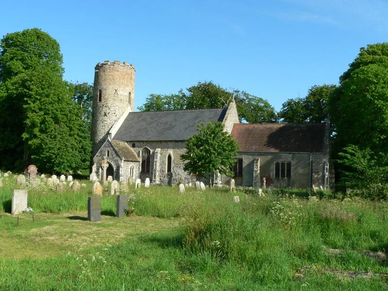
After 1066, the Normans found the same walls still useful. They built a motte-and-bailey castle inside the Roman fort, raising an earthen mound and timber stockade in the corner of a structure already a thousand years old. The medieval castle is gone now, dismantled by the mid-nineteenth century, but the Roman walls remain. The parish church just outside the fort tells a similar story of recycled stone: it's a Grade II* listed round-tower church dating mainly to the 13th century, and it incorporates significant amounts of Roman material almost certainly carried off from the fort. The Romans built, the Saxons borrowed, the Normans built, the medieval parish church borrowed - and at the centre of it all, the original walls still stand.
What You See Now
The Norfolk Archaeological Trust has owned the site since 1996, with English Heritage caring for the walls themselves. A footpath leads up to them across open ground. The view from the fort looks west over the River Waveney and Breydon Water to where the Roman ships once sailed - the modern river runs along the line of what was once the estuary's edge. Walk the perimeter and the six surviving bastions are easy to trace. Inside the walls, the ground rises and falls where centuries of buildings have come and gone. A stained-glass window in the parish church depicts St Fursey, the missionary who may or may not have prayed within these walls. The fort doesn't tell its story easily, but it does keep telling it - eighteen centuries on, in a Norfolk field.
From the Air
Burgh Castle Roman fort sits at 52.585 N, 1.654 E on the western edge of the modern town of Burgh Castle, roughly 3 miles southwest of Great Yarmouth. From altitude the rectangular footprint of the Roman walls is clearly visible at the top of a slope overlooking the River Waveney and the broad expanse of Breydon Water. Norwich Airport (EGSH) lies 18 nm west, London Stansted (EGSS) about 78 nm southwest. Best viewed at 1,500 feet on approaches to Great Yarmouth from the west.
Nearby Stories
- Redgrave and Lopham Fens 2.7 km away
- Cley next the Sea 4.8 km away
- East Dereham Windmill 7.1 km away
- Dunwich 12 km away
- Cromer Lighthouse 18 km away
- Battle of Lowestoft 58 km away
- Southern Bight 62 km away
- SM U-97 90 km away