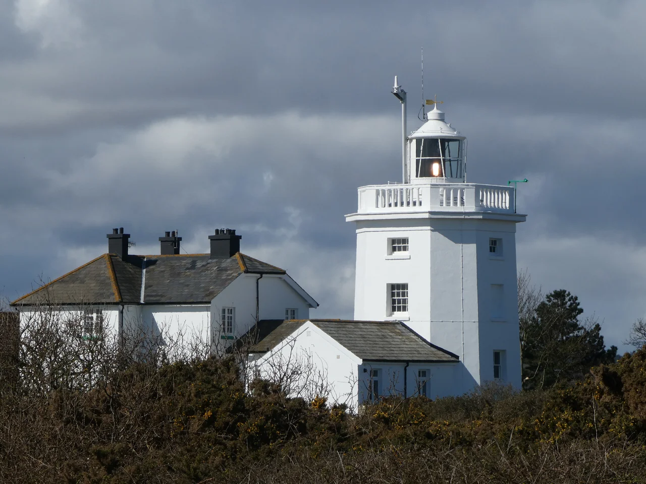

Cromer Lighthouse
Before there was a lighthouse at Cromer, there was a fire burning at the top of the parish church. Mariners passing the Norfolk coast used the church tower's light to navigate — an ecclesiastical convenience that reflected how urgently ships needed something to steer by on this stretch of the North Sea. In 1669, King Charles II granted a sixty-year patent to Sir John Clayton and his partner George Blake to build a proper lighthouse at Foulness, east of the town. The light has been burning, in one form or another, ever since.
A Patent and a Problem
The patent of 1669 came with complications. Trinity House — the authority responsible for English lighthouses — was 'rigorously opposed' to private individuals building navigational lights, seeing it as an encroachment on their domain. They lobbied against Clayton's enterprise among ship owners and raised legal objections at every opportunity. Despite this opposition, Clayton prevailed. The lighthouse first lit Michaelmas of that year: an octagonal brick tower, three storeys high, with a coal fire enclosed in a glazed lantern.
The dues set for passing vessels were a farthing per ton of general cargo and a halfpenny per chaldron of Newcastle coal. Payment, however, was only voluntary. The business model of early private lighthouses depended substantially on the goodwill of mariners who understood, rationally, that the light was worth paying for. In 1780, with the lease due to expire, it was extended for a further 42 years.
A Flash Every Minute
When the lighthouse was re-lit on 8 September 1792, Cromer became only the second lighthouse in England — after St Agnes in 1790 — to display a revolving, flashing light. The novelty irritated some seamen, accustomed to fixed lights, but the revolving characteristic was a technical advance. The optical apparatus took three minutes to complete a full revolution, producing one flash per minute. The light was said to be visible at 27 nautical miles.
By 1897 the lantern held fourteen mineral oil lamps and reflectors, revolving every two minutes. In 1905 the lighthouse converted to town gas — making Cromer the only sizeable Trinity House lighthouse to use it as an illuminant. The rotation speed increased to one revolution per minute, producing a flash every thirty seconds, with each lamp rated at 7,000 candle-power and a stated range of 20 miles to the horizon. By the mid-1950s, this was the last major lighthouse in Britain still using reflectors rather than lenses. Electrification came in 1958, when the reflectors were removed and a new optic installed. The light stands 275 feet above sea level.
Automated and Still Watching
In June 1990, the lighthouse was converted to automatic operation and is now monitored from the Trinity House Operations Control Centre at Harwich in Essex. The keeper's cottage alongside the tower is let out as a holiday apartment — the lighthouse itself remains inaccessible to visitors, though the ground around it is open.
In January 2025, the lighthouse was upgraded again: the revolving catadioptric drum optic and its lamp were removed and replaced with a flashing LED module that simulates the original characteristic. Three and a half centuries of technology have passed through this building. Coal fire, oil, gas, electricity, now LED — and in each case, the same function: a flash every minute, visible for miles, telling ships where the coast is. The church tower managed with a simple fire. Modern electronics manage with a module the size of a small cabinet. The cliff at Foulness is still there. Ships still pass.
From the Air
Located at 52.92°N, 1.32°E on the cliff top east of Cromer town centre. The lighthouse is clearly visible from altitude as a white tower on the clifftop, east of the town and north of the pier. At 275 ft above sea level, the structure provides an excellent visual landmark. Norwich International Airport (EGSH) is approximately 23 km to the southwest. The Cromer cliffs and pier are good orientation markers at 1,500–2,000 ft; EGSH airspace lies to the southwest, so check charts on approach.
Nearby Stories
- Castle Acre Castle and Town Walls 3.5 km away
- Brancaster 5.8 km away
- City of Norwich Aviation Museum 6.8 km away
- HMS Cobra 21 km away
- Alford Windmill 35 km away
- Battle of Lowestoft 83 km away
- SM U-97 95 km away
- Battle off Texel 119 km away