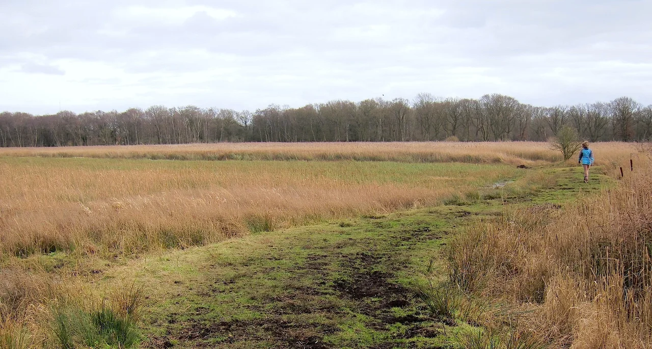

Redgrave and Lopham Fens
In 1959, a borehole was drilled at Redgrave and Lopham Fens to supply drinking water to the local population. It could draw 3,600 cubic metres a day from the underlying aquifer. Within a few years, the fens began to dry out. The springs that fed the wetland were being drained away, and by the early 1960s the site was cycling between summer drought and winter flood where there had previously been a stable year-round water supply. Scrub invaded. A 127-hectare fen that had been shaped by centuries of human use, and recognised since 1954 as a Site of Special Scientific Interest, was deteriorating.
England's Largest River Valley Fen
Redgrave and Lopham Fens occupies the headwaters of two rivers: the Waveney, which runs northeast to the Norfolk Broads, and the Little Ouse, which runs west toward the Fens. The site straddles the Suffolk-Norfolk border between Thelnetham and Diss. It is the largest remaining area of river valley fen in England, carrying a remarkable stack of conservation designations: a national nature reserve, a Ramsar internationally important wetland, a Grade I Nature Conservation Review site, and part of the Waveney and Little Ouse Valley Fens Special Area of Conservation. The habitats range from open water to reed and sedge beds, saw-sedge, purple moor-grass, heathland, and scrub — a mosaic that took centuries to develop and is extraordinarily difficult to maintain.
The Fen Raft Spider
One of only three sites in the United Kingdom where the fen raft spider — Dolomedes plantarius — is known to survive, Redgrave and Lopham hosts what is considered a nationally important population. The spider is large, semi-aquatic, and hunts on the surface of still water; it requires the specific conditions of undisturbed fen: stable water levels, undisturbed vegetation, and the kind of quiet that industrial agriculture disrupts. The site also supports 27 species of butterfly, 26 species of mammals including otters and pipistrelle bats, four species of amphibian, four species of reptile, and 96 species of bird recorded in a single survey year. The biodiversity is a product of the habitat complexity — which is itself a product of management.
Restoring the Water
The restoration project, funded in part by the European Commission's LIFE Fund, cost over £3.4 million and divided into three elements: borehole relocation, river restoration, and fen restoration. Finding a new borehole location that could supply the same water needs without drawing from the fen aquifer took years of testing. Eventually a site three kilometres southeast of the reserve was identified and developed at a cost of £1.2 million — the first time a public water borehole had been relocated on solely environmental grounds. The onsite borehole shut down in July 1999. Within one month, water levels at the fen began to rise. By summer 2002, the maximum groundwater recharge level had been reached, and the hydrological recovery closely matched the modelling predictions.
Managing a Living System
The Suffolk Wildlife Trust manages the reserve with a combination of professional staff and volunteers. Hebridean sheep and beef cattle graze the drier margins; in 1995 the trust introduced a herd of Polish Konik ponies — chosen for their hardiness and ability to graze in very wet conditions — to work the wetter areas. The success with Konik ponies at Redgrave and Lopham contributed to their wider adoption in other UK nature reserves and on the Norfolk Broads. Scrub clearance, sedge harvesting, coppicing, and reed mowing are ongoing tasks. The reserve runs three nature trails of 2, 3, and 4.5 kilometres; it has an education centre, picnic area, and toilet facilities. Coming here in the right season — the fen raft spider is active in summer — is to see something genuinely rare.
From the Air
Located at 52.38°N, 1.02°E on the Suffolk-Norfolk border between Thelnetham and Diss. The wetland is identifiable from the air by its open fen, reed beds, and the River Waveney running through it. Nearest airports: Norwich Airport (EGSH), approximately 22 miles northeast. Recommended viewing altitude 1,500–2,500 feet to appreciate the fen topography in relation to surrounding agricultural land. The B1113 road between Botesdale and Redgrave provides ground reference.
Nearby Stories
- Wicken Fen 4.5 km away
- Walden Abbey 7.6 km away
- Saxmundham 10 km away
- East Bergholt 11 km away
- RAF North Pickenham 13 km away
- Acle 13 km away
- Maunsell Forts 16 km away
- Wisbech & Fenland Museum 17 km away