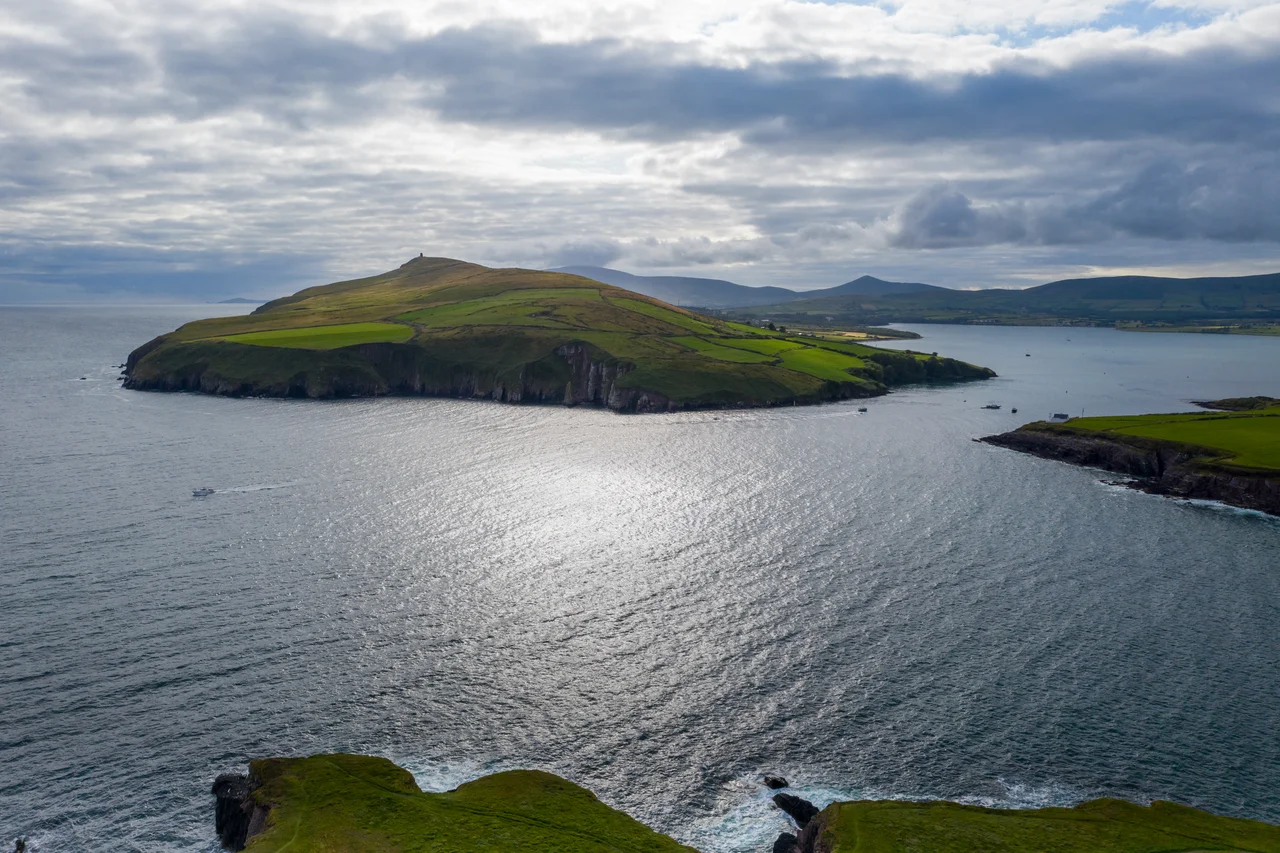

Eask Tower
A wooden hand points seaward from the top of Carhoo Hill, and it has been pointing for nearly two centuries. The Eask Tower was built in 1847, the worst year of the Great Famine, when entire parishes were emptying through emigration or death. Above Dingle Harbour, hungry men cut and stacked stone for a beacon whose only job was to keep boats from missing the narrow opening below. The structure they raised is solid the whole way through - not hollow, not habitable, just a finger of masonry on a hilltop, telling sailors where Ireland was hiding its harbour.
A Hand That Saves Boats
Dingle Harbour has what mariners call a blind mouth. From the sea, the opening is not where you would expect it to be - the headlands fold in such a way that the channel disappears against the cliffs until you are nearly on top of it. The Eask Tower was built to fix this. A wooden hand projecting from the masonry points the way in, and crews who saw it knew to slacken sail, lose speed and steer toward the finger rather than the rocks. The hand is still there. It still points. Boats running into Dingle on a misty Atlantic afternoon still aim for the same wooden joint of timber that pointed them home when Queen Victoria was on the throne and the potato crops were rotting in the fields below.
The Famine That Built It
1847 is remembered in Ireland as Black '47, the year the Great Famine reached its worst. The British government's response combined cash relief, soup kitchens and, controversially, public works - hard physical labour exchanged for wages just barely sufficient to buy food. Carhoo Hill is one of countless monuments to that scheme. Local men, weakened by hunger, hauled stone up a windy headland to build a navigation marker the rich landlords had decided would be useful. There is something exhausting in that arithmetic - a beacon for ships in a year when the people building it could not afford the fish those ships might bring home. And yet here it still stands, sturdy, plumb, looking out at the same horizon.
The View from the Top
Carhoo Hill is not high, but it sits in exactly the right place. From the base of the tower, the eye runs west along the spine of the Dingle Peninsula to the Blasket Islands, those dark humps that were inhabited until 1953 and have been silent since. Slea Head juts into the Atlantic. Ventry shelters behind its long beach. Across Dingle Bay, the Iveragh Peninsula rolls south toward the Ring of Kerry, and on a clear day the Skellig Rocks pierce the horizon - the same jagged crags that millennia of monks chose for their solitude. Turn inland and you face Carrauntoohil and Mount Brandon, two of Ireland's highest summits. Few hilltops on earth offer this much Irish geography in one full circle.
A Tower of Many Wars
The mariners' beacon was the original purpose, but the tower picked up extra duties as the centuries moved. The 19th-century beacon equipment was installed in the Victorian era, when the British Admiralty was mapping and lighting every coast it could reach. Then, during the Second World War, the Irish Defence Forces added a look-out post on top - one of dozens of LOPs strung along the neutral Irish coast to spot belligerent aircraft and submarines. The tower watched U-boats running into the Atlantic. It watched Allied bombers flying off course toward Brest. It is hard to think of another stone finger that has served quietly through famine relief, Victorian maritime science and two world wars.
Standing in the Wind
What strikes you, climbing Carhoo Hill from the harbour road, is how exposed the tower is. There is no shelter. The Atlantic wind comes off Slea Head and hits the hilltop without resistance. The locals say you can rarely stand at the base on a calm day. And yet the tower does not lean, does not crack, does not show the wear of nearly two centuries of weather. The Famine-era stonemasons knew their craft. They built solid where a hollow tower would have served just as well, perhaps because they had time on their hands, perhaps because work paid by the day rewarded slow careful labour. The result has the patience of geology - a marker that intends to last.
From the Air
Eask Tower stands on Carhoo Hill (52.116°N, 10.281°W), about 200 metres above sea level on the south side of Dingle Harbour. The solid stone tower with its projecting wooden hand is visible at low altitude in clear conditions. The nearest airport is Kerry (EIKY), roughly 40 nautical miles east near Farranfore. From cruise altitude, the tower is a small but recognizable point above Dingle town; descend below 2,000 feet for clear visual identification. Atlantic weather rolls in fast off Slea Head - check METARs at EIKY before approaching the peninsula.
Nearby Stories
- Ballyheigue Castle 1 km away
- Killemlagh Church 2.8 km away
- Pouldergaderry Sinkhole 6.8 km away
- Derreen Garden 11 km away
- Kilkee 59 km away
- The Laki Eruption: The Volcano That Changed World History 1366 km away
- The Northern Lights: The Sky Show That Vikings Thought Was Bridge to the Gods 1469 km away
- Sao Miguel 1935 km away