Eastern Province, Zambia
In 1968 the President of Malawi tried to annex this province. Hastings Kamuzu Banda, the autocrat running the country next door, declared that Eastern Zambia had been historically Malawian and should be returned. Zambian President Kenneth Kaunda responded in public with the kind of clarity that does not leave room for negotiation: he openly invited Malawi to wage war over the claim and made clear there would be no trade relations with Malawi until the demand was withdrawn. Banda backed down. Eastern Province stayed Zambian. The incident is mostly forgotten outside the region, but it marks one of the moments when post-colonial African borders came close to being redrawn by force, and one of the few times a smaller state confronted a larger neighbor's expansionism successfully.
The People of the East
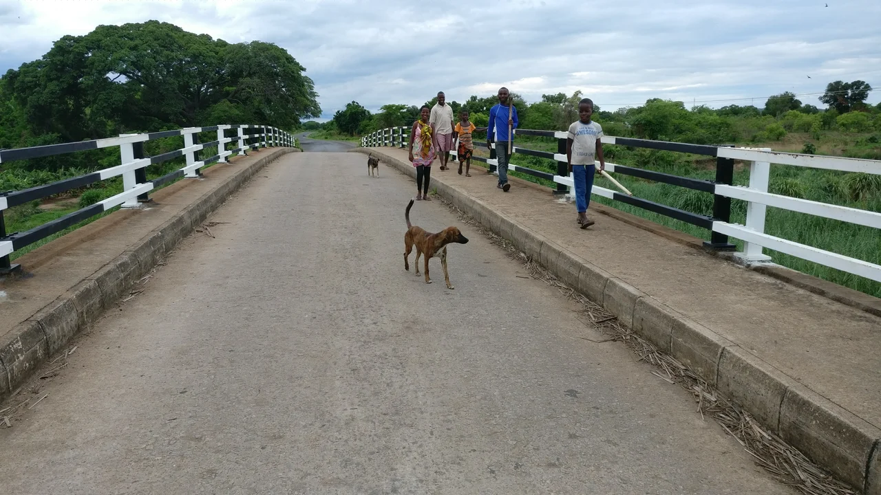
Eastern Province is Chewa country, and has been for centuries. The Chewa and their close relatives - the Tumbuka and Nsenga - are Bantu peoples who trace their origins to the Luba region in what is now the Democratic Republic of the Congo. The chieftainships they established across the region functioned as real political units long before Europeans drew the borders that now cut those societies into pieces across Zambia, Malawi, and Mozambique. Chichewa (Chewa) and Chitumbuka (Tumbuka) remain the dominant languages of daily life. The 2010 census counted 1,592,661 residents across the province, about 12 percent of Zambia's population, with the unusual demographic fact of 1,030 women for every 1,000 men. Chipata, the provincial capital, has grown to roughly 320,000 people. Lundazi and Petauke follow as secondary centers.
The Festival Calendar
Four major traditional ceremonies anchor the cultural year in Eastern Province. The Ncwala first-fruits festival brings Ngoni communities together in late February at Mutenguleni village near Chipata, where the Ngoni chief ceremonially tastes new-season produce and sacrifices a bull - a ceremony that traces back to the Zulu warrior traditions the Ngoni carried northward in the 1830s. Kulamba, held in August at Undi village near Katete, is the Chewa thanksgiving festival that draws masked Nyau society dancers from across Zambia, Malawi, and Mozambique. The Nyau masks - animal-headed, fur-covered, dramatic - belong to a ritual tradition that predates the colonial period by centuries. Zengani and Vimkakanimba fill out the ceremonial year. These are not tourist productions. They are the living religious and civic life of the province, held in their proper places at their proper times, whether or not outsiders are watching.
The Geography Between Rivers
The province lies between the Luangwa River to the west and international borders with Malawi to the east and Mozambique to the south, stretching from Isoka in the northeast down to the northern edge of Luangwa district. Covering 51,476 square kilometers, it is divided into fifteen districts. The province sits in the watershed between two major African river systems - the Congo to the north and the Zambezi to the south - though the Luangwa, which drains it, flows into the Zambezi and defines the western boundary. Isolated hills on the eastern edge rise to between 1,800 and 2,100 meters, breaking the general plateau character of the interior. Muchinga Province sits to the northwest; Central and Lusaka Provinces form the western border.
The Breadbasket
Eastern Province is Zambia's agricultural heart. It accounts for 20.41 percent of the country's cultivated land and 19.61 percent of its total agricultural production. Sunflower is the leading crop, but maize, tobacco, groundnuts, and cotton all fill the fields. The province's growth in the 1960s after independence was unprecedented - new infrastructure, new schools, expanded acreage - until the collapse of world copper prices in the 1970s ended the national boom and slowed the east along with everywhere else. Agriculture continues to employ the majority of residents. A bus ride through the province in February shows why: green rolling fields of maize and sunflower stretch in every direction, broken by the thatched homesteads of smallholders who have worked this land for generations.
The Safaris and the Routes Through
Four national parks sit within Eastern Province, and one of them - South Luangwa - is among the finest wildlife destinations in Africa. The walking safari was essentially invented in South Luangwa by Norman Carr and his peers in the 1960s, and the park's concentration of leopards remains unmatched on the continent. North Luangwa, Luambe, and Lukusuzi fill out the protected areas. Mfuwe Airport serves the South Luangwa tourism industry; Chipata Airport serves the provincial capital. The Great East Road runs from Lusaka through Chipata to the Malawi border - the main overland route between Zambia and Lilongwe, heavily trafficked by trucks, long-distance buses, and the kind of overlander expedition vehicles that make their way slowly across the continent. Everyone who reaches Chipata has come a long way, and most of them still have further to go.
From the Air
Eastern Province covers a wide area, roughly 11°S to 15°S and 30°E to 33°E, in eastern Zambia bordering Malawi and Mozambique. The reference point at 13.00°S, 32.25°E is near the provincial center. Main airports are Chipata (CIP) at the provincial capital and Mfuwe (MFU) for South Luangwa National Park; both are served by Proflight from Lusaka (LUN). From cruise altitude the Luangwa River and its escarpment define the western edge of the province as a dramatic geographical feature - the valley is 500 meters below the plateau above. Eastern hills reach 1,800-2,100 meters near the Malawi border. Agricultural patterns are visible from the air as patchwork cultivation across the plateau. Best flying conditions in the dry season (May-October); heavy afternoon storms during the wet season.
Nearby Stories
- Mambwe people 13 km away
- South Luangwa National Park 18 km away
- Luambe National Park 25 km away
- Lundazi 67 km away
- Mchinji 72 km away
- Kasungu 87 km away
- Lavushi Manda National Park 99 km away
- Luangwa Bridge 252 km away