Eastern Scheldt
The Eastern Scheldt has been quietly losing its connection to the Scheldt River for centuries. The first amputation came in 1530, when the St Felix's Flood drowned the towns of Reimerswaal and rearranged the delta. The next was in 1867, when engineers closed off the silted Kreekrak channel with a railway embankment to connect Zuid-Beveland to North Brabant. The final break came in 1986, when the Oosterscheldekering rose between Schouwen-Duiveland and Noord-Beveland. By any strict definition the Oosterschelde is no longer an estuary — its river is gone. What it became instead is the largest national park in the Netherlands, a 370-square-kilometre body of salt water where seals, oysters, and lobsters live behind a barrier that opens and closes with the weather.
A River That Left
Look at a Roman map and the Oosterschelde is the main mouth of the Scheldt. The river ran north out of Antwerp's hinterland, turned west near Bergen op Zoom, and emptied into the North Sea between the islands that now bear the names Schouwen-Duiveland and Noord-Beveland. Then came the floods. St Felix's Flood in 1530 washed away farmland, towns, and the geography itself; later reclamations cut the river's old path back to a narrow channel called the Kreekrak. By the mid-nineteenth century the Kreekrak had silted up so thoroughly that ships could no longer pass, and in 1867 the railway-builders closed it for good with an embankment. The Eastern Scheldt was orphaned. It kept its salt water — the North Sea still flowed in twice a day with the tide — but it stopped being the mouth of anything. It became, instead, an arm of the sea pretending to be a river.
The Decision That Saved It
After 1953, the original Delta Plan called for sealing the Eastern Scheldt with a solid dam, the way the Veerse Gat and the Haringvliet were sealed. Doing so would have been engineering on autopilot: pour the concrete, close the gap, move on. What stopped it was the people who fished and farmed the estuary, who pointed out that a sealed Oosterschelde would lose its tide and, with the tide, its oysters, mussels, and seabirds. A campaign that ran through the 1960s and 1970s succeeded in changing the plan. The compromise was the Oosterscheldekering — a barrier with movable doors, open to the tide most of the time, closed only against storm surges. When it finished in 1986, the tidal range inside the Oosterschelde dropped only from 3.40 metres to 3.25 metres. The estuary kept breathing, and the ecosystem held.
What Lives Here
Take a boat out from Yerseke or Zierikzee or Neeltje Jans and you can read the Oosterschelde with your eyes. Mudflats glisten at low tide; oystercatchers and avocets stitch their tracks across them. Harbour seals haul out on the Roggeplaat and other shoals to bask and to give birth in the spring. Harbour porpoises break the surface in the deeper channels. Beneath the water, the Eastern Scheldt is one of Europe's premier scuba destinations — visibility is moderate and the temperature is bracing, but the variety of life is extraordinary: cuttlefish, lobsters, anemones, sea bass, the occasional starfish the size of a dinner plate. Yerseke remains the centre of Dutch oyster and mussel farming, supplying restaurants across northern Europe with shellfish whose flavour the Zeelanders insist comes from this specific salt.
A Park With Engineers
On 8 May 2002 the entire Oosterschelde was designated a national park, 370 square kilometres bordered by the dykes of Schouwen-Duiveland, Tholen, Sint Philipsland, Noord-Beveland, and Zuid-Beveland, and by the dams of the Delta Works themselves. It is the largest national park in the country, and it is the only one where the park's boundary is a piece of human infrastructure. Engineers and ecologists have to negotiate this park together. The reduction in tidal energy after 1986 means the shoals no longer get naturally replenished with sand, and over decades the bird habitat has been slowly eroding. In 2019 and 2020, Rijkswaterstaat dumped large quantities of sand on the Roggeplaat shoal to rebuild it — gardening on a scale that fits a country built half below sea level.
How to Move Across It
Two roads cross the Oosterschelde between Schouwen-Duiveland and Noord-Beveland: the Oosterscheldedam on the western side, riding the storm-surge barrier itself, and the Zeeland Bridge on the eastern side, a five-kilometre concrete viaduct that for decades was the longest bridge in Europe. Smaller locks knit the Oosterschelde into the wider delta — the Roompotsluis at Neeltje Jans connects it to the North Sea, the Krammersluizen and Grevelingensluis to the Grevelingen and Krammer to the northeast, the Bergsediepsluis at the Oesterdam to the Scheldt–Rhine Canal, and the Zandkreeksluis to the Veerse Meer. Sail any of them and you slip between salt and fresh water, between river and sea, between the country the Dutch found and the country they invented in its place.
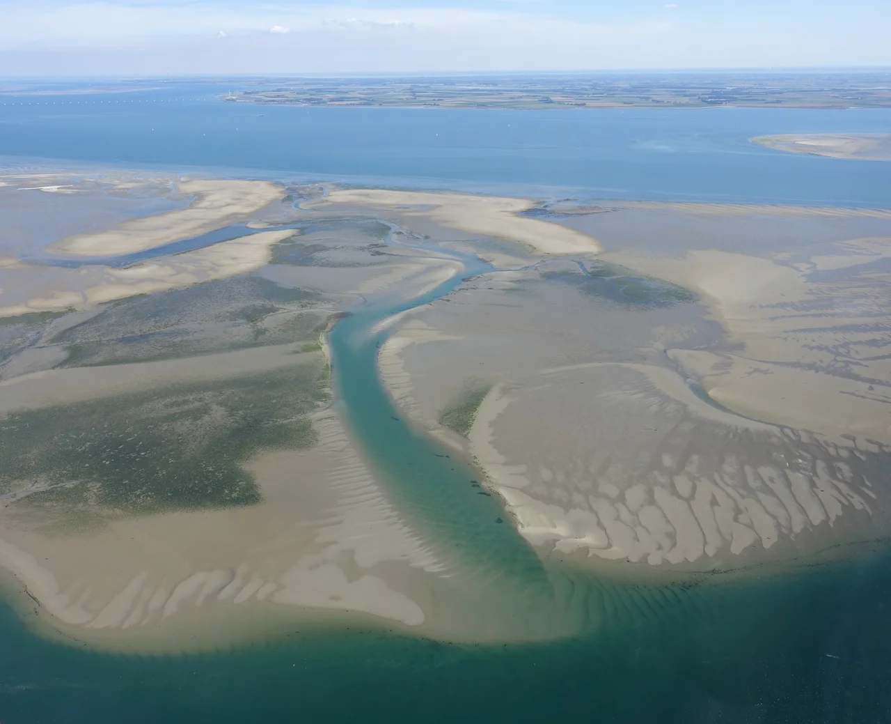
From the Air
The Eastern Scheldt sits at roughly 51.55°N, 3.97°E, occupying the broad water between Schouwen-Duiveland (north) and Noord-Beveland / Zuid-Beveland (south) in Zeeland. From cruise the basin is striking: dark tidal channels, pale shoals at low water, the Oosterscheldekering as a thin pale line on the west, and the long arc of the Zeeland Bridge on the east. Recommended viewing altitudes 4,000–10,000 ft; the full extent is visible up to FL150. Nearest airports: Midden-Zeeland (EHMZ) on Walcheren, Rotterdam The Hague (EHRD) ~35 nm north, Antwerp (EBAW) ~45 nm southeast. Coastal sea breeze in summer; strong winter westerlies and occasional dense sea fog year-round.
Nearby Stories
- Hulst 1.6 km away
- L. Smit en Zoon 5 km away
- Westmalle Abbey 7.7 km away
- NAC Breda 12 km away
- Calandbrug 14 km away
- Battle of Damme 19 km away
- Battle of Cadzand 26 km away
- Southern Bight 51 km away