.jpg)
The Lake They Almost Nuked
In the late 1960s, someone in the federal government looked at a stretch of the Chowchilla River in the Sierra Nevada foothills and proposed building a dam there with a nuclear explosion. A 10-kiloton bomb, roughly two-thirds the yield of the weapon that destroyed Hiroshima, would blast two million cubic yards of aggregate loose for construction material. The proposal, filed under the bureaucratically cheerful name Project Travois, was part of the Atomic Energy Commission's Project Plowshare program, which sought peaceful uses for nuclear weapons. The plan was abandoned. Buchanan Dam was built the old-fashioned way, and the reservoir it created was named for a local judge who had spent his career worrying about water, not fallout.
Plowshares into Dam Fill
Project Plowshare ran from 1961 to 1973, exploring whether nuclear explosions could dig canals, create harbors, and mine minerals more cheaply than conventional methods. Dozens of proposals were generated. Project Travois envisioned a 10-kiloton nuclear detonation at the Buchanan Dam site in Madera County, California, scheduled for 1970. The explosion would have shattered bedrock to produce roughly two million cubic yards of aggregate, which would then be used to construct the earthen dam. The scheme had a certain Cold War logic: repurpose the destructive capacity of the atom for irrigation and flood control in California's Central Valley. But concerns about radioactive contamination, seismic effects, and public opposition doomed it. The proposal was quietly shelved, and the Army Corps of Engineers turned to bulldozers and dump trucks instead.
A Judge's Legacy in Earth and Water
The dam that conventional construction produced is no small feat. Buchanan Dam rises 218 feet above the Chowchilla River, stretching 1,746 feet at its crest. It impounds up to 150,000 acre-feet of water, enough to submerge 150,000 football fields under a foot of water. The U.S. Army Corps of Engineers built, owns, and operates the structure as a dual-purpose flood control and irrigation project, taming a river that had periodically inundated the farms and towns downstream. The reservoir it created was named H. V. Eastman Lake, honoring Judge H. V. Eastman, who served as Secretary Manager of the Chowchilla Water District from the time the district was organized until his retirement. Born in 1891 and dying in 1972, Eastman spent decades advocating for the water infrastructure that sustains agriculture in Madera County. His name now rests on the surface of the lake he helped make possible.
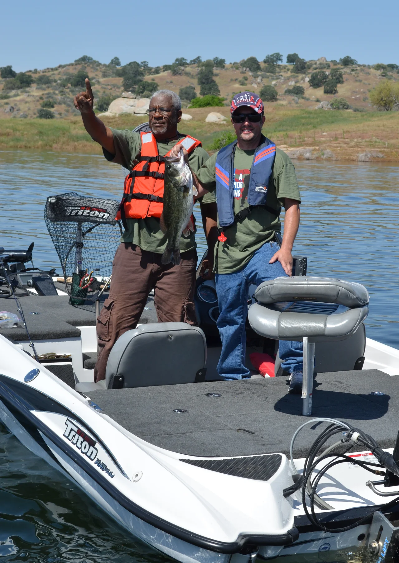
Foothill Quiet
Eastman Lake occupies a fold in the Sierra Nevada foothills where the terrain transitions from the flat agricultural grid of the San Joaquin Valley to the rolling, oak-studded grasslands that rise toward Yosemite. The reservoir sits primarily in Madera County, though a small slice of its northwestern arm crosses into Mariposa County. It is not a grand destination. No towering granite walls frame its shoreline, and no famous waterfalls cascade into its waters. What it offers is something rarer in California: uncrowded space. Bass and catfish move through the warm shallows. Eagles circle above the dam. The Corps of Engineers maintains campgrounds and boat ramps, and events like the annual Take a Warrior Fishing outing bring veterans to the shoreline. It is a working reservoir that doubles as a quiet park, the kind of place that rewards people who aren't looking for spectacle.
Water Politics in a Dry State
Every reservoir in California is a political statement. Buchanan Dam and Eastman Lake sit within the labyrinth of water infrastructure that keeps the Central Valley productive, a system that channels Sierra snowmelt through dams, canals, and irrigation districts to feed one of the most intensive agricultural regions on earth. The Chowchilla Water District, which Judge Eastman managed for decades, is one link in this chain. Water stored behind Buchanan Dam feeds farms that grow almonds, grapes, cotton, and dairy forage across Madera and surrounding counties. The dam also serves its original flood control mandate, absorbing the spring runoff that once turned the Chowchilla River into a seasonal torrent. In a state where water rights are litigated as fiercely as land titles, Eastman Lake is a quiet monument to the unglamorous work of keeping farms irrigated and towns dry.
From the Air
Eastman Lake is located at 37.22N, -119.98W in the Sierra Nevada foothills of Madera County. The reservoir is visible from altitude as a distinctive blue body of water surrounded by golden-brown grasslands and scattered oak woodland, contrasting sharply with the agricultural grid of the San Joaquin Valley floor to the west. Buchanan Dam is visible as the earthen barrier at the lake's southwestern end. The Chowchilla River feeds the lake from the northeast. Nearby airports include Madera Municipal Airport (KMAE) approximately 20 miles to the southwest and Fresno Yosemite International (KFAT) about 35 miles to the south-southeast.
Nearby Stories
- Merced National Wildlife Refuge 4.5 km away
- The Fifty-Dollar Ghost 8.2 km away
- Forestiere Underground Gardens 20 km away
- Panoche Hills: California's Last Desert Refuge 33 km away
- From Aluminum to Ammunition to Aviation Fuel 42 km away
- Mono Lake: Where Salt Towers Rise From Dying Water 78 km away
- Sequoia: Standing Among the Largest Living Things on Earth 98 km away
- Mono Lake 104 km away