Merced National Wildlife Refuge
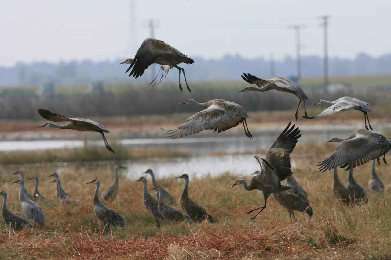
Every autumn, the sky above the San Joaquin Valley fills with a sound that predates agriculture, predates the irrigation canals, predates everything humans have built on this flat expanse of California. It is the rattling bugle of 20,000 sandhill cranes arriving from Alaska and Canada, their long necks stretched southward, their wingbeats slow and deliberate after thousands of miles of flight. They are heading for 10,262 acres of wetlands, grasslands, and vernal pools tucked into Merced County's farmland, a refuge established in 1951 not because anyone wanted to protect the birds, but because the birds were eating the crops. The Merced National Wildlife Refuge began as a compromise, and it became something far greater: the Pacific Flyway's most important winter staging ground for cranes and arctic-nesting geese.
A Problem That Became a Sanctuary
By the mid-twentieth century, California's Central Valley had been so thoroughly converted to agriculture that wintering waterfowl had nowhere to land except on planted fields. Farmers watched flocks of geese strip their crops. Congress responded with the Lea Act, and in 1951 the Merced refuge was carved from the valley floor to lure the birds away from adjacent farmland. The strategy worked, but it also revealed something unexpected. Once the wetlands were managed and the grasslands restored, the refuge attracted far more than the problem geese. Today, over 60,000 Ross's geese join the 20,000 lesser sandhill cranes each winter, making Merced the largest wintering ground for both species anywhere along the Pacific Flyway. Thousands of additional waterfowl, waterbirds, and shorebirds crowd the managed marshes, transforming the refuge into what biologists call a true winter phenomenon.
Pools That Vanish and Return
Scattered across the refuge are vernal pools, a habitat type so specific that it exists almost nowhere else. Shallow depressions underlaid with impermeable clay fill with winter rain, creating temporary wetlands that follow their own ancient calendar. As water rises, fairy shrimp and tadpole shrimp emerge from cysts buried in the soil the previous year, hatching in water that may last only weeks. The endangered tiger salamander lays eggs in these pools. Aquatic invertebrates multiply in staggering numbers, providing fuel for migratory birds preparing for the long flight north. Then spring arrives, and the pools begin to evaporate. As the water retreats, wildflowers germinate in concentric rings around each basin: goldfields, purple owl's clover, and butter-and-eggs paint thick halos of color on the drying mud. John Muir once saw this annual display and called the valley floor the "floweriest part of the world" he had encountered. When the pools finally dry, rare Colusa grass and Downingia appear in the parched basins, completing a cycle that repeats without fail every year.
Breeding Ground and Year-Round Haven
The refuge is not only a winter destination. Swainson's hawks nest in the scattered trees. Burrowing owls claim abandoned ground squirrel burrows across the grasslands. Tricolored blackbirds, a colonial-nesting songbird whose populations have declined sharply across California, breed here in colonies exceeding 25,000 pairs, their nests packed so tightly that the marshes seem to ripple with dark wings. Marsh wrens, mallards, gadwall, and cinnamon teal raise broods in the wetlands through the warmer months. Year-round residents include coyotes, desert cottontail rabbits, beaver, long-tailed weasels, and ground squirrels whose burrow networks support entire food chains. The refuge's diversity stems from its mosaic of habitat types: seasonal wetlands, permanent marshes, native grasslands, vernal pools, and riparian corridors along old stream channels, each supporting a different community of species.
Farming for the Flyway
In a twist that echoes the refuge's origins, agriculture remains central to its mission. Approximately 300 acres of corn and winter wheat are cultivated specifically for wildlife, and over 500 acres of irrigated pasture provide grazing for the tens of thousands of arctic-nesting geese and sandhill cranes that overwinter here. Local farmers manage these crops under cooperative agreements with the refuge, handling ground preparation, seeding, and irrigation. The carbohydrate-rich grains ensure that birds build adequate nutrient stores before their spring migration to breeding grounds in Alaska and Canada. The refuge also runs a livestock grazing program in partnership with local ranchers. Cattle and sheep serve as a management tool, controlling invasive weeds, maintaining the short-stature grasslands that geese prefer for foraging, and encouraging native grass species to outcompete introduced plants. It is an unlikely partnership: ranchers and wildlife managers working the same land, each benefiting from the other's presence.
From the Air
Merced National Wildlife Refuge sits at 37.1791N, 120.637W in the flat San Joaquin Valley floor. From the air, the refuge's wetlands and managed marshes stand out as a patchwork of green and silver against the surrounding agricultural grid, particularly visible during winter months when ponds are full. Best viewed at 2,000-4,000 feet AGL. The nearest airports are Castle Airport (KMER) approximately 10 nautical miles northeast and Merced Regional/Macready Field (KMCE) about 12 nautical miles east. In winter, look for massive flocks of cranes and geese that can be visible as swirling clouds of white and gray from altitude. The nearby San Luis National Wildlife Refuge lies about 10 miles to the west.
Nearby Stories
- Buried Alive in Summer 10 km away
- The Fifty-Dollar Ghost 17 km away
- Gold from the Sky Over Gold Country 29 km away
- Panoche Hills: California's Last Desert Refuge 30 km away
- The San Joaquin Valley: America's Grocery Aisle, Hidden in Plain Sight 32 km away
- Crossley telescope 36 km away
- Altamont Free Concert 41 km away
- Salinas and Steinbeck Country 41 km away