.jpg)
Emirate of Asir
Coffeehouses, dancing, and smoking were all forbidden. That detail, buried in an administrative footnote, says a great deal about the Emirate of Asir - a short-lived state that flickered on the eastern shore of the Red Sea from 1907 until 1934, carved out by a Sufi scholar-turned-warrior named Muhammad ibn Ali al-Idrisi. Look down from cruising altitude today and you see the Tihamah coastal strip of southwestern Saudi Arabia, blurring into northern Yemen. A century ago this 80-mile sliver, reaching perhaps 40 miles inland to the Asir escarpment, was its own country. Sabya was its capital. The Imam held absolute power. A police force drawn from Sudanese families walked the souks inspecting prayer times and public morals. And for a moment, the great empires of the age - Ottoman, British, Italian, Hashemite, Saudi - all had to reckon with it.
A Scholar from Morocco's Long Shadow
The story begins not in Arabia but in Morocco, with Ahmad ibn Idris al-Fasi (1760-1837), a religious scholar and Sufi of the Idrisiyya order who eventually settled in Sabya, in the Tihamah region of Yemen, in 1828 at the invitation of his students. His descendants mediated tribal disputes for generations without much political weight. Then his great-grandson, Muhammad ibn Ali al-Idrisi (1876-1923), changed everything. Born in Sabya, Muhammad studied religion in Mecca and at al-Azhar in Cairo, then came home to a region slipping out of Ottoman control. By 1907 he had the allegiance of the Tihama tribes. On 24 December 1908 he proclaimed himself Imam. Within weeks, tribes from Sabya to the Miklaf al-Shami were kneeling for his recognition.
The War of Seven Years
What followed was a guerrilla war against the Ottoman Empire that would last, with pauses, from 1909 until the 1914 truce. Idrisi fighters took Az Zaydiyah and Al Luhayyah. A treaty in January 1910 briefly made al-Idrisi Kaymakam of Asir under Ottoman suzerainty - a face-saving fiction that held until a debate over Sharia law in October 1910 reignited the rebellion. Italy, fighting its own Italo-Turkish War, sent naval bombardment, rifles, and ammunition. The Ottomans found themselves shelled from the sea and shot at from the hills. When the First World War erupted in August 1914, Istanbul signed a hasty truce. Al-Idrisi had been at war with them for seven years; he was in no mood to stop.
Britain's First Arab Ally
In April 1915, British political resident D. G. L. Shaw signed a "Treaty of Friendship and Goodwill" with al-Idrisi at Aden. It is an easily forgotten fact: the Emirate of Asir, not the more famous Hashemite revolt in Mecca, produced the first Arab leader to join the British against the Ottomans. The British sent weapons. The Idrisids, now guerrillas with modern rifles, captured the Farasan Islands in 1915. By 1921 Britain had handed over Al Luhayyah and then Hodeidah, pushing the emirate to its widest borders. But the Armistice of Mudros in October 1918 dissolved the old map, and Britain's wartime promises aged poorly. Sharif Hussein's Hashemite kingdom pressed from the north, Imam Yahya's Yemen from the south, and in the mountains a new power - Ibn Saud - watched everything.
The Bargain in the Highlands
In 1920 Ibn Saud sent his son Faisal and his cousin Abd al-Aziz ibn Musa'id into Asir al-Sarah to back mountain tribes unhappy with the al-A'id family. Saudi troops defeated Hasan ibn A'id near Abha. That summer, envoys from Najd arrived at al-Idrisi's court. In the fall the two rulers signed a treaty that divided the region's tribes: Ibn Saud received the Qahtan, Shahran, Wadi'a, and Rufayda highland tribes; al-Idrisi kept the Tihama tribes, including Rijal al-Ma. Both men benefited by squeezing Sharif Hussein. When Muhammad al-Idrisi died in 1923, the state began to contract. His successors signed a protectorate agreement with Ibn Saud, then watched the Kingdom of Hejaz and Nejd absorb them. The Treaty of Taif in 1934, ending the brief Saudi-Yemeni War, erased the Emirate of Asir from the map for good.
What Sabya Remembers
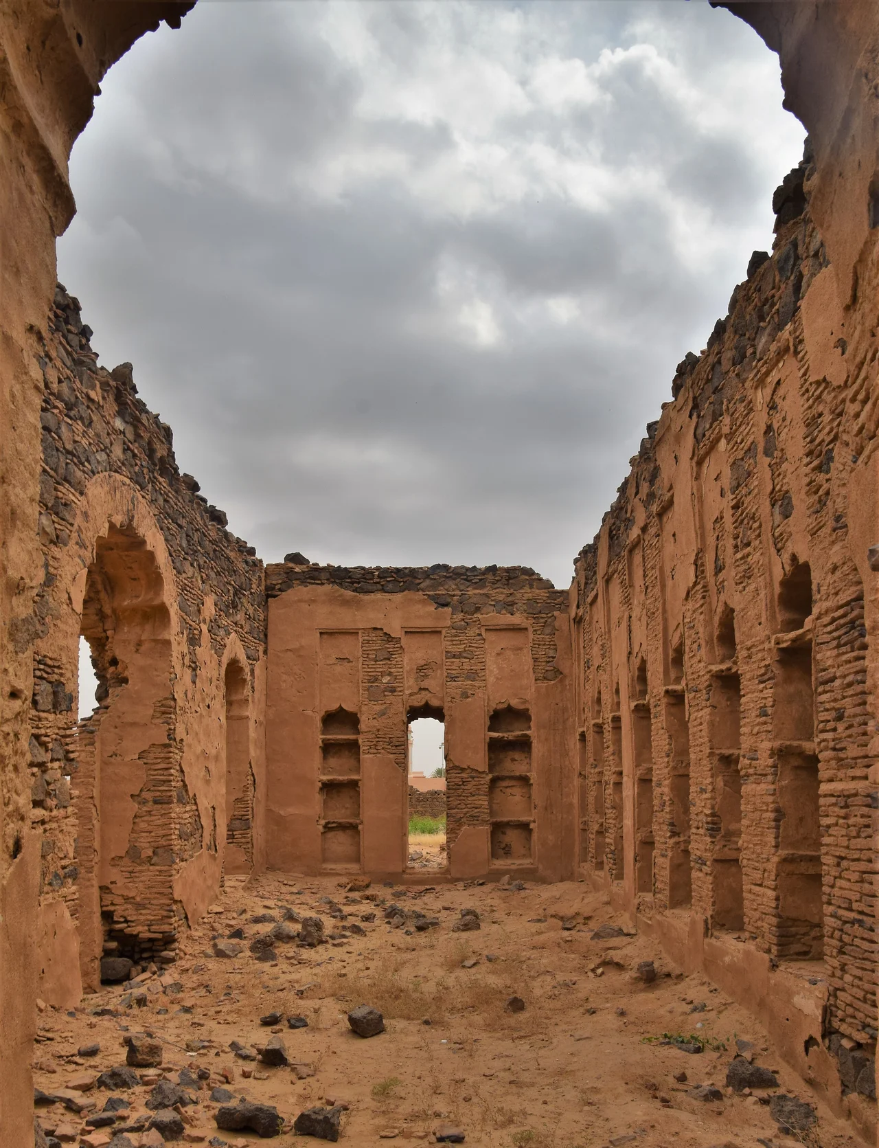
Fly over Sabya today at 17.15 degrees north, and you see a modest Saudi city in the Jazan Region, unremarkable from altitude. On the ground, Idrisid-era houses still stand, their mud-brick walls studied by architects. The Farasan Islands, lifted from Ottoman control by al-Idrisi's men and later by the British, are now a Saudi marine reserve famous for their turquoise shallows and whale sharks. The political memory has faded - Saudi Arabia tends not to linger on states it absorbed - but the story is instructive. In an age when the Middle East's borders are often described as things foreigners drew on maps, the Emirate of Asir reminds you that local leaders were also pulling on the pencil, sometimes winning lines and sometimes losing them.
From the Air
Centered near Sabya at 17.15°N, 42.62°E, on the Saudi Red Sea coast in the Jazan Region. Cruising southbound from Jeddah toward Sana'a, the Emirate's historical footprint sits on your right for roughly 80 nautical miles. Nearest major airport: Jizan Regional (OEGN). Farasan Islands visible offshore to the west in clear weather. Recommended viewing altitude FL200-FL300.
Nearby Stories
- Jazan Province 25 km away
- 2025 Saada prison airstrike 57 km away
- Battle of Port Midi 76 km away
- Al-Okhdood 95 km away
- Italian Submarine Guglielmotti (1938) 122 km away
- Dhorm Mountain 148 km away
- Battle of Amran 154 km away
- Bareq 201 km away