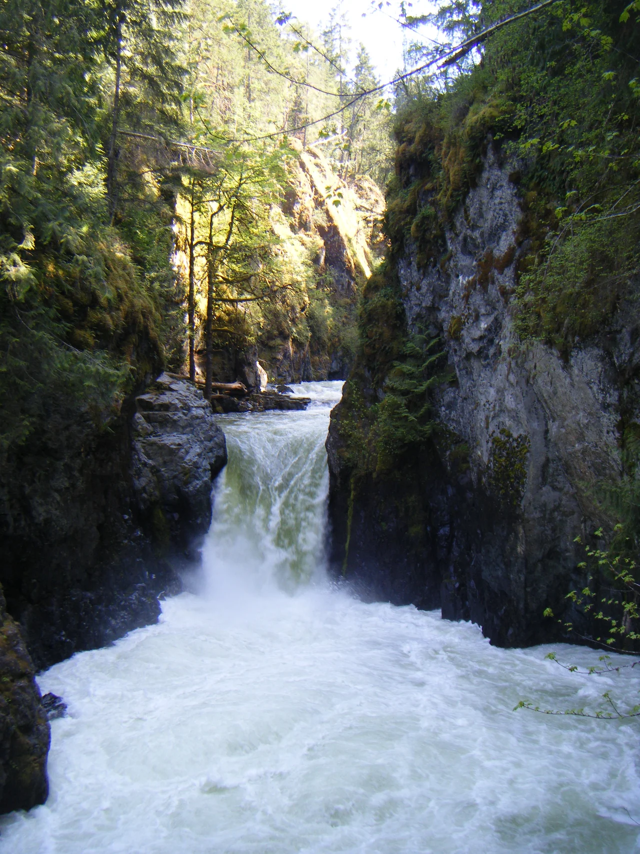

Englishman River
Spanish cartographers put this river on their charts as the Rio de Grullas, the River of Cranes. They had almost certainly been looking at great blue herons, standing motionless in the shallows where the current runs out into the Strait of Georgia, and they made the reasonable error of men a long way from home. The people who had lived on this coast for thousands of years named it for something more useful. In the island dialect of Halkomelem it is Kw'a'luxw - dog salmon - after the chum that shoulder up out of the salt every fall to spawn and die in the gravel. Then the English arrived and named it after themselves, on evidence that has never been very good. Four names, three languages, one river running forty kilometres from a small mountain lake to the sea at Parksville.
Out of the Beaufort Range
The Englishman begins in an unremarkable place: tiny Jewel Lake, on the eastern slopes of the Beaufort Range, high enough that snow lingers on the shoulders above it into early summer. From there it runs east for forty kilometres and empties into the Strait of Georgia at Parksville. The watershed it drains is a scatter of small lakes with a certain pleasing randomness to their names - Arrowsmith, Hidden, Fishtail, Rowbotham, Healy, Shelton, Rhododendron. The south fork tells its own compact story. It leaves Shelton Lake, which locals still call Echo, and almost immediately runs into Healy Lake, which they still call Panther, then turns northeast to find the main stem. Two names for each lake, held simultaneously, the way small places often do.
The Drowned Man and the Neighbour
How the river got its English name depends on who is telling it. One account holds that Indigenous people found the skeleton of a white man near the waterfalls, and that the name commemorates an Englishman who drowned trying to cross. Another is quieter and more likely: a settler named Hirst, the first to build beside the water, was known to his Indigenous neighbours as that Englishman by the river, and the description simply hardened into a label on a map. Neither version can be confirmed now. What both have in common is that the river was named by other people about an Englishman, rather than by the Englishman himself - which is, in its way, a fair summary of how most place names on this coast actually came about.
Two Waterfalls and a Grove
About ten kilometres upstream of the mouth the river drops twice in quick succession, and those two falls are the reason Englishman River Falls Provincial Park exists. It was created on 20 December 1940, in the middle of a war, specifically to protect the old-growth forest and the ecosystem along the river near the drops. The upper falls plunges into a narrow gorge the colour of old jade; the lower is broader and gentler, with a pool at its base that swimmers find unforgivingly cold even in August. Campsites sit back among the big trees. In the wet months the whole canyon runs loud enough that conversation at the viewpoints has to be shouted.
Drinking the River, Feeding the Fish
Parksville and its neighbours drink this water. Arrowsmith Dam, finished in 1999 and built jointly by the City of Parksville, the Town of Qualicum Beach, and the Regional District of Nanaimo, holds back a reservoir that keeps the summer taps running from an intake on the lower river. The dam operates under a rule that would have puzzled an earlier generation of engineers: it must maintain a minimum baseflow for fish before it serves anyone's kitchen. Downstream, the estuary has been under repair for years. Since the 1930s it has been diked, ditched, roaded, and built on, and more than a hundred hectares of what remains are now protected inside the Parksville-Qualicum Beach Wildlife Management Area. Juvenile chinook, coho, and chum spend weeks or months there, adjusting to salt water before they go to sea - the same estuary the Spanish once mistook for crane habitat.
From the Air
The Englishman River meets the sea at 49.326 degrees north, 124.292 degrees west, at Parksville on the east coast of Vancouver Island. A viewing altitude of 3,000 to 5,000 feet follows the whole drainage from the Beaufort Range down to the Strait of Georgia in a single pass. The easiest visual anchor is the shoreline: Parksville's broad sand flats go out for nearly a kilometre at low tide and read as a pale crescent against the darker water, with the river's estuary cutting through them. Inland, Mount Arrowsmith's twin summits mark the southwest side of the watershed. Qualicum Beach Airport (CAT4) is a few kilometres northwest, Nanaimo Airport (CYCD) about 45 kilometres southeast, and Comox (CYQQ) roughly 60 kilometres northwest. Expect winter rain and low cloud on the windward slopes, summer afternoon thermals off the Beauforts, and a fast-building sea breeze across the tidal flats most afternoons.
Nearby Stories
- McLean Mill National Historic Site 1.7 km away
- Union Bay Post Office 6 km away
- Thetis Island 7.1 km away
- Texada Island 12 km away
- Kildonan, British Columbia 15 km away
- Salish Sea Human Foot Discoveries 18 km away
- Cowichan Lake 19 km away
- Britannia Mine and the Mountain That Bleeds 40 km away