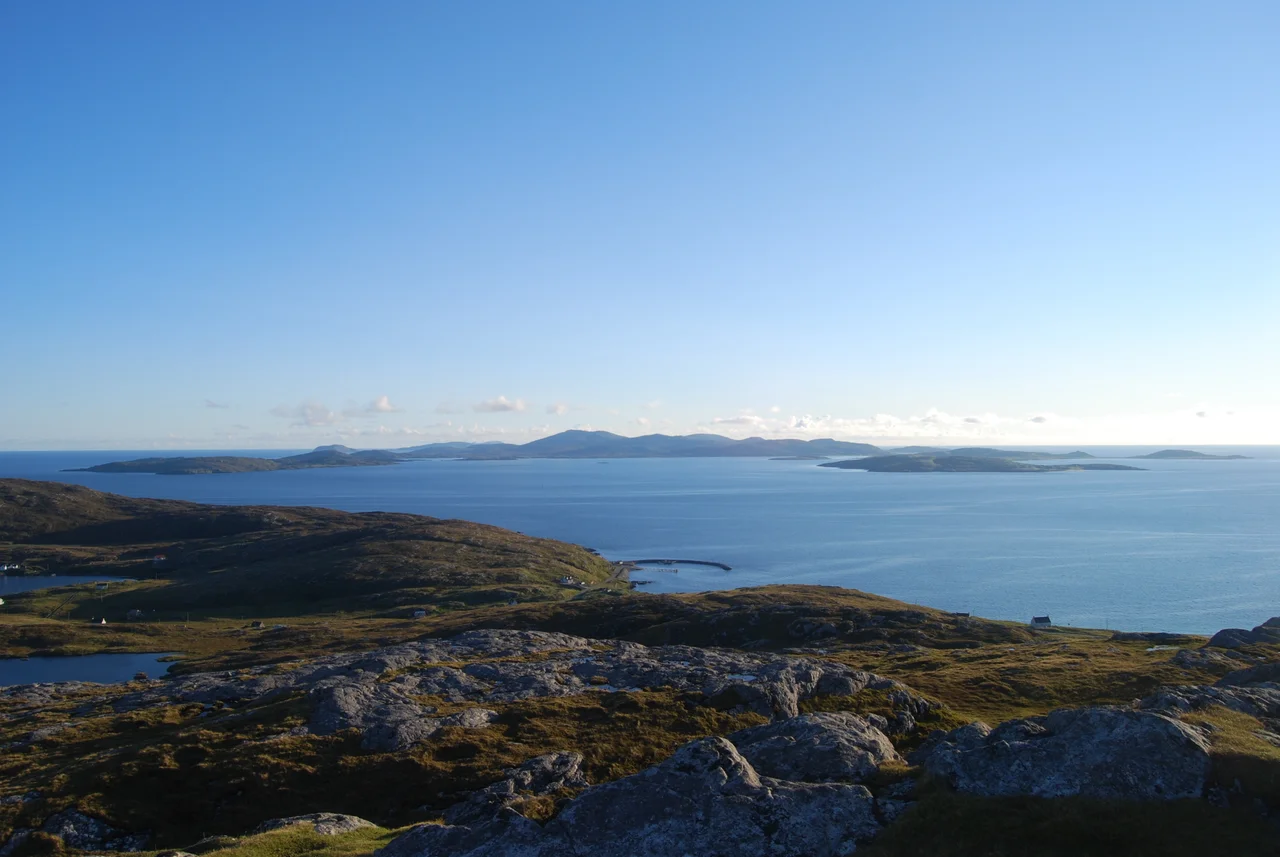

Eriskay
Try to picture a wartime Scottish bank clerk in 1941, asked to exchange a damp wad of Jamaican pound notes that smelled of fuel oil. Hebrideans were not, in 1941, holidaying in Montego Bay. But the SS Politician had run aground off Eriskay's east coast with 22,000 crates of Scotch whisky and £3 million in Jamaican banknotes, and a remarkable amount of both began turning up across the Western Isles. Eriskay is three miles long by two miles wide, with a population of 143 at the last count. Its name is Norse, Eric's island, after some Eric whose identity has been lost. Its history could not be louder.
Where the Prince Stepped Ashore
On 23 July 1745, Old Style, Prince Charles Edward Stuart waded ashore at Coilleag a' Phrionnsa, the Prince's Cockleshell Strand, just north of the present ferry pier. He arrived in the French privateer Du Teillay with seven companions and some artillery. His transport ship, carrying most of his men and weapons, had limped back to France after a battle with HMS Lion. Charles continued to Loch nan Uamh on the mainland to launch the rising. The clan chiefs were horrified to find he had arrived almost empty-handed. The 1745 ended at Culloden eight months later, the prince became a fugitive across the Highlands and Hebrides, and he never returned to Eriskay. A 1995 memorial cairn now stands above the beach with verses from Alasdair Mac Mhaighstir Alasdair's song-poem Oran Eile don Phrionnsa.
Whisky Galore, the Real Story
The freighter Politician, a 7,900-ton ship plying between Britain and South Africa, was sailing north on 4 February 1941 to join an Atlantic convoy when she ran aground. Her crew thought they were south of Barra; they were probably off Acairseid Mhor on Eriskay's east coast. The lifeboat from Barra searched fruitlessly in the wrong place. Once the crew were safe ashore and word of the cargo spread, the cargo began to disappear. Roughly 7,000 crates were taken by islanders across the Hebrides, hidden in rabbit holes, peat stacks, sea creels, and behind house panels. The Bank of Jamaica eventually withdrew the most-compromised note series. Customs officer McColl spent months trying to chase down what had been carried away, and the party only ended in August when, in pique, he had the wreck blown up with much intact cargo still aboard. Compton Mackenzie's 1947 novel Whisky Galore and the 1949 Ealing comedy made the story famous; both omit the Jamaican banknotes.
Ponies and Weaver's Castle
Eriskay Ponies still graze the quieter east side of the island. They are small, grey, about 130 centimetres at the shoulder, stocky and docile. The breed is recorded back to Pictish times. They were once common across the Hebrides, but elsewhere were crossbred for heavier work; only isolated Eriskay kept the line pure. By 1920, fewer than twenty remained. Today, with stud books and conservation, the population worldwide has recovered to around four hundred, still classed as critically endangered. They helped cart the Politician's whisky home, which they would not have known meant anything to anyone. Off the south tip of Eriskay, on the bifurcated islet of Eilean Leathan, sit the ruins of Weaver's Castle, Caisteal a' Bhreabadair, where weaver is actually a corruption of riever; a pirate lived there until soldiers ended him and his kin.
Walks, Causeways, and the Politician Pub
Beinn Sciathan is a Marilyn, 186 metres high, the island's highest point, with views to South Uist, Barra, and, on a clear day, St Kilda 68 miles into the Atlantic. The Hebridean Way passes through Eriskay between the Barra ferry at the south end and the South Uist causeway at the north. The causeway opened in 2001 and connects the chain of islands all the way up to North Uist and on to Harris by another ferry. There are two places to buy a drink on Eriskay: the shop and the Am Politician pub, named after the wreck. As of September 2023, Eriskay had no mobile phone signal. Some places change. This one does so slowly.
From the Air
Coordinates 57.075N, 7.290W. Eriskay sits in the Sound of Barra between South Uist (north, by causeway since 2001) and Barra (south, by ferry to Ardmhor, 40-minute crossing). Beinn Sciathan (186 m / 609 ft) is the highest point and an obvious visual reference. The ferry pier and main village are on the low-lying northwest corner. Recommended viewing altitude 2,000-3,000 ft. Nearest airport is Barra (ICAO: EGPR) to the south on Traigh Mhor's tidal beach runway; Benbecula (ICAO: EGPL) is the larger field on the Uist chain to the north. Common conditions: strong westerlies, low cloud, rapidly changing visibility off the Atlantic.
Nearby Stories
- Canna 8.3 km away
- Our Lady of the Isles 10 km away
- Wiay, Inner Hebrides 11 km away
- Coll 18 km away
- HMS Sturdy (1919) 35 km away
- St Kilda, Scotland 76 km away
- SS Athelstane (1941) 102 km away
- German submarine U-516 130 km away