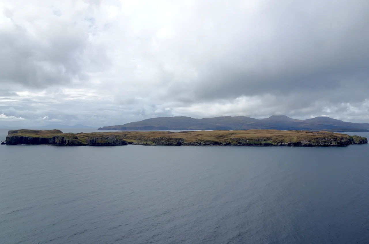

Wiay, Inner Hebrides
On 22 September 1773, James Boswell rowed across Loch Bracadale with Samuel Johnson and a local laird called Ullinish to look at a cave. Boswell measured it. He noted it was 180 feet long, 30 feet wide and at least 30 feet high. Their guide promised them a remarkable echo, but the cave that day was damp and the echo did not perform. Johnson, characteristically, blamed the exaggerations of Highland storytellers. The cave was on Wiay, a 148-hectare uninhabited island in Loch Bracadale off the western coast of Skye, and you can still find it. The island has gone by many names - Buyamoire, Buia, Vinay, Vuiay, Wia, Via Moir - and once held six people. Tuberculosis ended them.
An Island of Cliffs
Wiay is roughly 1.3 km wide by 2.1 km long, lying 1.3 km west of Ullinish in Loch Bracadale on Skye's western coast. Most of the coastline is cliff, up to 60 metres high, and the southern bluff is a striking overhanging wall that drops 59 metres straight into the water. The high point of the whole island is only 61 metres above the sea, so the topography is almost like a tilted plate, gentle on top and severe at the edges. The cliffs are pierced by five sea caves, including the one Boswell measured at 180 feet. There is also a natural sea arch on the eastern shore. Sea eagles ride the updraughts off the cliffs. Great skuas nest on the grass.
Six People in 1841
The 1841 census, the first to count individuals, recorded six inhabitants of Wiay: three men and three women, four of them under twenty, all born in Inverness-shire. They lived in one building. The 1851 census found five. The 1861 census, one family of six. By 1871 there were five again. An 1869 newspaper report on the Harmonia shipwreck called Wiay's sole inhabitant a shepherd named Dougald MacDonald. By 1891 the island was empty. Local tradition holds that the last residents were found dead after a fortnight of silence, having succumbed to tuberculosis. The disease tore through the small communities of the Hebrides in the 19th century, and an island as isolated as Wiay could not call for help.
The Harmonia's Long Drift
On 5 July 1869 a 643-tonne Aberdeen barque called Harmonia left Quebec with fifteen crew and a cargo of timber, bound home across the Atlantic. Two days out, near the Grand Banks of Newfoundland, a gale broke her mast and she sprung a leak. At 23:30 on 6 July she rolled onto her beam-ends with her masts under water; eight men were drowned, including her captain Peter Ross, the mate, the carpenter and the sailmaker. The seven survivors clung to the side of the hull until the masts gave way and the ship righted herself. They were picked up two days later by a Greenock ship called the Renfrewshire, and got home alive. The Harmonia did not. The waterlogged hulk floated on, derelict, with no one aboard. The ship Nova Scotian sighted her two months later, 1500 nautical miles east of where she had been abandoned. Around 25 September 1869, after a drift of nearly three months across the North Atlantic, she came ashore on the western cliffs of Wiay.
Dougald's Beacon
It was the shepherd Dougald MacDonald who saw her. He found his coastline strewn with oak logs, deals and staves marked with the names of merchants in Aberdeen. On the following Monday, 27 September, he climbed a small hillock on the island, piled together what heather, wood and hay he could collect, and set it on fire. From the Skye shore, his neighbours saw the smoke and sent a boat. A Lloyd's of London report dated 2 October recorded the wreck, including the detail that one of the winches was marked HARMONIA, OF ABERDEEN, NO. 2. The salvage yielded oak, planks, staves, a porthole, two steering wheels, and a bell. The wreck site is tentatively placed at Rubha Garbh, the rough headland at Wiay's western tip. The bell came up from the seabed during a Receiver of Wrecks amnesty in 2001.
The Many Names of Wiay
Maps and gazetteers have called this island many things. Sir Donald Monro in 1549 wrote it down as Buyamoire, with mòr being the Gaelic for big. Martin Martin in 1703 called it Buia. The 1654 Blaeu atlas, the first proper atlas of Scotland, shows it as Via Moir. The 1856 topographical dictionary gives it as Vuiay. The 1868 National Gazetteer calls it Vinay, and that is how Lloyd's recorded the Harmonia wreck the next year. The modern Wiay is most often traced to Old Norse būey, meaning settlement, suggesting Viking shepherds were already running stock here a thousand years ago. The Gaelic form Fuidheigh survives in folk speech. The island under all these names is the same low-lying rock surrounded by cliffs, full of nesting birds, with a single ghost-house and a wreck offshore.
From the Air
Located at 57.34°N, 6.50°W in Loch Bracadale on the western side of the Isle of Skye. Wiay is the largest island in the loch, an oval 2.1 km long by 1.3 km wide, with cliffs up to 60m on most of its coastline. Useful landmarks include MacLeod's Tables (Healabhal Mhòr and Bheag, both around 488m) on the Duirinish peninsula to the north and the Cuillin ridge to the south. Nearest airports are Plockton (EGPP) about 25nm east-northeast, Glenforsa on Mull (EGEL) 50nm south, Inverness (EGPE) 70nm east, and Stornoway (EGPO) 55nm north-northwest. Recommended viewing altitude 1500-2500 ft AGL to take in the cliffs and the surrounding loch; sea fog can settle into Loch Bracadale and obscure low-level navigation.
Nearby Stories
- Sabhal Mòr Ostaig 7.8 km away
- Canna 8.3 km away
- Duntulm Castle 9.7 km away
- BUTEC 11 km away
- SS Politician 15 km away
- Gair Loch 16 km away
- Flannan Isles Lighthouse 78 km away