
Erris
The rocks along the beaches of Elly Bay and Annagh Head are pink and orange and shot through with stripes - and they used to be Canadian. Pieces of the same gneiss, the same exact rock layered the same way, sit on the eastern coast of Northern Canada more than three thousand kilometres west. The two were once joined as a single landmass. The Atlantic was not yet an ocean. Then the mid-Atlantic Ridge began to widen, the continents began to drift, and over hundreds of millions of years the rock split. Stand on Elly Bay today, pick up one of those striped stones, and you are holding a piece of a vanished world. Erris remembers things on a scale that humbles human history.
The Blanket Bog
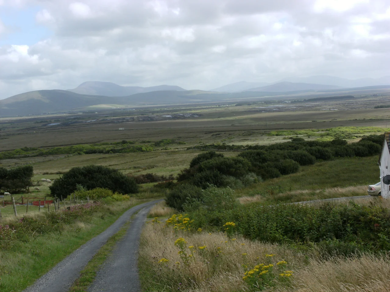
Most of inland Erris is covered by Atlantic blanket bog, an acidic carpet that grows slowly across the landscape wherever the rainfall keeps the ground waterlogged. The pH runs between 3.5 and 4.2 - hostile to most plants but perfect for mosses, bryophytes, carnivorous sundews, and delicate flowers like the scarlet pimpernel. Beneath the bog, preserved in the peat, lie the fossilised stumps of ancient Scots pine forests that once covered Erris before Neolithic farmers cleared the trees and the climate cooled. When turf-cutters dig today they sometimes uncover Bronze Age tools, cooking sites, and the buried geometry of fields ploughed five thousand years ago. The bog is the closest thing this island has to an archive of itself, written one millimetre per year.
To Hell or to Connaught
In the mid-seventeenth century, Oliver Cromwell decreed that the native Irish who refused his authority would be sent to hell or to Connaught. Many came to Erris. The dispossessed worked thin soils on land held by the Bingham and Carter families, two of the major planted landlord families in the area. Two centuries later, when the Great Famine struck between 1845 and 1847, many of their descendants died here - despite the sea being close at hand, despite the possibility of fish - because they could not raise the cash for a passage to America. The empty landscape that visitors now call beautiful was made empty by these centuries: by clearance, by famine, by the slow draining of population through emigration. The grandness of the silence has a history.
The Children of Lir
On the small uninhabited island of Inishglora, just off the Mullet Peninsula, tradition places the burial site of the Children of Lir. The story belongs to the oldest stratum of Irish myth: four siblings turned into swans by their jealous stepmother, condemned to spend nine hundred years on the lakes and waters of Ireland. When they finally regained their human forms at Inishglora, the centuries collapsed on them all at once. They aged in moments and died, and were buried on the island. The ruins of an early monastic site still stand there. Nearby, the Tain Bo Flidhais - one of the great cattle-raid tales of the Ulster Cycle - is set at Rathmorgan Fort beside Carrowmore Lake. Erris is where Irish mythology often ends. The west was the country of the dead.
Rescue 116
On 14 March 2017, an Irish Coast Guard Sikorsky S-92 helicopter, callsign Rescue 116, crashed into Blackrock Island off the Mayo coast while returning from a mission. All four crew died. The community of Erris mobilised for the search and recovery operation that followed - small boats, search lines, hospitality for the families, weeks of grim work along the shore. In 2018, the people of Erris and the Irish Coast Guard were jointly recognised with a People of the Year Award for what they had given. The crew of Rescue 116 - Captain Dara Fitzpatrick, Captain Mark Duffy, Winch Operator Paul Ormsby, and Winchman Ciarán Smith - had spent their careers pulling fishermen and sailors out of the same Atlantic. Their community pulled them back.
The Sea and the Wind
The coastline of Erris carries what many call the grandest sea cliffs in Ireland. Erris Head, the northernmost point of the Mullet Peninsula, marks one of the sea areas named in Met Eireann's weather forecasts - a name fishermen hear before every storm. There is no road to Erris Head. You leave the road at the hamlet of Glenlara and walk the last fields on foot. From the cliff edge, the Atlantic rolls unbroken to North America. Erris is now being studied as a site for wave power, tidal power, and offshore wind - the same Atlantic that emptied the bays of farmers in the 1840s now potentially powering the country that abandoned them. The Tir Saile sculpture trail, started in 1993, scatters stone artworks across the barony to mark five thousand years of habitation. Erris has been inhabited a long time. It looks empty only to those who do not know how to read it.
From the Air
Erris occupies the northwest of County Mayo, roughly centered on 54.27 N, 9.78 W. The barony stretches from Belmullet on the Mullet Peninsula east to Bangor Erris and south toward Ballycroy. The nearest airport is Ireland West Airport Knock (EIKN), about 100 km southeast. From 5,000 feet on a clear day, you can take in the entire barony in a single view: the long arm of the Mullet sweeping out into Blacksod Bay, the brown expanse of bog reaching south toward the Nephin Beg mountains, and the great cliff lines of Benwee and Erris Head facing the open ocean. This is exposed Atlantic country - expect rapid weather changes and persistent westerlies.
Nearby Stories
- Inishkea Islands 11 km away
- Newport, County Mayo 12 km away
- Swinford 13 km away
- Easky 13 km away
- Glencolmcille 36 km away
- Inishbofin Island 39 km away
- The Laki Eruption: The Volcano That Changed World History 1156 km away