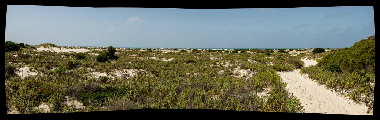

Eucla, Western Australia
A rabbit can topple a town. It took less than a decade of them. In the 1890s a plague of introduced rabbits swept across the Eucla district and stripped the dune grasses bare, and once the plants that anchored the sand were gone, the dunes began to walk. They have been walking ever since, swallowing the old telegraph station of Eucla a little at a time, then drawing back to reveal it, a set of stone ruins half-drowned in a slow ocean of sand on the edge of the Great Australian Bight.
Where the Continent Talked to Itself
Eucla was born to carry messages. When the telegraph line linking Western Australia to the rest of the country opened in 1877, this lonely point near the colonial border became one of the most important stations on the wire. It was a translator as much as a relay: South Australia and Victoria sent in American Morse code, while Western Australia used the international Morse familiar today, and the operators at Eucla converted between the two systems by hand. For a few decades, a meaningful share of the continent's east-west conversation passed through this single room on the Nullarbor's edge.
A Hundred People at the Edge of Nowhere
At its height around the 1920s, Eucla supported close to a hundred residents, an astonishing density of life for a place this remote. Supplies arrived by sea, hauled ashore at a jetty and carried inland on a kilometre-long tram line to the station. Telegraph operators, their families, and the farmers who tried to work the surrounding land made a genuine community here. The 1898 census counted 96 people. Then in 1927 a new telegraph line was built far to the north, alongside the Trans-Australian Railway, and the wire that had been Eucla's reason for existing fell quiet.
The Town That the Sand Took
As the dunes advanced, the original townsite became unlivable, and the settlement retreated about four kilometres north and uphill onto the escarpment. The old town was abandoned to the sand. Even the dead were not left in peace: as the dunes crept over the graves of pioneer farmers and telegraph operators, some headstones and plaques were lifted and carried to the museum in the new town for safekeeping. Today the ruined telegraph station and the remains of its jetty still stand in the sandhills south of present-day Eucla, appearing and disappearing as the dunes shift, the most haunting set of ruins on the Eyre Highway.
Mirning Country
Long before any telegraph wire, this was, and remains, the Country of the Mirning people, whose lands stretch along the Nullarbor coast and the Bunda Cliffs of the Great Australian Bight. The very name Eucla is thought to come from a Mirning word connected to the planet Venus, Yerkala, the rising of the bright star woven into stories far older than the town. The Mirning hold the Bight as the realm of Jeedara, a great white whale of the Dreaming, and the waters offshore are still among the most important whale nurseries on Earth. The ruins in the sand are a single recent chapter in a place that has been known and named for thousands of generations.
The Nullarbor Nymph
Eucla's strangest moment of fame came in 1971, when reports and blurry photographs spread of a wild blonde woman said to live among the kangaroos out on the plain. The world's press seized on the so-called Nullarbor Nymph, and for a giddy season this dot on the map drew international attention. It was a hoax, dreamed up by the tiny settlement itself, a piece of outback mischief that says something true about Eucla: a place this isolated learns to make its own entertainment, and occasionally fools the entire watching world.
From the Air
Eucla sits at approximately 31.68 degrees south, 128.88 degrees east, the easternmost locality in Western Australia, about 11 kilometres from the South Australian border on the Eyre Highway. From the air, the defining features are the dramatic Eucla Pass, where the highway climbs from the low Roe Plains up onto the escarpment, and the bright band of the Delisser Sandhills running down to the white beaches and turquoise shallows of the Great Australian Bight. The old telegraph station ruins lie in the dunes south of the present town, between it and the coast. Eucla Airport (YECL) is the local strip, used mainly by the Royal Flying Doctor Service; the nearest weather-reporting field is Forrest Airport (YFRT) about 120 kilometres west. Visibility is usually excellent, though hot northerly winds off the Great Victoria Desert can raise dust.
Nearby Stories
- Bunburra Rockhole Meteorite 35 km away
- Mundrabilla, Western Australia 46 km away
- Old Homestead Cave 49 km away
- Koonalda Cave 49 km away
- Eyre Highway 77 km away
- Great Australian Bight 127 km away
- Roe Plains 143 km away
- Eyre Telegraph Station 241 km away