Ewiges Meer
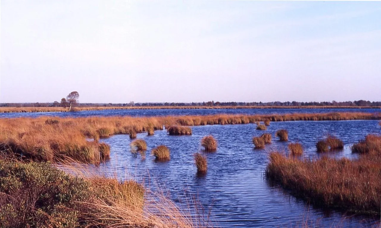
The name translates as Eternal Sea, and the choice of words is not modest. Ewiges Meer is not a sea. It is a 91-hectare lake, dark with the tannins that peat releases, sitting at 8.5 meters above sea level on the shoulder of the Oldenburg-East Frisian Geest Ridge between Aurich and Wittmund. What makes it remarkable is what it sits on. This is the largest raised-bog lake in Germany - a body of water perched on top of an active peat dome, held in place not by stone or clay but by the slow-growing carpet of sphagnum moss and decomposed plant matter that has been accumulating here for thousands of years. The whole arrangement is precarious in geological terms and stable in human ones, and the surrounding 1,290 hectares of unutilized bog show the actual raised-bog profile of the country before drainage and agriculture rewrote it.
A Lake Inside a Living Sponge
Raised bogs do not behave like ordinary wetlands. They grow upward from their own dead vegetation, forming domes that sit above the local water table - kept wet not by groundwater but by rainfall alone. The peat layer functions like a vast saturated sponge, and a pool of water sitting on top of one is, technically, a lake floating on a vegetable cushion. The local term for the smaller versions is bog eye - a Dobbe. Nearby, just off the main lake, sits one of these smaller dark pools, a perfect circle reflecting the sky, fringed with purple moor-grass tussocks. The Ewiges Meer is the giant of the type, the core zone of the roughly 33-square-kilometer Grosses Moor bog complex that surrounds Aurich, and one of the only places in East Frisia where the land has been allowed to keep doing what it did before humans arrived.
Eversmeer and the Ground Fog
Approach from the village of Eversmeer and the bog announces itself in stages. The cultivated fields end. The trees thin to scattered birch. The ground softens underfoot, the path narrows, and the smell shifts toward something earthy and slightly sweet that is the signature of saturated peat. In the right weather - cool mornings after warm days - the bog produces its own ground fog, a low layer that hangs over the moor-grass and the open water, sometimes thick enough to swallow a person at the knees. Photographs of this fog over the lake are some of the most reproduced images of East Frisian nature, and they explain something about the name. On a still morning the dark water and the white fog together look genuinely oceanic, as if a small piece of the North Sea had been laid down inland and forgotten.
What the Reserve Protects
The nature reserve covers 1,290 hectares, and most of it is the bog around the lake rather than the lake itself. The protection is about preserving the profile - the layered structure of living moss on top, fibrous peat in the middle, denser black peat at the base - that took thousands of years to build and that nineteenth-century drainage projects across northern Germany erased almost everywhere else. Purple moor-grass dominates the open ground. Birch and Scots pine creep in at the margins. The wildlife is the quiet kind: bog-specialist invertebrates, breeding meadow birds, dragonflies that need acid water. The reserve straddles the county line between Wittmund and Aurich, which makes it administratively complicated and ecologically simple. The bog does not care about borders. It is simply allowed to keep being a bog.
From the Air
Spot it from above and the Ewiges Meer looks like an inkblot dropped on a piece of green paper. The shape is irregular, with a long axis running roughly east to west. The water reads as black or deep brown depending on the light, sharply different from the lighter green of the surrounding moor and the brighter green of cultivated fields beyond. The Dobbe sits just to one side, a smaller dark spot. The whole protected complex shows clearly against the geometric grid of drainage ditches and field boundaries that defines the cultivated East Frisian landscape on every side - a single patch of land where the older logic of water, peat, and time has been left to run its own course.
From the Air
The Ewiges Meer sits at 53.55 degrees north, 7.43 degrees east, on the border of Aurich and Wittmund counties in East Frisia. From the air it appears as a dark, irregular sheet of water set in a paler patch of unutilized bog and moor-grass, surrounded by the cultivated rectangles of the East Frisian Geest. Nearby airfields: Wittmundhafen (ETNT) about 12 km east-northeast, Emden (EDWE) about 35 km west-southwest, and Wilhelmshaven-Mariensiel (EDWI) about 35 km east. Recommended viewing altitude 2,000 to 4,000 feet for a clear read of the lake outline, the smaller Dobbe pool, and the protected bog complex against the surrounding farmland.
Nearby Stories
- Wilhelmshaven 1.3 km away
- Evenburg 5.4 km away
- Rastede Palace 8 km away
- German Trawler V 1101 Preussen 8.6 km away
- German submarine U-777 8.6 km away
- Wadden Sea 9.8 km away
- Battle of Heiligerlee (1568) 12 km away
- HVDC DolWin2 22 km away