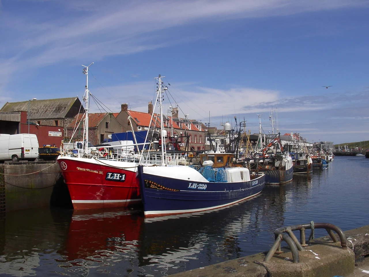

Eyemouth
On the evening of 14 October 1881, the wives and children of Eyemouth waited on the pier. They had heard the boats had set out that morning. They had heard the wind rise. They had seen, by mid-afternoon, the sky to seaward turn the colour of an old bruise. By midnight, 129 of their men were gone, and most of the town's fishing fleet lay broken on the rocks below St Abbs Head. The Eyemouth Disaster did not happen because the fishermen were careless. It happened because they had bills to pay, and because the sea, on the morning of 14 October, had looked merely uncertain. The town has never quite forgotten.
The Mouth of the Eye
The Eye Water carves a narrow notch in the cliffs of the Berwickshire coast, and where it meets the North Sea, the town huddles around its harbour like hands around a small fire. The name is literal: the mouth of the Eye, the river giving up to the sea. Two miles east of the A1, eight miles north of Berwick-upon-Tweed, Eyemouth occupies one of the few breaks in a coastline of high cliffs and clear deep water. The vennels, those narrow alleys preserved from the older village, were built deliberately tight to baffle the wind that comes screaming off the North Sea in winter. Walking them, you can still smell the haar coming in - the cold sea fog that drifts up the Eye Water on summer mornings and erases the world in twenty minutes flat.
An Italian Fortress on a Scottish Spur
In 1547, with England and Scotland at war during the Rough Wooing, the English engineer Sir Richard Lee built something on the promontory above the harbour that had never been built in Britain before: a trace-italienne artillery fort with angled bastions designed to deflect cannon fire. It cost £1,906. Stone came from a demolished tower at Dunglass; timber came from Coldingham Priory, plundered for the purpose. The fort was demolished three years later under the Treaty of Boulogne. Then in 1557, the French - allies of the Scots under Mary of Guise - built a larger one in the same place, capable of holding 500 French troops, probably under the Italian engineer Lorenzo Pomarelli. That one was scheduled for demolition in 1559. Today the earthwork ramparts of both phases survive on Fort Point, a grassy reminder that Eyemouth once mattered to the great powers of Europe.
Black Friday
William Spears, a fisherman whose bronze statue still points the way to Ayton from the Market Place, had won the long battle against the Church of Scotland's tithes on fish. The fishermen of Eyemouth were finally free of the levy. The cost of fighting it had been crushing, but the victory was real. And then came 14 October 1881. The morning broke fair enough that the fleet went out. By afternoon, hurricane-force winds were driving in from the south-east. Twenty boats and 129 men from Eyemouth alone were lost; including the dead from other coastal villages, the total reached 189. The harbour was too shallow for many of the returning boats to enter safely against the wind, and townspeople watched from the cliffs as their own husbands and sons drowned within sight of land. The disaster is remembered in the Eyemouth Tapestry, a community-stitched memorial in the museum, and since 2016 in a five-metre bronze called Widows and Bairns standing at the harbour.
The Resurrectionists' Watch-House
Among the older buildings of the town, the cemetery watch-house tells its own quiet story. In the early nineteenth century, when medical schools in Edinburgh paid well for fresh corpses and asked few questions, families along the east coast began posting guards at new graves. The Eyemouth watch-house was built so that someone could sit through the night with a lantern and a musket, waiting for the Resurrectionists. Gunsgreen House, the elegant Georgian mansion across the harbour, has its own clandestine past - it was built by a smuggler, with hidden chambers for contraband tea. The town has always lived on the edge of legitimate trade. The Eyemouth Pale, a delicately cold-smoked haddock with a paler colour and subtler flavour than the famous Finnan, is still produced here, a quiet survivor of the old industries.
The Working Harbour
In 1997, EU funding and local matching funds paid for a deep-water extension to the harbour. The fish market still runs in the early mornings, visible from a viewing platform; the boatyard still works on commercial vessels; the lifeboat crew still scrambles when two maroons are fired (one means coastguard only). A resident seal called Sammy haunts the harbour, fed scraps by the fishermen, occasionally injured by discarded hooks. The wide sandy bay called the Bantry was built, the story goes, by Irish labourers from the fishing town of that name in County Cork - sent north for work during the lean years - and named in their honour. In storms, plumes of spume still leap clear over the sea wall. The town's residents, as they will tell you, consider themselves Scottish rather than British. The border at the A1 is for tourists.
From the Air
55.87N, 2.09W on the Berwickshire coast, 8 mi north of Berwick-upon-Tweed and just east of the A1. From altitude, look for the tight harbour notch where the Eye Water meets the North Sea, with the grassy earthworks of Fort Point on the promontory immediately north and the wide sweep of the Bantry beach to the south. Nearest ICAO: Edinburgh (EGPH) 50 mi west-northwest, Newcastle (EGNT) 60 mi south. Best viewed at 2,000-3,000 ft AGL on clear days; haar can blanket the coast suddenly between May and August.
Nearby Stories
- Chillingham Castle 3 km away
- Battle of Ancrum Moor 9.3 km away
- Bass Rock 11 km away
- HMS Nottingham (1913) 12 km away
- HMS Pathfinder (1904) 15 km away
- Yester Castle 18 km away
- German submarine U-1274 23 km away
- Alexander L. Kielland (Platform) 282 km away