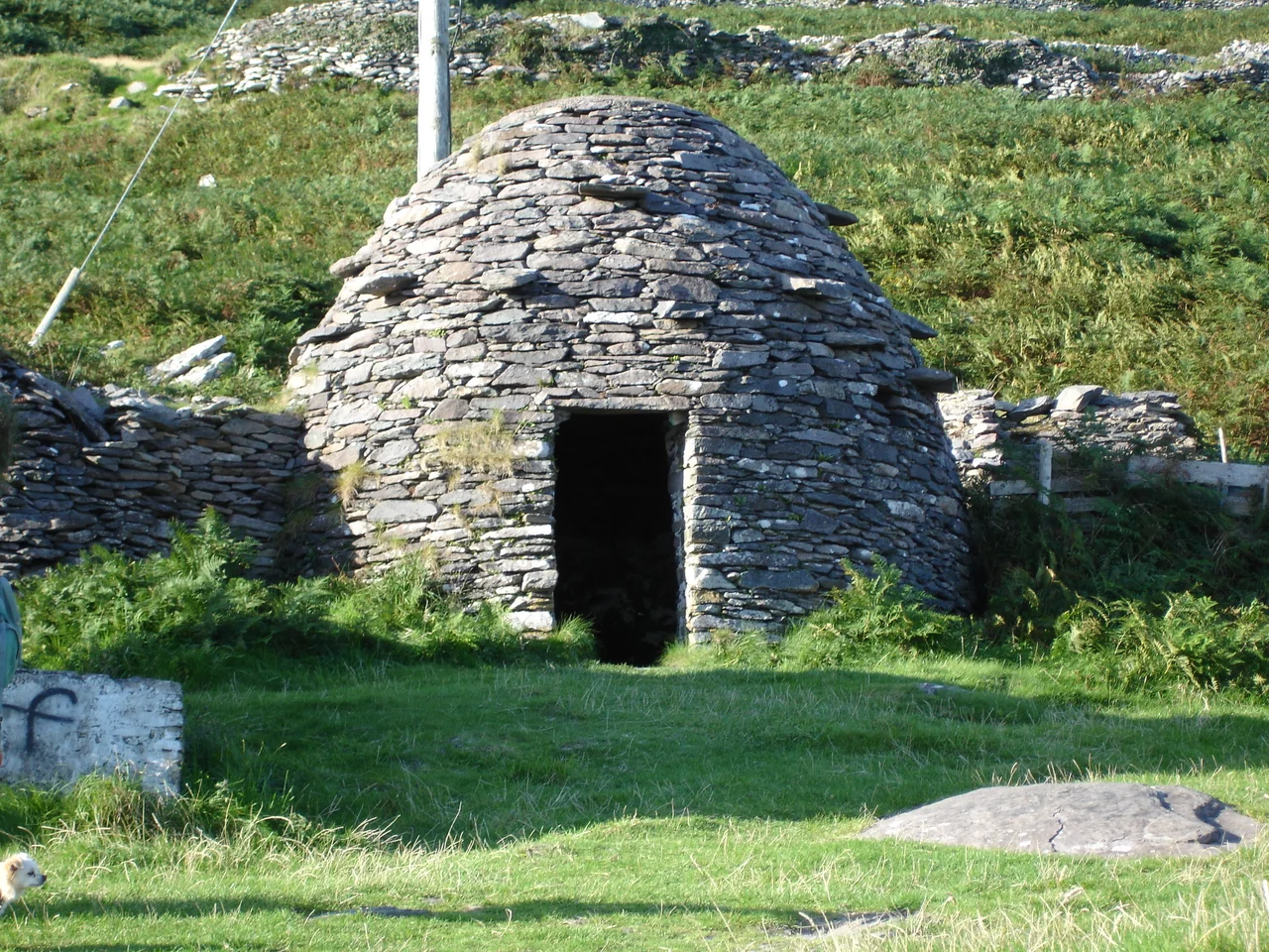

Fahan, County Kerry
Four hundred and sixty stone structures sit on the slopes of Mount Eagle, of which four hundred and fourteen are beehive huts. That is not a misprint. Walk a single hillside above the road between Ventry and Slea Head and you can trip over millennia. Dunbeg Fort clings to a promontory whose cliffs are slowly chewed away by the Atlantic. Drystone clocháns - their roofs corbelled inward in tightening rings - cluster on the hillsides. A Famine-era cottage, restored and furnished, sits a stone's throw from a fort built before Christ. The whole of Irish history is folded into a four-mile drive, layer upon layer, and the layers do not bother to keep themselves separate.
Dunbeg, Slipping into the Sea
Dunbeg Fort is built on a triangular promontory that pokes out into Dingle Bay like the prow of a ship. The Atlantic has been chewing on that prow for centuries. The cliffs have eroded since the fort was built, and a substantial portion of the structure has already gone over the edge into the surf below. What remains is dramatic - a thick stone wall cutting off access from the landward side, with a single large beehive hut behind it that someone occupied long after the original builders were gone. The dating is wide open. Its design resembles Iron Age blockhouse forts in Scotland, such as Crosskirk in Caithness and Clickimin in Shetland - which would push its origins to before the Christian era. A visitor centre at the site offers audiovisual displays, a craft room and a café, all kept comfortably back from the eroding cliff.
Cities of Beehives
The collection of clocháns at Fahan is said to be the most remarkable in Ireland. A clochán is a drystone hut, round or sometimes D-shaped, built by laying flat stones in tightening rings until the roof closes itself into a corbelled dome - a beehive shape without a single piece of timber. They range in diameter from four feet to twenty-two feet. Some sit alone. Some are wrapped inside larger stone ringforts called cashels, forming what archaeologists call 'cities' - two great clusters of huts at Fahan, sharing walls and walkways. Dating them is the hard part. Hermit monks may have built the earliest huts in the early Christian centuries. Most, though, are now thought to date to the twelfth century, when Norman invaders pushed Gaelic Irish farmers off the better lowlands and onto marginal land like the Dingle hillsides.
Du Noyer's Sketches
George Victor Du Noyer visited Fahan in 1858 and drew what he saw - careful pen-and-ink sketches that are still useful to archaeologists today. Du Noyer was a geologist for the Geological Survey of Ireland and an obsessive landscape artist, and his Fahan drawings caught the settlement at a moment when it was still actively transitioning from working farmland into curiosity. He believed Dunbeg Fort had been built to protect the clochán community. Modern dating disproves him - Dunbeg likely predates the Christian Era by centuries, while the surrounding huts are mostly medieval - but his instinct that the structures formed a single coherent landscape has held. Whoever lived in the huts surely used the fort, even if they did not build it.
The Kavanaugh Cottage
The Kavanaugh Famine Cottage sits on the north side of the R559, just west of the Dunbeg car park. In its original form it had two rooms and a loft, the standard layout for a small tenant family in the early 19th century. Restored as a museum, it now has three rooms and two outhouses, furnished with the kinds of objects a family would have owned during the worst years of the Great Famine - a turf creel, a metal pot for the potatoes that failed, a single iron bed shared by parents and children. The Famine emptied this peninsula. Many of the families who left this cottage and the others around it boarded coffin ships for Boston, Newfoundland and New York. The cottage is small. It contains an entire chapter of Irish history.
Walking Through Time
What makes Fahan extraordinary is the indifference of its landscape to its own age. You round a bend on the R559 and find yourself looking at a hut wall built before the Romans reached Britain. You park beside a Famine cottage and walk to a promontory fort that might predate writing in Ireland. Sheep graze among walls that once divided cashel from clochán. The air smells of furze and salt. The Atlantic chops below the cliffs in the same direction it chopped when the first stones were laid. There are 414 beehive huts within a single townland. Their builders did not write their names. They left only stone, and that turns out to have been enough.
From the Air
Fahan sits at 52.10°N, 10.42°W on the southern shore of the Dingle Peninsula, below Mount Eagle and between Ventry and Slea Head. The cluster of stone structures is visible from low altitudes against the green hillsides, especially in raking morning or evening light when shadows define the circular huts. The nearest airport is Kerry (EIKY), about 45 nautical miles east near Farranfore. For sightseeing, descend to 1,500-2,500 feet AGL and follow the coast from Dingle town west toward Slea Head; expect strong Atlantic gusts and quickly changing cloud bases. The R559 ribbons along the shore as a useful visual reference.
Nearby Stories
- Ballyheigue Castle 1 km away
- Killemlagh Church 2.8 km away
- Pouldergaderry Sinkhole 6.8 km away
- Derreen Garden 11 km away
- Kilkee 59 km away
- The Laki Eruption: The Volcano That Changed World History 1366 km away
- The Northern Lights: The Sky Show That Vikings Thought Was Bridge to the Gods 1469 km away
- Sao Miguel 1935 km away