
Fan District
Look at a map of central Richmond and the geometry leaps out: from a point on the eastern edge of Monroe Park, streets fan westward in a slowly widening spray until they re-organize themselves into a regular grid past Virginia Commonwealth University. This is exactly what the neighborhood is called - the Fan - a name coined in the mid-twentieth century by a Richmond Times-Dispatch editorial when 'West End' no longer accurately described what had become a midtown district. In 1880 these blocks were tobacco fields. By the 1920s they were almost completely built out. In between came one of the great residential developments of the American urban nineteenth century, made possible by the country's first electric streetcar system, which Richmond inaugurated in 1888 and which ran straight up Franklin Street to make these new addresses fashionable.
From Sydney to the Fan
The land was originally part of William Byrd II's holdings, the same Byrd family that gave its name to Byrd Park a few blocks south. In 1817 it was plotted as the village of Sydney. Development proper began after the Civil War, accelerated by streetcars, and exploded around 1900 when Franklin Street became the fashionable West End address everyone in Richmond wanted. The real estate frenzy from 1880 to 1920 produced the architectural fabric that defines the Fan today - block after block of attached and semi-attached houses in styles that arrived one after another like dance partners changing at a ball. The University of Richmond, which had been on Lombardy Street near today's VCU, moved west to its present Westhampton location to escape the density. During the Great Depression many of the single-family houses were subdivided into apartments, which is part of how the neighborhood survived the mid-century flight to the suburbs that emptied so many comparable districts elsewhere.
The Architecture
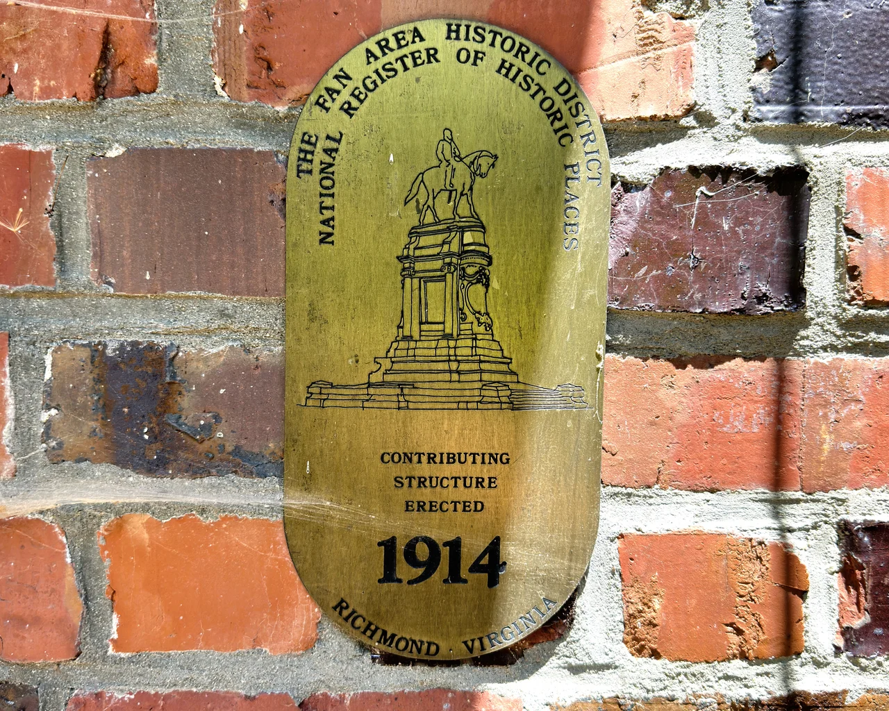
The Fan is often described as having one of the longest continuous stretches of Victorian architecture in the United States, though strictly speaking much of the housing stock is Edwardian or Revivalist rather than Victorian proper. The eastern blocks, built earliest, are full-throated Italianate and Queen Anne. The western blocks, built later, are the same general ideas in a more restrained classical vocabulary - gables and turrets, but pared back, with details done in simplified classical form rather than full Victorian exuberance. Colonial Revival and American Craftsman are everywhere. So are Richardsonian Romanesque, Second Empire, Beaux-Arts, Tudor Revival, Spanish, Gothic Revival, Art Deco, Jacobethan, Bungalow, James River Georgian, Southern Colonial, and Federal. The Branch House on Monument Avenue, a 1914 Tudor design by John Russell Pope, became home to the Virginia Center for Architecture in 2005. The Fan was added to the National Register of Historic Places in 1985, and the brass plaques on many buildings document the year each was built.
Monument Avenue
Monument Avenue runs straight through the Fan, a grand European-style boulevard with grassy medians, and for most of a century it carried equestrian statues of Confederate figures - Robert E. Lee, J.E.B. Stuart, Stonewall Jackson, Jefferson Davis, Matthew Fontaine Maury. The avenue was Richmond's most prestigious address and its most contested public memory at the same time. In 1996 the city added a statue of Arthur Ashe, the Richmond-born tennis champion whose family had been segregated out of the public courts where he learned to play. After the murder of George Floyd in 2020, the avenue was emptied of its Confederate figures - Stuart taken down on July 7, 2020, the Lee statue removed on September 8, 2021 - leaving Ashe as the only remaining major statue on the boulevard. The Fan around the avenue has continued its everyday life through all of it: locally-owned cafes and restaurants, parks, tree-lined avenues, houses of worship, students walking to class through what has become VCU's Monroe Park Campus.
Local Life
What makes the Fan a Fan and not just a historic district is that people still live in these houses. The District is primarily residential. It blends west into the Museum District around the Virginia Museum of Fine Arts, south toward Carytown with its ornate Byrd Theatre, and east into the Lower Fan and Uptown areas around VCU. The main east-west thoroughfares - Broad, Grace, Monument, Patterson, Grove, Floyd, Main, Parkwood, and Cary - each carry a slightly different commercial character. The Fan District Association still publishes histories of individual blocks. The plaques still mark building dates. A neighborhood that was tobacco fields when the Civil War ended, that was built out within sixty years, that survived its statues both standing and falling, is still doing the slow work of being a place where people raise children and walk dogs and take their coffee on the porch.
From the Air
Coordinates 37.5525 N, 77.4656 W, just west of downtown Richmond. Best viewed from 1,500-3,000 ft AGL. The fan-shape is most obvious from altitude: streets diverging from a point near Monroe Park and Belvidere Street, widening westward to Arthur Ashe Boulevard. Monument Avenue runs straight east-west through the middle with its distinctive median islands and circles - now mostly empty of their former monuments. The district is bounded north by Broad Street and south by VA Route 195. Richmond International Airport (KRIC) lies 7 miles east; Chesterfield County (KFCI) is 7 miles south-southwest.
Nearby Stories
- Kings Dominion 8.4 km away
- Battle of Hatcher's Run 9.7 km away
- Francisco's Fight 14 km away
- Piney Grove at Southall's Plantation 17 km away
- Jamestown Settlement 19 km away
- Battle of Amelia Springs 22 km away
- Menokin 29 km away
- Highland (James Monroe House) 42 km away