.jpg)
Feather River
Two of the Feather River's tributaries do something that rivers in the Sierra Nevada are not supposed to do. The East Branch and the Middle Fork both originate east of the Sierra crest, in the Diamond Mountains, and then cut westward through the granite wall that divides the Great Basin from California's Central Valley. Most Sierra rivers start near the crest and flow downhill in one direction. The Feather's tributaries breach the range itself, carving canyons through rock that has stood for millions of years. This geological stubbornness -- water finding a way where topography says there should not be one -- defines a river that has shaped Northern California's landscape, economy, and water supply for more than a century.
Four Forks Into One
The Feather River assembles itself from four main branches that converge in the Sierra Nevada foothills about five miles northeast of Oroville in Butte County. The North Fork is dominant, draining roughly 60 percent of the entire upper watershed. Its headwaters begin in Feather River Meadows, where Rice Creek flows south from Cold Boiling Lake in Lassen Volcanic National Park. The Middle Fork accounts for another 32 percent of the upper basin, gathering water from Sierra Valley -- the largest high-alpine valley in the continental United States, sitting at nearly 5,000 feet and straddling the Pacific Flyway where migrating birds rest each season. The South Fork and West Branch are comparatively modest, each draining less than 5 percent of the upper basin. All four branches ultimately merge as arms of Lake Oroville, the reservoir that serves as the linchpin of California's water infrastructure.
Gold Fever and Settlement
The California Gold Rush of 1849 transformed the Feather River from a remote waterway into a destination. Prospectors flooded the river's forks, panning gravel bars and digging into canyon walls. The gold was real, and the damage was immediate -- hydraulic mining would later choke streams with sediment and reshape entire hillsides. Settlers followed the miners. The American and Indian Valleys saw permanent homesteads by the 1850s, and Sierra Valley's first settlers arrived in 1852. Towns like Loyalton, Sierraville, Beckwourth, and Portola grew up where tributaries came together and valleys offered level ground. The Feather River's canyons also attracted railroad engineers. The Western Pacific Railroad threaded its main line through the Feather River Canyon, choosing the river's relatively gentle grade over the steeper crossings used by the Central Pacific to the south.
California's Lifeline
Since the 1960s, the Feather River has served as the primary water source for the California State Water Project, one of the largest public water infrastructure systems ever built. The river's average annual flow exceeds seven million acre-feet, and much of that water is captured at Oroville Dam, then pumped south through hundreds of miles of aqueducts to supply farms in the San Joaquin Valley and cities in Southern California. The same impoundment generates hydroelectric power through the Oroville-Thermalito Complex, and smaller facilities along the West Branch -- including the Lime Saddle Powerhouse and Coal Canyon Powerhouse, operated by Pacific Gas and Electric -- add to the grid. The river that once drew prospectors looking for gold now moves something more valuable: the water that allows tens of millions of people to live in a place where rainfall alone could never sustain them.
A River Still Wild
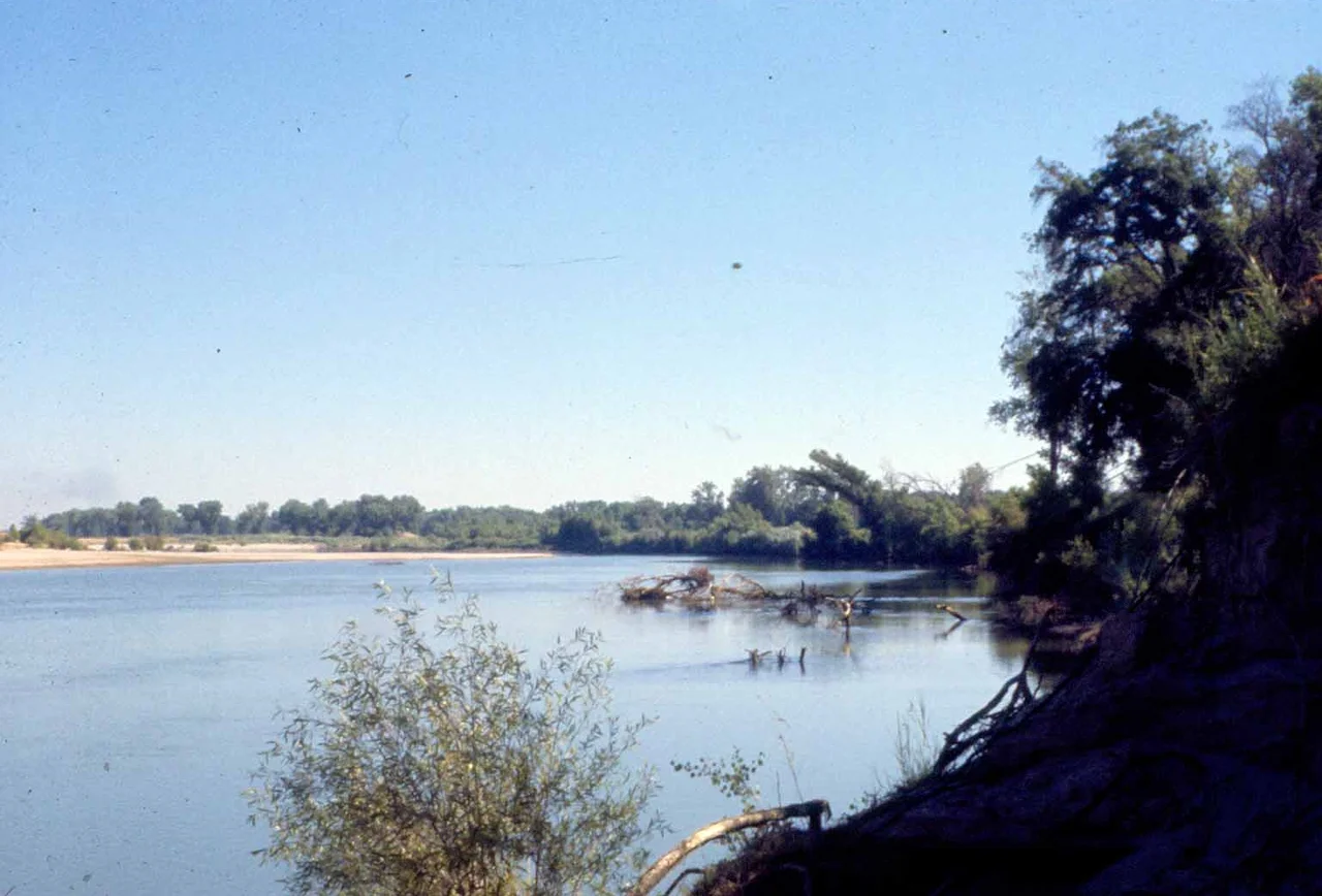
Despite its heavy engineering, stretches of the Feather River retain genuine wildness. In the upper Sierra Nevada reaches, steep gradients and rocky channels create the kind of turbulent whitewater that earns Wild and Scenic River designations. Lower down, after the forks have merged and the river broadens through the Sacramento Valley, the riparian corridor supports a different kind of richness. Near Yuba City, valley oak trees line the banks with understories of wild grape, a landscape that would be recognizable to the Maidu people who lived along these waterways for thousands of years. The Feather River stonecrop, a rare succulent found nowhere else on Earth, grows only within this watershed. Mercury contamination from Gold Rush-era mining still lingers in the river's fish populations, a reminder that the Feather carries its history in its sediment as much as in its current.
From the Air
The Feather River's confluence with the Sacramento River lies near 38.785N, 121.622W, visible as a broad junction of waterways in the Sacramento Valley. From 3,000-5,000 feet AGL, Lake Oroville and the massive Oroville Dam are prominent landmarks upstream. Following the river northeast, the four forks branch into the Sierra Nevada foothills and higher mountains. The Feather River Canyon, carved by the North Fork, is a dramatic sight from altitude. The nearest airports are Sacramento Executive (KSAC) about 25 nautical miles south and Oroville Municipal (KOVE) near the dam. Beale Air Force Base (KBAB) lies approximately 15 nautical miles to the east.
Nearby Stories
- Twenty Rounds in a Grandmother's Backyard 1.7 km away
- Sutter's Mill 5.9 km away
- The Siege at Lindhurst 9.1 km away
- The Warehouse on Oakdale Road 9.8 km away
- Where a Quarter Million Wings Converge 16 km away
- Gold Country 16 km away
- The Night Napa Burned 25 km away
- Malakoff Diggins State Historic Park 38 km away