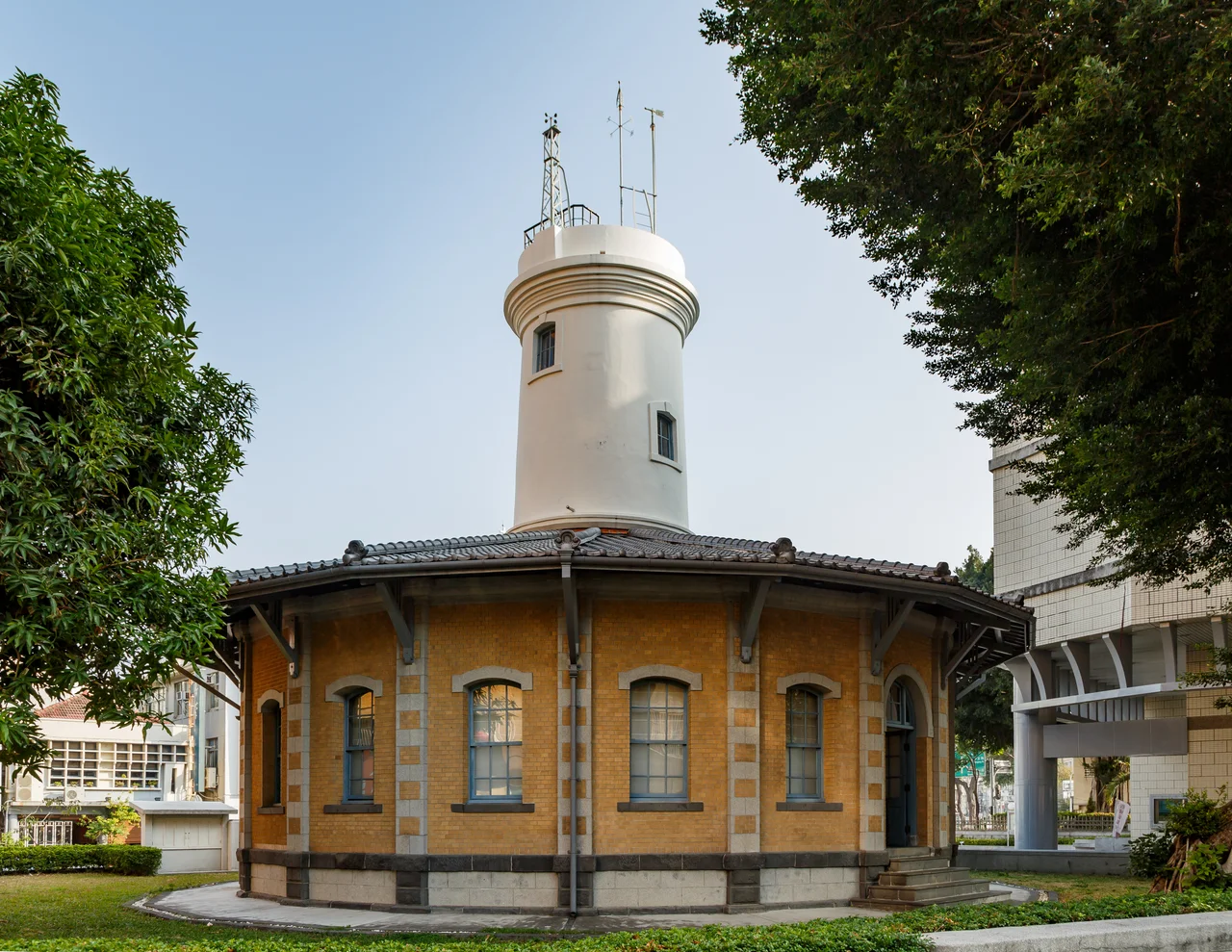

Former Tainan Weather Observatory
Count the spokes. From above, the Former Tainan Weather Observatory reads like a wheel pressed into the earth — eighteen radiating lines extending outward from a central tower, a design so unusual that locals have called it the 'eighteen-spoke building' for more than a century. Built in 1897, just two years into Japanese colonial rule, it was Taiwan's first modern meteorological station. Weather instruments still crown the tower. The building never moved. The city grew around it.
The Wheel in the City
Most buildings follow a street grid. This one follows a different geometry entirely. The Former Tainan Weather Observatory was constructed on a circular plan organized around three concentric rings: an outer band of offices, a circular hallway running between them, and an inner core with the tower at its center. From ground level, the design is elegant and slightly disorienting — corridors curve where you expect corners. From the air, the logic becomes clear. The radiating pattern of the original layout, which gave the building its popular nickname, reflected the scientific purpose of the structure: a wheel built to take the measure of the sky. The exterior instruments at the top of the tower recorded temperature, humidity, wind speed, and barometric pressure across decades of Taiwan's history under Japanese administration.
Measurement and Memory
Japan brought systematic scientific administration to its colonies, and the Tainan Weather Observatory was part of that project. Established in 1897, it collected meteorological data across the southern reaches of the island at a time when Tainan was the island's largest and most historically significant city. For most of the twentieth century, the building stood — first as an active station, then as something in between: too important to demolish, too neglected to use. Tainan City Government designated it a municipal historic site in 1998, and the national government followed in 2003 with full national monument status. It eventually opened to the public as a museum of meteorology, giving the old instruments a new audience.
Shaken and Restored
On February 6, 2016, a magnitude 6.4 earthquake struck southern Taiwan, killing more than a hundred people and damaging structures across Tainan. The observatory sustained damage and closed for six months of repairs — a reminder that even buildings designed to document the forces of nature are not immune to them. When it reopened on March 31, 2019, visitors could again walk the curving hallways and climb toward the observation instruments. The museum inside tells the story of how Taiwan's weather has been tracked, categorized, and understood across more than a century of changing political authority and scientific practice.
Walking Distance from History
The observatory stands a short walk southwest of Tainan Station, which places it within easy reach of the city's dense concentration of historic monuments. Tainan, often called Taiwan's cultural capital, preserves more surviving historical structures per square kilometer than anywhere else on the island. The weather observatory fits naturally into that context — not as a temple or administrative palace, but as evidence of a different kind of ambition: the desire to understand and record the physical world. In a city full of sites devoted to gods, ancestors, and heroes, the old meteorological station offers something quieter. It is a monument to observation itself.
From the Air
The Former Tainan Weather Observatory sits at approximately 22.9937°N, 120.2050°E in the West Central District of Tainan. Its distinctive circular footprint with radiating spoke-like elements is most visible from lower altitudes. A viewing altitude of 1,500–3,000 feet offers the best perspective on the building's unusual geometry within the surrounding urban grid. The nearest major airport is RCKH (Kaohsiung International), approximately 25 km to the southwest. Tainan Airport (RCNN) is a closer regional option, about 5 km to the west. Tainan sits on the southwestern coastal plain, with flat terrain and generally good visibility in dry-season months.
Nearby Stories
- Chung Li-ho Museum 0.7 km away
- Jingzaijiao Tile-paved Salt Fields 8 km away
- Wanchin Basilica of the Immaculate Conception 9.3 km away
- Namasia District 16 km away
- Battle of Penghu 21 km away
- Shoushan (Kaohsiung) 21 km away
- Penghu Air Raids 62 km away
- Daya Bay 512 km away