Shoushan (Kaohsiung)
The monkeys will steal your lunch. Thousands of Formosan rock macaques live on Shoushan, a 365-meter mountain that guards the northern entrance to Kaohsiung Harbor, and they have learned that hikers carry food. This is the most immediate thing visitors discover about the mountain the Dutch named Ape Hill in the 17th century. But Shoushan -- also called Monkey Mountain, Chaishan, and Kotobuki-yama, depending on who ruled Taiwan at the time -- rewards those who look past the macaques. Beneath the tropical canopy lies one of the oldest sites of human habitation in southern Taiwan, with ruins dating back 4,000 to 5,000 years. The mountain is built from coral reefs and limestone that rose above the sea, and its flanks are riddled with caves where stalactites still drip in the darkness.
Five Names for One Mountain
Shoushan's collection of names reads like a roster of Taiwan's rulers. The Dutch called it Ape Hill for its macaques. The northern section was known as Snake Hill, a 17th-century term that has mercifully fallen out of popular use. During the Japanese colonial period, the southern peak was renamed Long Life Hill in honor of crown prince Hirohito, sometime between 1911 and 1915. Old European maps label the summit Saracen's Head. The Chinese name Shoushan -- Longevity Mountain -- and its alternate, Chaishan, or Firewood Mountain, reflect more practical local concerns. Each name captures something real about the mountain: its wildlife, its strategic position, its relationship to the powers that passed through. Together, they form a linguistic archaeology of southern Taiwan.
Coral Cliffs and Hidden Caves
Shoushan is not what most people picture when they think of a mountain. It is made of coral reefs and limestone, evidence of a seabed that rose above the waves. The limestone consists of fossilized coral, sea algae, and shells compacted over geological time. Because the mountain emerged from the ocean, its flanks bear the marks of marine erosion: jagged cliffs, sea caves, and formations studded with stalactites. The mountain and its foothills contain a large number of caves, four of which are open to the public during the dry season from November through April, though a permit from the Shoushan National Nature Park management office is required. The mountain stretches 5.5 kilometers from north to south and 2.5 kilometers east to west, covering roughly 485 hectares -- an improbable wilderness at the edge of a city of nearly three million people.
A Tropical Island of Biodiversity
Despite being classified as a secondary forest -- regrown after earlier clearing -- Shoushan harbors over 800 plant species. The tropical climate, with average temperatures around 25 degrees Celsius and nearly 1,750 millimeters of annual rainfall concentrated between June and August, creates conditions for remarkable diversity. Banyans spread their aerial roots through the canopy. Paper mulberry and the dreaded Dendrocnide meyeniana, known locally as "dog-bitten fruit" for the rashes it inflicts on bare skin, grow along the trails. The animal inventory is equally rich: 5 amphibian species, 24 reptiles, 106 birds, and 8 mammals, including the Formosan rock macaque -- found only in Taiwan -- and the masked palm civet. The golden birdwing butterfly, Troides aeacus, flashes through clearings. From the tea station at the mountain's summit, hikers look out through the trees toward the Taiwan Strait.
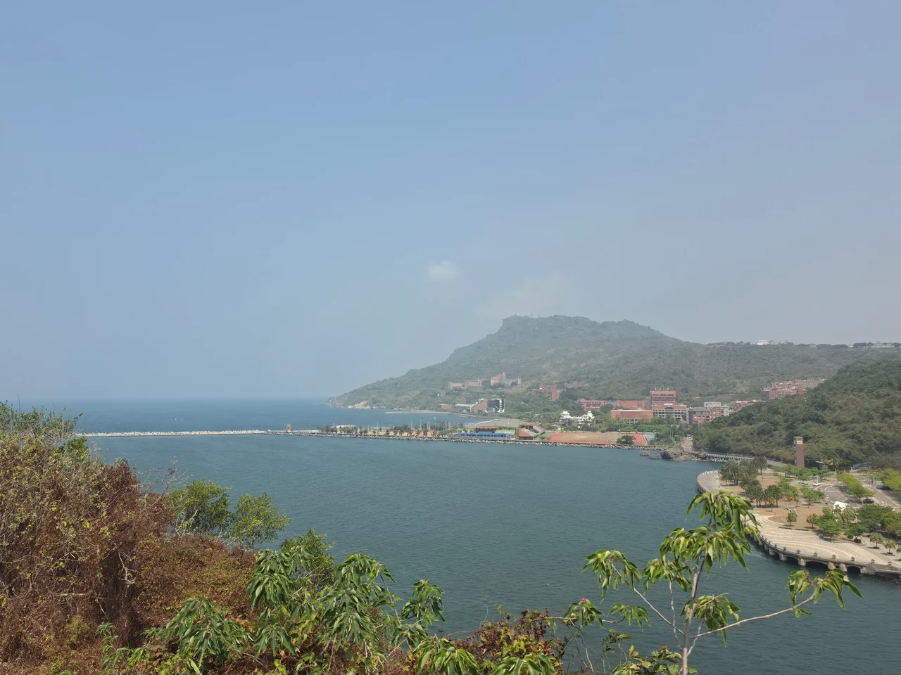
Garrison, Consulate, University
Humans have occupied Shoushan for millennia, and the mountain's strategic position overlooking the harbor has drawn military interest from every regime that governed Taiwan. Qing-era installations from the 17th and 18th centuries and Japanese military facilities from 1895 to 1945 left their traces on the slopes. At the mountain's base, the former British Consulate at Takao, established in 1865, stands as a historical landmark from the era when Western powers demanded trading access to Taiwan's ports. Sizihwan, the natural harbor at Shoushan's southern foot, faces the Pacific and has become one of Kaohsiung's premier tourist attractions. National Sun Yat-sen University, first established in Guangzhou in 1924 and re-established on this site in 1980, occupies the slopes above the beach. An extensive system of boardwalk hiking trails circles the mountain, with tea stations where hikers pause -- water carried up from a reverse osmosis station at the base by volunteers who climb daily.
From the Air
Located at 22.646N, 120.263E, Shoushan rises 365 meters at the northern entrance to Kaohsiung Harbor. It is the most prominent terrain feature in western Kaohsiung, a forested ridge clearly visible against the urban surroundings. Nearby airports: RCKH (Kaohsiung International Airport, 10 km south). Maintain safe altitude -- terrain rises abruptly from sea level. Sizihwan beach and National Sun Yat-sen University are visible at the southern base. Cijin Island and the harbor entrance are immediately to the south.
Nearby Stories
- Taimali 7.2 km away
- Meinong East Gate Tower 15 km away
- Kunci Temple 20 km away
- Checheng Fu'an Temple 42 km away
- Dongji Island 49 km away
- Orchid Island 69 km away
- South Penghu Marine National Park 77 km away
- Hong Kong 12 549 km away