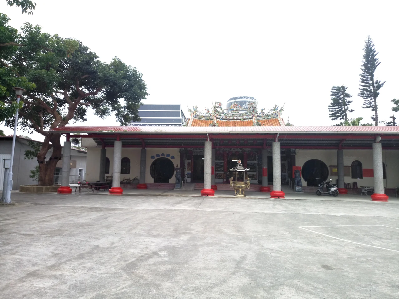

Kunci Temple
In 1960, a young woman who had recently taken Buddhist vows arrived at a small temple in the Taitung valley and stayed for two months. She was not famous yet. She slept in the temple, held conversations about the Dharma under an old chinaberry tree in the courtyard, and then moved on. Her name was Cheng Yen, and she would go on to found Tzu Chi — today one of the largest Buddhist charitable organizations in the world. The chinaberry tree is still there, still standing outside Kunci Temple, still leafy and vast. People come to sit under it. The tree was there before she arrived, and it is here after.
A Plain That Invited Settlement
Longtian Village, where Kunci Temple stands, occupies a stretch of flat land along the Beinan River in Luye Township. At the start of Japanese colonial rule over Taiwan, the area was largely unpopulated — a riverside plain that the colonial administration identified as suitable agricultural land. In 1912, a newly established company acquired a tract of this land as part of the government's "immigration village" program, with plans to plant sugarcane. Families from Niigata Prefecture in Japan were persuaded to relocate here, establishing the settlement that would become Longtian. What arrived as a colonial plantation village became, in time, a real community — with the social and spiritual structures that communities inevitably develop.
A Shrine That Moved, and Moved Again
Inside the new Japanese settlement, a Shinto shrine was built on October 17, 1923. It was dedicated to Prince Yoshihisa and served the spiritual needs of the Japanese immigrant community through the colonial decades. On November 13, 1931, the shrine was relocated to the current grounds of what is now Kunci Temple. When Japan's administration ended in 1945 and the Japanese settlers departed, Han Chinese families who had been living nearby moved into Longtian. They brought with them the Tudigong — the earth god venerated in Chinese folk religion — and installed him in the old Shinto shrine building. The sacred space shifted hands without being destroyed. What had been a Shinto structure became a Taoist and folk religion temple, layering one tradition onto the architecture of another.
The Shrine Reconstructed
Today, Kunci Temple's grounds contain something unusual: a reconstructed Shinto shrine known as Luye Shrine (鹿野神社). The original shrine structure, adapted and absorbed into the temple complex after 1945, was eventually reconstructed through a Taiwan-Japan cooperative effort completed in 2015. This pairing — a working Taoist temple and a reconstructed Shinto shrine on the same grounds — is a compressed architectural history of the twentieth century in rural Taiwan. Colonial-era Japanese religious practice, displaced and transformed, has been restored not as a living faith but as a historical marker, standing alongside the Taoist rituals that replaced it. Visitors move between the two structures and read the same land through two different spiritual vocabularies.
The Chinaberry Tree
Outside the main temple building grows an eighty-year-old chinaberry tree, roughly 20 meters tall — more than twice the expected height for its species. The tree predates many of the temple's current structures. Its size alone would make it a landmark, but it carries additional significance because of the months Cheng Yen spent at Kunci Temple in 1960, early in her life as a nun, when she would gather with other monastics beneath its branches for Dharma discussions. Cheng Yen went on to establish the Buddhist Compassion Relief Tzu Chi Foundation, which grew into one of Taiwan's most influential humanitarian organizations. For Tzu Chi adherents, the tree at Kunci Temple is a pilgrimage point — a living thing that was present at the beginning of something larger. The chinaberry does not know this, presumably. But it keeps growing.
From the Air
Kunci Temple is located at approximately 22.905°N, 121.120°E in Longtian Village, Luye Township, Taitung County. The flat riverine plain of the Beinan River valley is visible from altitude — a contrast with the steep terrain of the surrounding ranges. Taitung Airport (RCFN) is approximately 30 kilometers to the southeast, accessible via Provincial Highway 9. The Luye Highlands, Luye Township's famous hot-air balloon launch site, lies nearby and provides an aerial reference point; Longtian Village sits in the valley below the highlands. Approach from the south or east to appreciate the flat agricultural plain and the forested slopes that frame it. Best viewed at 1,500 to 2,500 feet.
Nearby Stories
- Liudui Hakka Cultural Park 3.3 km away
- 2025 Tainan–Chiayi Earthquake 3.4 km away
- Meinong Hakka Culture Museum 4.3 km away
- Chiaming Lake 13 km away
- Taimali 13 km away
- 1951 East Rift Valley Earthquakes 78 km away
- 2021 Hualien Train Derailment 142 km away
- Mavulis Island 176 km away