Fort Knokke
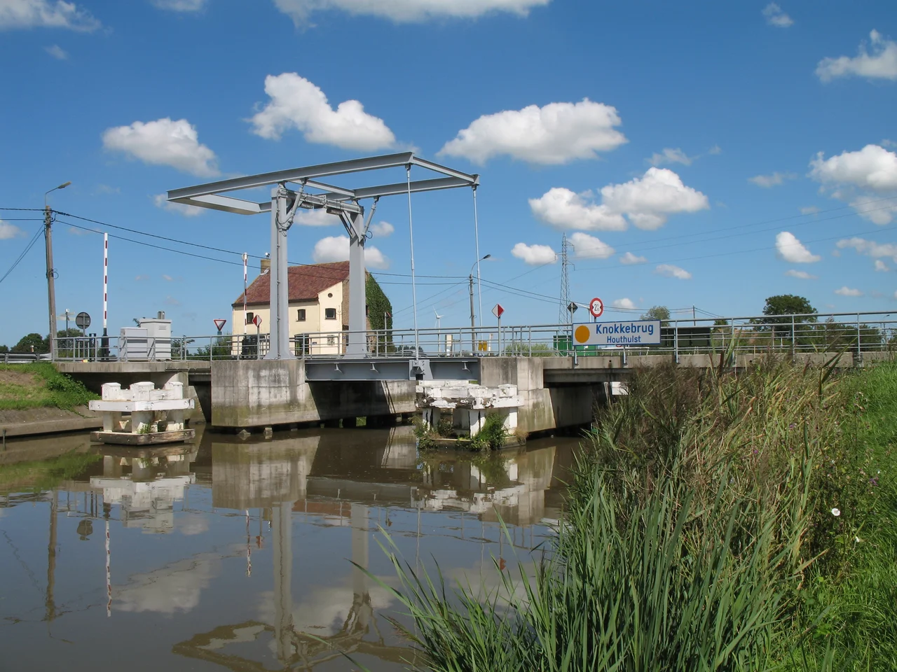
From the ground there is almost nothing to see. A draw bridge spans the Yser, called the Knokkebrug. A wedge of pasture sits between the river and the Ypres Canal where they meet. Cows graze it. A satellite image tells the older story. The pasture is not a pasture but the outline of a star fort, the rays of its bastions and ravelins still legible in the contour of the land even though the brick parapets came down two and a half centuries ago. Fort Knokke, which French maps called Fort de la Knocque, guarded this confluence for two hundred years. Vauban himself redesigned it. Four empires fought over it. Emperor Joseph II of Austria ordered it slighted in 1781 because by then it had outlived the geometry of war.
Why Here
Look at the map and the answer is the water. The Yser flows north toward Nieuwpoort and the North Sea. At Knokke, the Ypres Canal, the Ieperlee, joins it from the southeast, coming down from Ypres. Whoever held the fork held movement in three directions. Holding the fork meant a fort, and holding a fort in seventeenth-century low country meant a star: bastions angled so that defenders could rake the walls of their neighbours with crossfire, ravelins poked forward like wedge-shaped islands to break up assaults, lunettes farther out as forward bastions. Sébastien Le Prestre de Vauban, military engineer to Louis XIV and the man who industrialised siege warfare, walked this ground in 1678. He understood at once what the Spanish had only roughed in a century earlier. By 1692 he had built a triangular citadel with hornworks and ravelins on the south, two bastions added at the cardinal points, and a wide moat dug along the east and west sides.
Four Empires, Two Centuries
The Spanish built the first fort here between 1584 and 1591, during the Eighty Years' War, after Alexander Farnese had captured Ypres and Veurne. The job was to block raiding parties of Dutch rebels coming down from Ostend, and when the long Siege of Ostend ended in 1604, the fort fell into disuse. Spain rebuilt it in 1649 during the Franco-Spanish War. France took the Castellany of Veurne-Ambacht by the Treaty of Aix-la-Chapelle in 1668, which is when Vauban arrived. The fort then changed hands again. In 1695 the Grand Alliance under the Duke of Wurttemberg tried to take it and failed, beaten back by French counter-battery fire and the Yser's geography. In 1712, during the War of the Spanish Succession, it was captured from the French by ruse rather than assault. The Treaty of Utrecht in 1713 handed it to the Austrian Netherlands. In 1744 the French took it back after a two-month siege. Each transfer was a paragraph in a different treaty.
The Day in 1695
The 1695 attack is the clearest small story in the fort's military history. On 19 June, the Duke of Wurttemberg moved on Knokke with 3,000 soldiers and a train of artillery. A French outpost sat half a league away on the Yser under Count de la Mothe, holding the river with over 400 dragoons. The Allies attacked the outpost. The French reinforced. The post fell after a tenacious defence. At the captured bridgehead the Allies threw up a temporary work and mounted two cannon. The French answered with a counter-battery nearby and the two new positions traded fire for days, killing men in numbers that the records will not give us precisely. The Allies tried to widen the bridgehead. French gunners in Fort de la Knocque ranged on them. On the night of 26 to 27 June the Allies withdrew. It is the kind of week that fortresses were built to make happen.
The Engineer of the Sun King
Vauban is the figure who connects this small Flemish fort to the larger story of how Europe fought wars. He served Louis XIV for half a century and built or improved more than 150 fortresses, mostly along the French frontiers. His double pre carre, two parallel lines of fortresses guarding the northern border, was meant to be impenetrable in depth, so that an enemy who broke the first line still faced the second. Fort de la Knocque sat in the outer line. The shape Vauban gave it, the triangular core with hornwork and ravelins, was a textbook diagram drawn in earth and brick. His system of attack on enemy forts, the parallel trenches dug ever closer in zigzags, was as influential as his defensive work. He died in 1707. The geometry he formalised governed siegecraft until rifled artillery made it obsolete in the mid-1800s.
Slighted
By the late 1700s the fortifications had lost their purpose. Joseph II of Austria, a reforming emperor who closed monasteries and rewrote provincial administration with equal energy, ordered Fort Knokke slighted in 1781. The brick south face came down completely. The earth works on the other sides were partly preserved by neglect and by the fact that the surrounding land is too wet to easily reuse. The fort was 750 by 500 pieds, French feet, a single narrow door for entry, a few casernes for soldiers, a private house for the commander, a chapel. None of that survives. The shape does. Walk the Knokkebrug today and the modern bridge sits at the northern limit of where the defences once stood. Look south at the wedge of pasture between the streams. You are looking at Vauban's triangle, drawn faintly in the contour of the grass.
From the Air
Fort Knokke lies at 50.9800 N, 2.8056 E, at the confluence of the Yser River and the Ieperlee (Ypres Canal) in the municipality of Lo-Reninge, about 8 km southwest of Diksmuide and 17 km northwest of Ypres. From altitude the star outline is visible in the field pattern on the south side of the river fork, especially in low sun. The Knokkebrug carries the east-west road across the Yser. Closest airports are Ostend-Bruges (EBOS) about 40 km north and Lille-Lesquin (LFQQ) about 50 km south. Recommended viewing altitude 1,500 to 3,000 feet for the bastion traces; 4,000 feet to read the whole confluence.
Nearby Stories
- Port of Zeebrugge 3 km away
- 1921 SNETA Farman Goliath ditching 4.5 km away
- 1382 Dover Straits Earthquake 7.7 km away
- HMS Wakeful (H88) 8.2 km away
- Battle of Mouscron 8.4 km away
- Battle of Cassel (1677) 10 km away
- 1933 Imperial Airways Ruysselede Crash 12 km away
- Boulonnais 26 km away