Boulonnais
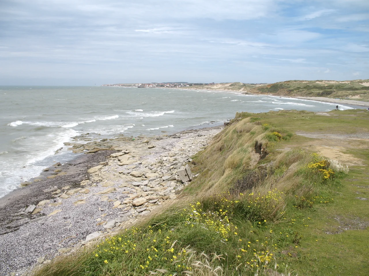
Almost every coastline in France faces south or east. Boulonnais does not. Drive north from Le Touquet and the land tilts slowly upward, the fields giving way to wooded ridges, and somewhere west of Boulogne the coast performs a small geographic act of defiance: it turns to face the open Atlantic. From here to Cap Gris-Nez, the cliffs and beaches look due west into the English Channel, the only stretch of mainland France that does this north of the Loire estuary. The chalk under your feet is the same chalk that resurfaces, twenty-six miles across the water, as the white cliffs of Dover. The two coasts were once joined. The Strait of Dover is the place where the joining failed.
The End of a Wave
Geologically, the Boulonnais is the eastern end of the Weald-Artois Anticline - a great upward arch of chalk that runs from southern England under the Channel and reappears here as a curved belt of downs. The high ground meets the sea twice, at Cap Gris-Nez in the north and at the cliffs around Dannes in the south. Between the two caps the chalk dips inland, opening into the wooded valleys that feed the river Liane and its smaller cousins, all of them running west toward Boulogne and the sea. The region extends fifteen to twenty kilometers inland and is almost entirely contained within the Caps et Marais d'Opale Regional Natural Park - a designation that has kept the countryside green and the villages small while the rest of the Pas-de-Calais industrialized. The result is a paradox: a slice of working agricultural France within sight of one of the busiest shipping lanes on Earth.
The White Draft
If the Boulonnais is famous for one thing beyond its geography, it is for its horses. The Boulonnais breed is a heavy draft horse with a coat that is most commonly an almost luminous grey-white, a small fine-boned head out of all proportion to its enormous muscular body, and a temperament that working farmers spent centuries selecting for patience. Roman authors recorded heavy horses from this coast; medieval breeders crossed the local stock with Arabian blood brought back from the Crusades; nineteenth-century coopers and brewers worked them in the streets of Lille and Paris. Today the breed is critically endangered, with an estimated 1,200 to 1,800 registered animals left, almost all of them in the Pas-de-Calais. To see one moving at speed across a field is to watch a piece of living agricultural history, the kind of animal that pulled the carts before the carts had engines.
The Sacrifice of Le Portel
Sitting on the southern shoulder of Boulogne, the small commune of Le Portel was singled out by the Allies during the war for one of the cruelest tactical sacrifices of 1943. On the nights of 8 and 9 September, Bomber Command struck the village as part of Operation Cockade - an elaborate Allied deception meant to convince occupying German forces that an invasion of the French coast was imminent, drawing attention away from the real campaigns elsewhere. The bombing destroyed 93 percent of the village. Around 365 civilians were killed - fishermen, their wives, their children, a community that had been waiting for liberation and was instead burned to make a feint look like an army. Charles de Gaulle himself came to Le Portel on 12 August 1944 to mark its liberation, and the town was awarded the Croix de Guerre with silver star. The rebuilt houses face the sea where the bombers came from.
Concrete Among the Cows
Walk the back lanes of the Boulonnais today and the war is still everywhere. Pillboxes squat among the hedgerows. The hill above Audinghen holds the colossal concrete dome of the Todt battery, built to launch shells across to Kent. Down on the beaches there are still German bunkers visible at low tide, slowly tilting as the dunes shift. Older fortifications are folded into the same landscape: Napoleonic forts at Wimereux, the Tour d'Ordre stump in Boulogne where Henry VIII's engineers once made an English garrison, the medieval Chateau Mollack at Marquise burned by Henry VIII's army in 1544 and rebuilt later that century. Inland tourism now supplements agriculture - summer festivals at Hardelot Castle, autumn theater performances in the rebuilt halls of Chateau Mollack, golf along the dunes at Dannes. The countryside is quiet in a way that hides its history. The history is everywhere, half-buried, waiting to be noticed.
From the Air
Centered around 50.72 degrees North, 1.77 degrees East, on the western edge of the Pas-de-Calais. The region runs from Cap Gris-Nez in the north to just south of Dannes, with most of it falling within the Caps et Marais d'Opale Regional Natural Park. Cruise 3,000 to 8,000 feet for the full sweep of the coast. Look for the curved chalk ridge dipping inland east of Boulogne; the white cliffs of Cap Blanc-Nez are visible to the north. Nearest airfields: Le Touquet (LFAT) 25 km south, Calais-Dunkerque (LFAC) 35 km north-east. The Strait of Dover shipping lanes are immediately offshore.
Nearby Stories
- Battle of Hondschoote 8.8 km away
- Battle of Cassel (1328) 9.9 km away
- 1921 SNETA Farman Goliath ditching 12 km away
- Admiralty Pier Turret 16 km away
- Courrieres Mine Disaster 31 km away
- Dungeness Lighthouse 38 km away
- Cléon 129 km away
- Royaumont Abbey 148 km away