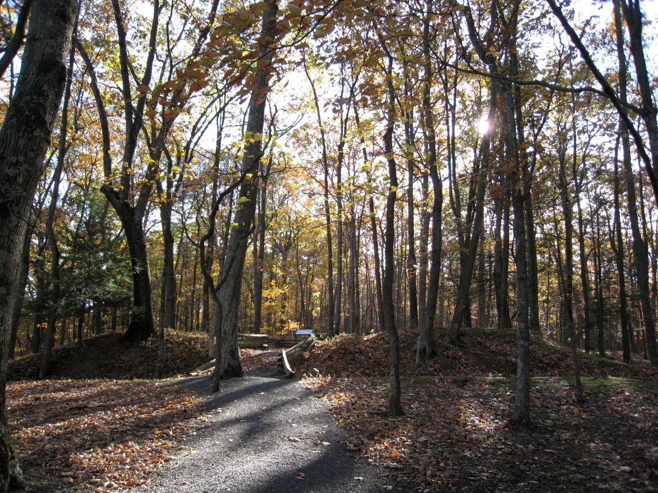

Fort Mill Ridge Civil War Trenches
Walk the ridge above the South Branch Potomac just south of Romney and the ground gives away a story most American battlefields no longer can. Long shallow ditches still cut across the woods, banked up on one side, lined with the remains of chestnut log revetments. These are Confederate artillery trenches, dug in 1861 and 1862, refurbished by Union infantry in 1863, and never plowed under. They survived because nobody farmed them. They are now among the best-preserved Civil War earthworks in West Virginia.
Why Romney Mattered
Romney sat at a strategic junction. The Northwestern Turnpike - one of the few graded roads through the Allegheny ridges - ran through the town, connecting the eastern seaboard to the Ohio River valley. The South Branch Potomac flowed past, providing water and a navigable route in good seasons. Whoever held Romney controlled an obvious approach to the Shenandoah Valley from the northwest. The town changed hands an extraordinary number of times during the war - by some counts more than fifty - as Union and Confederate forces traded the place season by season. The Fort Mill Ridge trenches were built to defend that strategic ground, dug by Confederate artillery crews in 1861 and 1862 to cover the turnpike and river approaches.
Chestnut Logs and Earth
The original construction was straightforward and labor-intensive. Confederate soldiers cut chestnut logs - then the dominant hardwood of the Appalachian uplands, before the chestnut blight of the early 20th century wiped the species out - and used them to revet the trench walls. Earth was thrown up to form parapets behind which artillery and infantry could shelter. The trenches followed the natural contours of Fort Mill Ridge, taking advantage of the slope to give defenders elevated fields of fire while restricting attackers to predictable approaches. The wooden revetments rotted long ago. The earthworks themselves survived because the steep ridge ground was poor for farming and the area never developed into a town or road corridor. What you see today is essentially the 1863 contour.
Union Hands, Confederate Design
Although the Confederates dug them first, Union forces held the trenches for most of the war. Between March and June 1863, the 54th Pennsylvania Infantry under Colonel Jacob M. Campbell and the 1st West Virginia Infantry refurbished the works to Union specifications. Campbell garrisoned his troops at Romney and established camps at nearby Mechanicsburg Gap. The trenches' defensive value did not depend on which side built them. They allowed a small garrison to control a strategic approach without committing the larger forces that an open-field defense would have required, and the protection they offered shifted the local cost-benefit calculation of attack and defense. Romney became a place that was easier to garrison than to capture.
Why the Trenches Matter to Military History
The American Civil War is widely regarded as the first modern war in part because of the increasing role of field fortifications. From the early entrenchments at places like Fort Mill Ridge through the catastrophic siege lines at Petersburg, Virginia at the end of the war, both armies learned that infantry behind dug-in defenses could repel forces several times their own size. The lesson would be relearned, at far greater cost, in the trenches of World War I. Fort Mill Ridge is not a famous battlefield. There was no decisive engagement here. But the surviving earthworks document the slower, less visible transformation of how armies thought about ground - the recognition that the spade was becoming as important as the rifle. The site was added to the National Register of Historic Places in 2014. It is now maintained as an open-air museum, with interpretive trails leading visitors along the original earthworks.
From the Air
Located at 39.32 degrees north, 78.79 degrees west, on a ridge just south of Romney in Hampshire County, West Virginia. From 3,000 to 5,000 feet AGL the wooded ridge of Fort Mill Ridge is visible above the South Branch Potomac River, with the town of Romney and the cluster of fields around it just to the north. The trenches themselves are under tree cover and not visible from the air. Nearest airports include Hampshire County (W30) at Romney and Eastern WV Regional / Martinsburg (KMRB).
Nearby Stories
- Allegheny Mountains 4.8 km away
- Hardy County, West Virginia 5.9 km away
- Hoye-Crest 6.2 km away
- Willa Cather Birthplace 6.8 km away
- Belle Grove Plantation 8.2 km away
- Battle of Fort Necessity 32 km away
- United Airlines Flight 93 56 km away
- Camp David: Where Presidents Escape and History Gets Made 81 km away