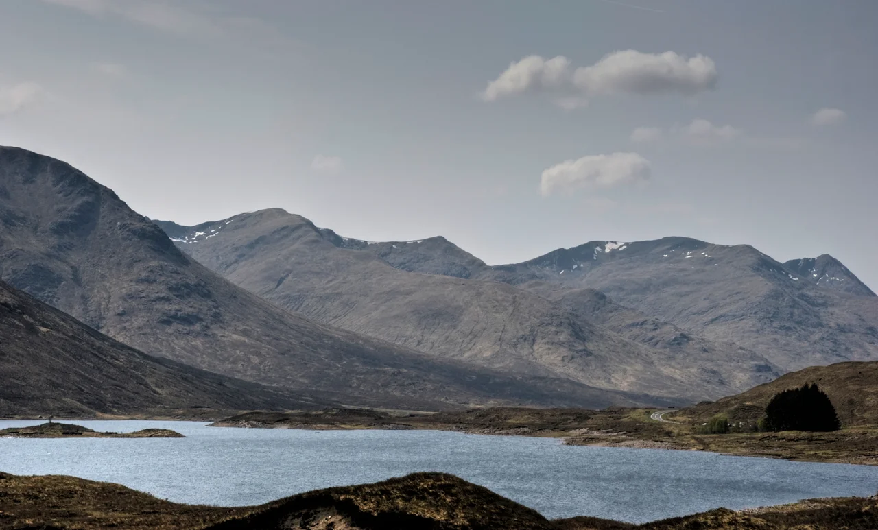

Glen Shiel
There is a peak above Glen Shiel called Sgurr nan Spainteach - the Peak of the Spaniards - and it is named for the two hundred soldiers of King Philip V of Spain who fought a rearguard action there on the afternoon of 10 June 1719. Most people who drive the A87 between Loch Cluanie and Loch Duich know Glen Shiel as a stretch of road framed by some of the most photographed mountains in Scotland. Far fewer know that the road itself runs over a battlefield, and that the battlefield is one of the strangest in British history.
Between The Sisters And The Saddle
Glen Shiel runs roughly nine miles from southeast to northwest, climbing from sea level at Shiel Bridge on Loch Duich to 216 metres at the Cluanie Inn at the head of the valley. The road through it is the A87 - Skye's main artery from the south - and it reaches a high point of 271 metres about two miles west of the Cluanie Inn before descending. On the northern flank rise the Five Sisters of Kintail: Sgurr na Ciste Duibhe, Sgurr na Carnach, Sgurr Fhuaran, Sgurr nan Spainteach and Sgurr nan Saighead, a serrated wall of peaks that draws hillwalkers from across Europe. On the southern side stretches the South Glen Shiel Ridge with seven Munros in a single chain. In the lower glen rises The Saddle, which the mountain writer W. H. Murray called 'the best mountain of the region both in distant shape and close acquaintance.' Few rivers flow through finer company than the River Shiel.
The Battle Nobody Quite Expected
The 1719 rising was the strangest of all the Jacobite attempts. Philip V of Spain, looking for ways to embarrass George I, sent ships, troops and guns to George Keith, 10th Earl Marischal, who landed Spanish soldiers in the Outer Hebrides and then established a headquarters in Eilean Donan Castle at the mouth of Loch Duich. The Highland clans, by 1719, were already weary of risings that had failed; far fewer joined than Keith had hoped. By the time three Royal Navy ships destroyed Eilean Donan in early May, the surviving Jacobite force - Spanish regulars, men from Clan Cameron, Clan Mackenzie, Clan Mackinnon, Rob Roy MacGregor with about forty followers - had pulled south to a defensible position in Glen Shiel. On 10 June 1719 they faced government troops dispatched from Inverness: grenadiers, Dutch and Swiss companies, four companies raised from Clan Fraser, Clan Ross and Clan Sutherland, eighty men of Clan MacKay, about a hundred of Clan Munro. The battle lasted into the evening. The Spanish surrendered the next day. It was the last time foreign regular soldiers fought on mainland British soil.
Tillemans Painted It; The Stones Are Still There
The Flemish painter Peter Tillemans, working in London soon after the battle, produced what is now considered a 'highly accurate' contemporary painting of the engagement. It shows the glen, the Jacobite barricade, the Spanish formation, the British advance. The figures in the foreground are thought to include Lord George Murray and Rob Roy MacGregor on the Jacobite side and General Joseph Wightman on the British. The painting hangs in the Scottish National Portrait Gallery in Edinburgh. For more than two hundred years it was catalogued mistakenly as a picture of the Battle of Killiecrankie. The battlefield itself is now reckoned the only Scottish battle site where contemporary fortifications still exist on the ground - including the stone dyke enclosure where the Jacobites stored their munitions. The road passes through it. Most drivers never notice.
A Glen Of Pine, Deer And Survival
Below the battle marker, the glen carries on quietly being one of the most striking places in Scotland. The lower river hosts native woodland - common alder, downy birch, sessile oak, rowan - which the Forestry Commission has worked to restore from the Sitka spruce plantings of an earlier era. Fragrant orchid and butterfly orchid grow on the grassy mountain flanks; the rare mountain azalea hugs the higher ground. Herds of red deer and wild goats roam the slopes. Most of the northern side of the glen forms part of the National Trust's Kintail and Morvich estate; the lower section lies inside the Kintail National Scenic Area. John Farquhar Munro, the long-serving Scottish parliamentarian, was born here in 1934. He grew up between the Five Sisters and the South Cluanie Ridge, in a glen whose air still tastes of sea and pine and old smoke.
From the Air
Located at 57.2103 N, 5.4239 W in the Northwest Highlands of Scotland. The glen runs ESE-WNW from Loch Duich at sea level to the Cluanie Inn at 216 m. Distinctive aerial features: the serrated Five Sisters of Kintail forming the northern wall (peaks 1027-1027 m, Sgurr Fhuaran the highest), the South Glen Shiel Ridge on the southern side with seven continuous Munros, The Saddle (1010 m) and Sgurr na Sgine (946 m) in the lower south. The A87 Road to the Isles traces the valley floor. Nearest aerodromes: Inverness (EGPE) approximately 90 km east-northeast; small strip at Plockton 25 km northwest. Weather: this glen sits squarely in the path of Atlantic frontal systems and orographic cloud forms rapidly on both ridges. The peaks of Kintail are unforgiving in low cloud - winter conditions persist into May above 800 m. Best photographed from southwest looking northeast, ideally in early morning when the Five Sisters catch first light. Maintain at least 1500 ft AGL above the highest local peaks for safe transit.
Nearby Stories
- High Pasture Cave 2.5 km away
- South Rona 6 km away
- Battle of Mulroy 7.5 km away
- Glenmoriston 8.2 km away
- Torridon 8.5 km away
- Glenfinnan Viaduct 8.6 km away
- Eigg 13 km away
- Conon Hydro Scheme 21 km away