
Glenelg
In October 2012 NASA officially twinned the village of Glenelg in the Scottish Highlands with a target site called Glenelg on Mars, where the Curiosity rover was scheduled to do science. The reason was technical and slightly whimsical: both names are palindromes, and Curiosity was going to visit the Martian site twice, once on the way in and once on the way out. There may be no other Highland village with formal interplanetary relations. There may also be no other village whose ferry has to be turned by hand on a turntable because it ties up alongside the slipway, or whose nearest neighbours are two of the best-preserved Iron Age towers in Europe.
The Last Hand-Turned Ferry In The World
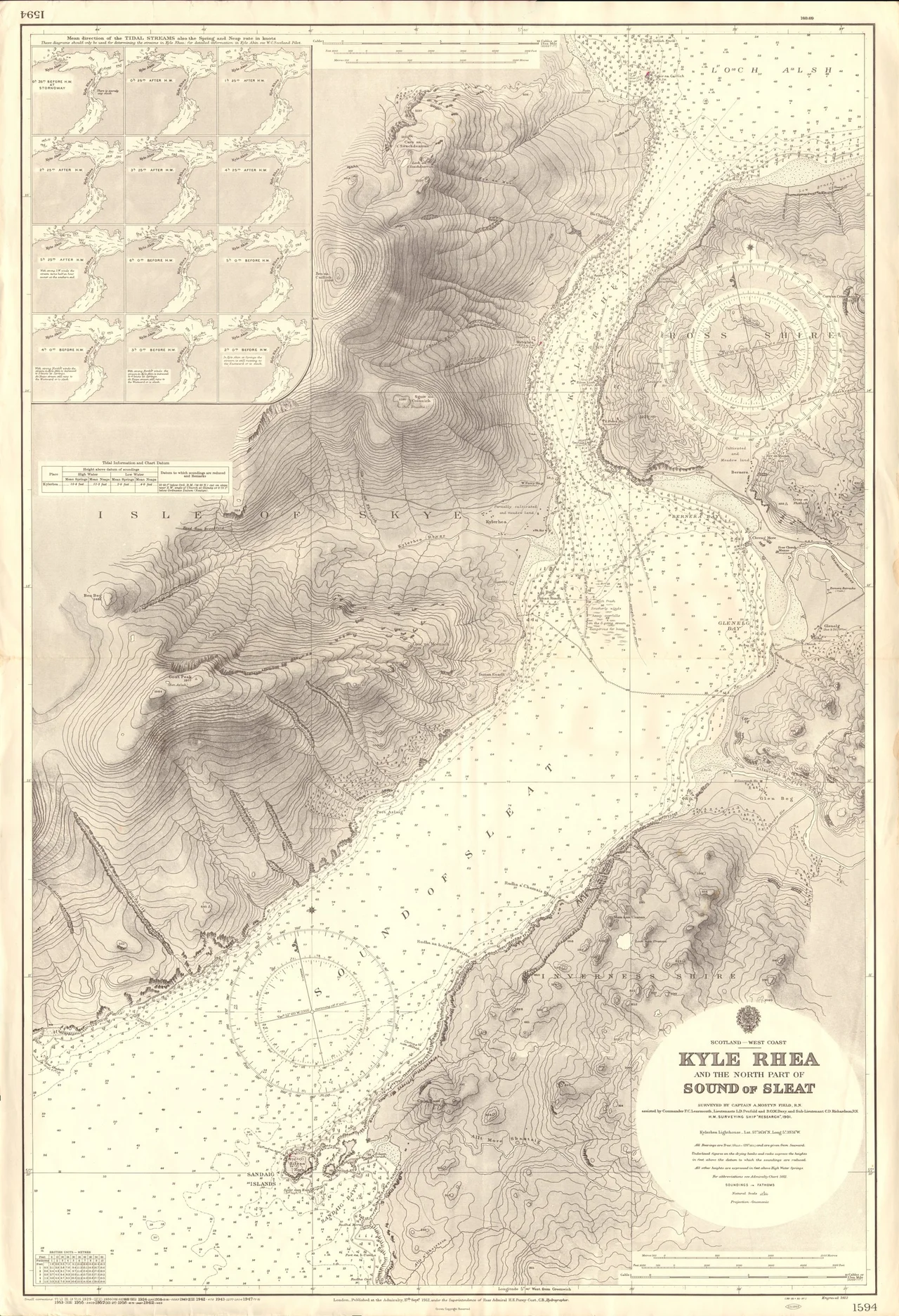
Between March and October, a small vehicle ferry runs across the powerful tidal currents of Kyle Rhea between Glenelg and Kylerhea on Skye. The boat is the world's last hand-operated steel turntable ferry, built in 1969 by the Ailsa Shipbuilding Company in Troon and originally working the Ballachulish crossing. It can carry six cars and foot passengers on an open deck. The unusual part is the docking procedure: the ferry ties up alongside the slipway, and the crew manually rotate the entire deck through ninety degrees, on a turntable, so cars can roll on and off. When the Ballachulish Bridge opened in 1975 the boat became a relief vessel for other West Highland crossings, but in 1982 it found a permanent home at Glenelg, where a community-interest company has operated it ever since. Across the narrows, on the Skye side, the Kyle Rhea Otter Haven looks back at you. The whole crossing takes about five minutes.
Cattle Across The Narrows
Before the ferry there was the drove road. For centuries, cattle from the outer Hebridean islands were brought to Uig in the north of Skye, joined with cattle reared on Skye itself, driven south to Kylerhea, and then - tied together in groups of a dozen, nose ring to tail, guided by a rowing boat - swum the 534 metres across the narrows to the Glenelg shore. From there the drovers herded them through Glen Beag to Kinlochhourn, then south to the trysts at Stirling and Falkirk where Lowland buyers paid hard cash. The route was punishing, the losses to drowning and exhaustion routine, and the cattle markets utterly dependent on the safe arrival of these herds. The first atlas of Scotland, published by Joan Blaeu in Amsterdam in 1662, shows Glenelg already established as a place that mattered.
Brochs, Barracks, And Boswell's Bad Inn
Glenelg attracts visitors for the remains of the two best-preserved Iron Age brochs on mainland Scotland - Dun Telve and Dun Troddan - in Glen Beag about three miles along the road from the main settlement. The ruined Bernera Barracks, one of four Hanoverian forts built across the Highlands after the 1715 rising, stands above the village; troops withdrew in 1797 and the walls have been weathering ever since. Dr Samuel Johnson and James Boswell stayed at the local inn during their 1773 tour, an experience Johnson recorded with characteristic frankness in his 'Journey to the Western Isles of Scotland.' The building, now called Ferry House, still stands. The village's only pub is the Glenelg Inn, which occupies the site of an earlier hotel that burned down in 1946. The Glenelg Parish Church has an eighteenth-century core with an unusual bird-cage bellcote on the west gable.
Sandaig And The Otter Of Camusfearna
Six miles south of Kirkton, along the coast road, lies the small bay of Sandaig. The naturalist Gavin Maxwell lived here in the 1950s and 1960s, calling the place Camusfearna - 'the bay of the alders' - in his book 'Ring of Bright Water', which became one of the best-loved nature books in the English language. Maxwell raised otters at Sandaig; one of his otter keepers as a teenager was Terry Nutkins, who later became a beloved British television naturalist. The house at Sandaig had previously belonged to the part-time keeper of the Sandaig Lighthouse, built in 1910 by Charles Alexander Stevenson, cousin of the novelist Robert Louis Stevenson. The lighthouse tower was restored in 2002 and moved to the Glenelg Ferry Terminal as a community memorial. The Sandaig Islands just offshore have the kind of fine silvery shell-sand beaches that make people wonder why they are not crowded - until they remember how long the walk in is.
From the Air
Located at 57.212 N, 5.624 W on the West Highland coast, opposite the Isle of Skye across the narrow Kyle Rhea strait. Glenelg sits at the seaward end of Glen More with the village of Kirkton spread along the shore of Glenelg Bay. Key visual features from the air: the Glenelg-Kylerhea ferry slipway and turntable boat (when operating March-October), the ruined Bernera Barracks immediately west of the village, the two Iron Age brochs in Glen Beag three miles south. Mam Ratagan (the Bealach) climbs from Shiel Bridge to 339 m and is the only road in/out between November and February. Nearest aerodromes: Inverness (EGPE) approximately 100 km east; Plockton airstrip 25 km north. Surrounding peaks: Beinn Sgritheall 974 m southwest, Beinn a' Chapuill 760 m south, Beinn a' Chaonich 770 m east. Kyle Rhea is narrow and the tidal currents can exceed 8 knots - watch for unusual sea-state and rapidly changing local wind in the channel. Best photographed in late afternoon when westering light catches the village against the dark mass of Skye behind.
Nearby Stories
- High Pasture Cave 2.5 km away
- South Rona 6 km away
- Battle of Mulroy 7.5 km away
- Glenmoriston 8.2 km away
- Torridon 8.5 km away
- Glenfinnan Viaduct 8.6 km away
- Eigg 13 km away
- Conon Hydro Scheme 21 km away