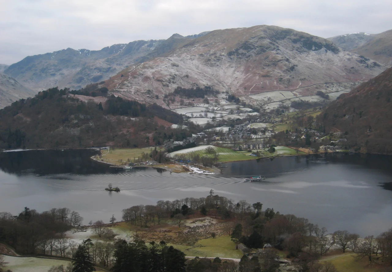

Glenridding
Without the Greenside lead mine, Glenridding would not exist. The fells above this village hold a small, intricately worked-out network of shafts and adits, and for two hundred years the men who worked them - and the women who ran the lodging-houses, the children who carried water, the carters and the smelters - made their livings off ore hauled out of the mountain. The mine closed in 1962. The village it built is still there: a handful of streets, a pier, two youth hostels and a campsite, tucked against the southern foot of Ullswater. Today the people who come to Glenridding come to climb.
A Cumbric Name
The name is older than the mine. It is generally agreed to be Cumbric in origin - the lost Brythonic Celtic language that was spoken across what is now northern Cumbria before the Anglo-Saxons and the Norse arrived. The first element is glinn, meaning valley, related to the modern Welsh glyn. The second is redin, meaning ferns or bracken, related to Welsh rhedyn. So the original meaning was something like the valley of bracken. The present spelling probably owes something to the Middle English word ridding, meaning a clearing - a useful coincidence that turned a Brythonic place-name into something Anglophone tongues could pronounce. The village was, in its early life, a place of upland pasture and bracken-cutting. The lead came later.
Greenside Mine
Lead ore was found above Glenridding in the 18th century, and serious mining began in the second half of that century. By the Victorian era Greenside was the largest lead mine in the Lake District. It ran on hydroelectric power generated from reservoirs built high on the eastern flank of Helvellyn - the dams in Brown Cove and Keppel Cove are still visible, though both leak now. Ore was hauled down the valley, originally by carts and pack-ponies, later by boats on the lake to Pooley Bridge, and then on to Penrith and the smelters. The men who worked underground knew the cost. Lead poisoning was endemic in mining communities; respiratory illness was common; the work was physically brutal and intermittently dangerous. The shafts went deep. When the mine finally closed in 1962, after almost two centuries, the village lost its central reason for being - and had to invent a new one.
The Boats on the Lake
The Ullswater Steamers operate from the Glenridding pier - five vessels in service today, running the length of Ullswater from Glenridding through Howtown and Aira Force to Pooley Bridge at the northern end. The company started life in the 19th century as a working transport service, carrying mail, miners, supplies and finished ore between the lake's settlements. The arrival of mass tourism gave the boats a second life. The oldest of the current fleet, the Lady of the Lake, has been in service in various forms since 1877, making it the oldest working passenger vessel in the UK. The ride is unhurried. The boats are slow on purpose. From the deck the view shifts steadily as the lake bends through its three reaches, and the eastern fells - Place Fell, Beda Fell, Hallin Fell - take turns presenting themselves to the camera.
Walking Out and Up
Glenridding is the standard launching point for an ascent of Helvellyn, England's third-highest mountain, via Striding Edge - the long, dramatically narrow arete that climbs from the village to the summit ridge. On any clear summer weekend the path from Glenridding to Hole-in-the-Wall is busy with hundreds of walkers, and the village fills with steam from drying boots. Every September the Helvellyn Triathlon runs from Jenkins' Field on the shore of Ullswater up over the mountain and back - swim, bike, fell-run, repeat. It was once described as the toughest triathlon in the UK. Easter Monday in the village is gentler: the local mountain rescue team holds a duck race in the beck that runs through Glenridding, a small fundraising event with rubber ducks and cake stalls, in the same valley where men once dug for lead.
Floods, Rescue and the New Life
In December 2015 Storm Desmond delivered an extraordinary deluge to the Lake District, and Glenridding Beck burst its banks twice in three days. Houses flooded, the road into the village washed out, and the bridge piers shifted. The Glenridding Community Flood Group was formed in the aftermath, an entirely local volunteer organisation that has since pushed for better flood defences and clearer information for residents. The village still floods occasionally - climate change has made the Cumbrian deluges more frequent and more sudden - but it has not closed up. The youth hostels still open every spring, the steamers still leave the pier, and the walkers still arrive at dawn with packed lunches and route maps, ready to go up Helvellyn. The lead mine is gone. The village it built has decided to stay.
From the Air
Glenridding sits at 54.53 degrees north, 2.95 degrees west, at the southern tip of Ullswater. From the air the village reads as a small cluster of buildings on the lake's southern shore, with the steamer pier visible as a pale finger projecting into the water. The Helvellyn massif (950 m at summit) rises sharply to the west. Ullswater extends north-east in three distinct reaches. The Greenside mine workings are visible as scarring on the western fells above the village. Nearest airfields: Carlisle Lake District (EGNC) approximately 22 nm north-west, Newcastle (EGNT) about 55 nm east. Cruise altitudes of 4,500-6,000 feet give views over both Ullswater and the Helvellyn range. Watch for orographic cloud on the high fells - the summit of Helvellyn is often in cloud when the valley is clear.
Nearby Stories
- Parton railway station 4.4 km away
- Brough Castle 11 km away
- Cartmel Racecourse 13 km away
- Caerlaverock Castle 15 km away
- Vindolanda 18 km away
- Yorkshire Dales 25 km away
- Cashtal yn Ard 55 km away