
Glyder Fawr
In late 2010 a surveying team with modern GPS gear climbed Glyder Fawr, took accurate measurements of its highest point, and gave the Snowdonia National Park Authority an awkward piece of news. The mountain everyone had thought was 999 metres tall was actually 1,000.8. A spokesman for the park authority took the news cheerfully. Now the mountain exceeded a thousand metres, he said, walkers would be more interested in climbing it. There is something distinctly Welsh in the notion that a mile-high mountain - well, three-thousand-foot - has been an under-the-radar peak because of a survey error a metre and a bit short of fame.
The Glyderau Spine
Glyder Fawr - "big heap of stones" - is the highest peak in the Glyderau range and the fifth-highest in Wales. The range runs west to east from Elidir Fawr (924 m) through Y Garn (947 m), then climbs to Glyder Fawr (1,001 m) and Glyder Fach (994 m) before dropping to Tryfan (918 m). Together these five summits form the wall north of the Llanberis Pass and south of the Ogwen Valley. From the Snowdon massif across the pass, the Glyderau profile is unmistakable - a long, comparatively level ridge with a few rougher tops, very different from the spiky drama of Snowdon's Pyg or Crib Goch. The two ranges sit so close together yet so different in feel that they sometimes seem like geological strangers, despite having been forged in the same Caledonian collision.
Five Hundred Million Years of Erosion
About five hundred million years ago, two land masses on opposite sides of the Iapetus Ocean drifted into each other and threw up the Snowdonia massif. The rocks beneath your feet on Glyder Fawr today are the volcanic and sedimentary remnants of that collision - tuffs and lavas, sandstones and siltstones, all metamorphosed by pressure and time. Then ice took over. The last ice sheet retreated about 10,000 years ago, leaving the cirque of Cwm Idwal as a textbook example of glacial sculpture: a north-facing amphitheatre, smoothly scoured cliffs, the long shallow bowl of Llyn Idwal at its base, and the moraine wall of debris dumped at its foot. Massive boulders and shattered rocks crashed down from above to form the boulder fields and screes that any walker on Glyder Fawr will negotiate.
The Routes Up
The most popular ascent starts at Ogwen Cottage on the A5, follows the shore of Llyn Idwal to the base of the Idwal Slabs - the Rhiwiau Caws climbing crag, one of Wales' great traditional rock-climbing areas - then climbs the steep cleft of Twll Du ("the Black Hole," usually called the Devil's Kitchen in English) to reach a small lake called Llyn y Cwn. From there a brutal scree path zigzags up the western shoulder to the summit. An alternative is to traverse along the ridge from Glyder Fach to the east; though both summits are at similar elevation, the ridge between them is relatively level and the going is easy. A scrambling circuit linking Tryfan, Glyder Fach and Glyder Fawr is one of the classic days in Snowdonia, taking six or seven hours and traversing some of the most photographed broken rock in Britain.
Land in Lieu of Death Duties
In 1951 the Penrhyn family - whose fortune had come from slate quarrying down the valley at Bethesda - faced enormous death duties on their North Wales estate. Rather than break it up, they handed the Glyderau and the Carneddau to the National Trust in lieu of tax. The transfer brought roughly 7,000 hectares of high country under conservation management, half of it common land carrying registered grazing rights for 45,000 sheep and 741 ponies. Eight tenant farms remain on the estate. The Trust maintains the footpaths, the cairns marking the safer routes across the plateau, and the drystone walls - some of which date back hundreds of years and march straight up the mountainside in lines that ignore modern fences entirely. Without the Penrhyn tax problem, the high Glyderau might today be carved into shooting estates or windfarm leases. Instead they are open land.
The View from a Thousand Metres
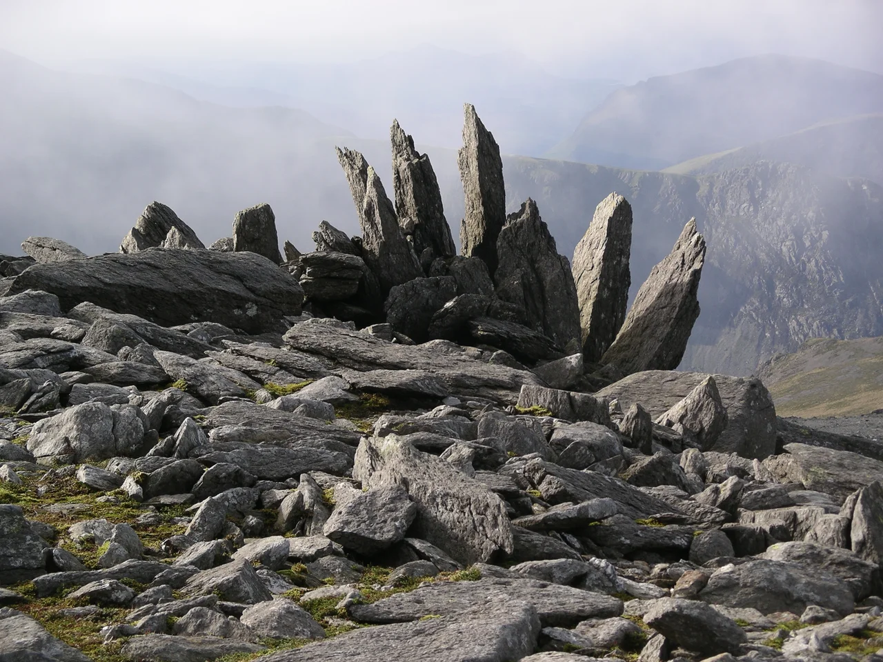
Standing on Glyder Fawr at 1,001 metres, on a day when the cloud lifts off the ridge, you can see Snowdon two kilometres south and slightly higher across the Llanberis Pass; the broad whaleback of the Carneddau north of the Ogwen; Anglesey and the Menai Strait to the north-west; and on clear days the Wicklow Mountains across the Irish Sea. The summit is not flat in the way Carnedd Llywelyn's is - it is a confused mess of slabs and pinnacles, particularly the spiky outcrop called the Cantilever's western cousin. Snow lingers in shaded gullies into June. Cloud can drop without warning. The mountain is not Welsh shorthand for danger the way some peaks are; but five hundred million years of erosion have left a place where a careless step in poor visibility ends rapidly in the boulder fields below.
From the Air
Located at 53.10°N, 4.03°W. The summit reaches 1,001 m (3,284 ft); maintain minimum FL060 for safe terrain clearance. Visible from 30+ nm in clear weather as the high western anchor of the Glyderau ridge. Cwm Idwal sits in the north face, an obvious amphitheatre above the A5. Nearest airports: EGCK (Caernarfon Airport) 9 nm W, EGOV (RAF Valley) 22 nm WNW. Expect severe orographic turbulence in westerly flow and frequent cap cloud below ridge level in any moist airmass; the Llanberis Pass funnels venturi acceleration along its length.
Nearby Stories
- Tudweiliog 3.6 km away
- Denbigh Castle and Town Walls 6.4 km away
- Rhoscolyn Lifeboat Station 7.6 km away
- Butlin's Pwllheli 20 km away
- East–West Interconnector 20 km away
- New Brighton Lifeboat Station 31 km away
- Battle of Oswestry 31 km away
- Celtic Array 44 km away