
Glyderau
Look at a map of Snowdonia and three great mountain blocks line up across it. Snowdon to the south, the Carneddau to the north, and between them, narrow but unmistakable, the Glyderau - eleven peaks running east from Llandegai to Capel Curig, five of them above 3,000 feet, and Tryfan at their eastern end forming what is widely considered the most beautiful mountain in Wales. The range gets its name from the highest pair: Glyder Fawr ("big heap of stones") and Glyder Fach ("small heap of stones"). Sir Ifor Williams traced "Glyder" to an older Welsh word - Cludair - meaning, again, a heap of stones. Welsh mountains rarely make grand claims for themselves.
Between Snowdon and the Carneddau
The Glyderau form the central spine of Snowdonia. They are separated from Snowdon to the south by the Llanberis Pass and the Nant Peris valley, and from the Carneddau to the north by the deeper, wider trench of the Nant Ffrancon and the Ogwen Valley. The A5 - Telford's London-to-Holyhead road - threads beneath the range's northern flank; the A4086 climbs up over Pen-y-Pass beneath its southern. From west to east the main summits run: Elidir Fawr (924 m), Carnedd y Filiast (821 m), Mynydd Perfedd (813 m), Foel Goch (831 m), Y Garn (947 m), Glyder Fawr (1,001 m), Glyder Fach (994 m), Tryfan (918 m), Y Foel Goch (805 m), Gallt yr Ogof (763 m), and the modest end-cap of Cefn y Capel. Tryfan is one of the few mountains in Britain whose summit cannot be reached without hands-on scrambling - the final move involves jumping between two upright stones nicknamed Adam and Eve.
Where Two Continents Hit
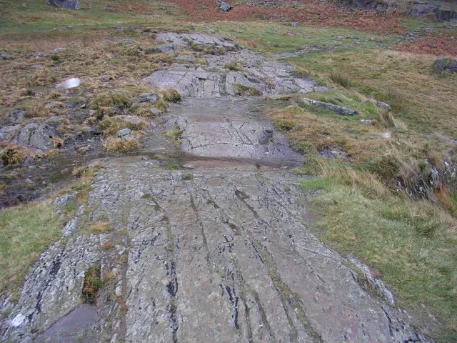
The Glyderau were born in the Ordovician period, about 500 million years ago, when two land masses on opposite sides of the Iapetus Ocean drifted into each other and pushed up what became the Snowdonia massif. The volcanic and sedimentary rocks that resulted have been wearing down ever since. The last ice age finished about 10,000 years ago, leaving Cwm Idwal as one of Britain's most cited textbook examples of a glacial cirque - a north-facing amphitheatre cut by ice that flowed down what is now the Nant Ffrancon Valley, with Cwm Idwal hanging as a side glacier. The ice scoured the cliffs, hollowed out Llyn Idwal in the bowl below, and dumped moraines along the route of its retreat. The boulder fields and screes of the high ground are the loose debris of that long thaw.
Cwm Idwal and the Snowdon Lily
The hanging valley of Cwm Idwal is now a national nature reserve, and for good reason. Its dark cliffs preserve some of the most southerly Arctic-Alpine plants in Britain - cool-climate species that retreated north as glaciers melted but found a permanent refuge on these shaded ledges where temperatures barely climb. The Snowdon lily (Lloydia serotina), a small starlike flower discovered here in the seventeenth century by Edward Lhuyd, grows nowhere else in Britain. Purple saxifrage, tufted saxifrage, alpine meadow rue, mountain sorrel - all hang on in vertical gardens that sheep cannot reach. Sheep were excluded from the cwm to protect them. The lake is shallow, fringed with rushes and bottle sedge, and around its edges live wood anemone, water avens, Welsh poppy, and the rare wood-rush. Buzzards, peregrines, choughs, skylarks, black grouse and red grouse all hunt or graze the slopes. Badgers, foxes and polecats work the lower ground.
Electric Mountain
On the western flank of the range, inside Elidir Fawr, is one of the strangest things in any British mountain: the Dinorwig Power Station, a 1,728-megawatt pumped-storage hydroelectric scheme installed in a vast artificial cavern carved out between 1974 and 1984. At night, when demand is low, the station pumps water from Llyn Peris up to Marchlyn Mawr reservoir on the summit plateau, 600 metres above. When demand spikes - the so-called "TV pickup" at the end of a major football match, for example - it releases that water back down through turbines and goes from zero to full output in 16 seconds. From the surface you see almost nothing: the upper reservoir, the lower lake, and the visitor centre at Llanberis. Inside Elidir Fawr is a turbine hall the size of a cathedral.
Walls That Pre-Date the Roads
The Glyderau and Carneddau passed to the National Trust in 1951, in lieu of death duties on the Penrhyn Estate. Seven thousand hectares, half of it registered common land, came under conservation management at a stroke. There are still eight tenanted farms on the estate. The Trust maintains the drystone walls that snake up the mountainsides in lines so straight they ignore every modern road; some of those walls are several hundred years old and predate Telford's A5. The whole range now sits inside Snowdonia National Park, popular with walkers, climbers and the occasional pop musician - Half Man Half Biscuit, the Birkenhead band with a longstanding habit of name-dropping North Wales places, set their song "Evening Of Swing (Has Been Cancelled)" on the Glyderau peaks. There is, you may be unsurprised to learn, no swing on the summits.
From the Air
Located at 53.10°N, 4.03°W as the range centre. The Glyderau spine runs west-east for roughly 12 nm, with peaks from 763 m (Gallt yr Ogof) to 1,001 m (Glyder Fawr). Maintain minimum FL060 across the range. Cwm Idwal is unmistakable from the north - a dark cirque above Llyn Idwal on the south side of the A5. Nearest airports: EGCK (Caernarfon Airport) 9 nm WSW, EGOV (RAF Valley) 22 nm WNW. Expect severe rotor turbulence in westerly flow off the Nant Ffrancon, frequent cap cloud at ridge level, and venturi acceleration through the Llanberis Pass.
Nearby Stories
- Tudweiliog 3.6 km away
- Denbigh Castle and Town Walls 6.4 km away
- Rhoscolyn Lifeboat Station 7.6 km away
- Butlin's Pwllheli 20 km away
- East–West Interconnector 20 km away
- New Brighton Lifeboat Station 31 km away
- Battle of Oswestry 31 km away
- Celtic Array 44 km away