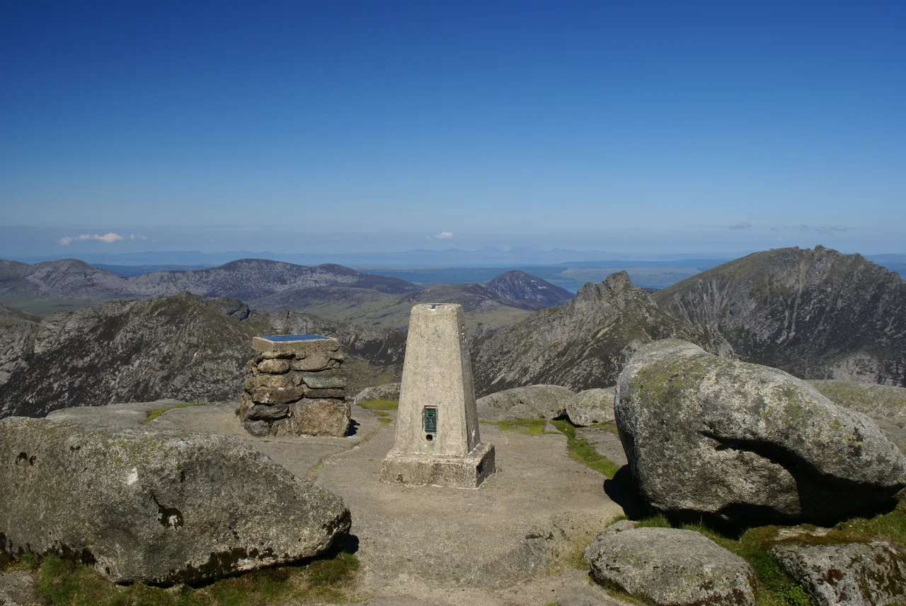

Goat Fell
On a clear day, you can see Northern Ireland from the summit of Goat Fell. There is a viewpoint table at the top that lists the landmarks visible across the Firth of Clyde and the North Channel, and on the right kind of late spring morning the table is not lying. The mountain rises 875 metres above the village of Brodick on the east coast of Arran - one of four Corbetts on the island, and the highest of them by a clear margin. Most days, walkers come up the main path from Cladach, just past Brodick Castle, through rhododendron forest and out onto bare moor. They come back down with photographs and aching knees. Once, a man came up Goat Fell with a companion he had only just met. He did not come down.
Scotland in Miniature
Arran is sometimes called 'Scotland in miniature' because the Highland Boundary Fault runs across it, dividing rugged northern peaks from the gentler lowlands of the south. Goat Fell anchors the northern half. Its Gaelic name, Gaoitbheinn, suggests the windy hill - and the wind here can rake across the summit ridge with little warning, even on summer days. The mountain, along with nearby Brodick Castle, is now owned by the National Trust for Scotland, which manages the main path and the moorland above it. The standard ascent from Cladach is just over three miles long, climbing through the wooded grounds of Brodick Castle before breaking out onto moor at about three hundred metres. The route then heads up the east ridge to the summit, where the cairn and the viewpoint table sit on a small flat platform of granite.
A Ridge of Granite
From the summit, three ridges drop away. The most spectacular is the northwest ridge, which falls to a bealach called The Saddle before climbing again to Cìr Mhòr - one of the most distinctive peaks in Scotland, a sharp granite spire that looks like something cut with a knife. The northeast ridge runs over Cìoch na h-Òighe ('the Young Maiden's Breast' in Gaelic) with a section of easy scrambling. The right-of-way between Glen Rosa and Glen Sannox crosses The Saddle, allowing walkers to make a long horseshoe traverse over Goat Fell and its neighbours. The granite was created by magmatic activity around 58 million years ago, when a major volcanic centre sat where Arran is now; the whole northern half of the island is essentially a deeply eroded volcano. The summit cairn perches on an outcrop of that ancient magma chamber.
Edwin Rose
Edwin Rose was an English tourist from Brixton, a builder's clerk on holiday in 1889. He was thirty-two years old. On Arran that July, he met a man calling himself John Annandale - whose real name was John Watson Laurie - and the two arranged to climb Goat Fell together. Rose was last seen alive on the mountain on 15 July 1889. When he failed to return to his lodgings, a search was mounted. His body was found weeks later, hidden under stones on Coire nam Fuaran on the mountain's east flank. He had been beaten, robbed, and concealed. Laurie was arrested, tried at the High Court in Edinburgh, and convicted of his murder. The death sentence was commuted to penal servitude for life, and Laurie spent the rest of his days in prison. Rose was buried in Brixton. He had come north for a holiday in beautiful country, and he had trusted the wrong companion.
What the Mountain Holds
The Edwin Rose case became one of the most famous Scottish murder trials of the late Victorian era, and the mountain has carried the weight of it for more than a century. Walkers today usually know nothing of the story - they know only the viewpoint table, the granite, the views to Antrim and Kintyre, the long descent. From Corrie, a shorter and steeper route climbs to the east ridge; from the north, an approach over North Goatfell leads to the same summit by a longer ridge walk. In summer, hundreds make the ascent each day. The wind across the summit is the same wind Rose felt the morning he set out. The mountain holds neither grudge nor memory; only the place names and the cairns on the lower slopes mark anything at all. The granite remains. The names remember. The view to Ireland still opens, on the right kind of day, exactly as it always did.
From the Air
Summit located at 55.626°N, 5.190°W, rising 875 metres (2,871 ft) above the Firth of Clyde at the centre-east of the Isle of Arran. The peak is the highest on Arran and a major terrain feature - maintain safe vertical separation. From altitude the granite mountain shows as a pale grey peak above darker moorland, with Brodick Bay and the village of Brodick visible to the southeast. Nearest aerodromes: Campbeltown (EGEC) about 30 nm to the west, Glasgow Prestwick (EGPK) approximately 25 nm to the east. Mountain weather can change rapidly; visibility above 600 m is often reduced even when the lowlands are clear.
Nearby Stories
- Kilmaurs 2.6 km away
- Siege of Dumbarton 4.2 km away
- Dunaverty Castle 7.2 km away
- Tighnabruaich Lifeboat Station 8.5 km away
- Achamore House 8.6 km away
- Ailsa Craig 13 km away
- Jura, Scotland 22 km away
- Battle of Glen Trool 32 km away