Granite Mountains (Eastern San Bernardino County)
General George Patton needed a desert that looked like North Africa. In the summer of 1942, as American troops prepared for the campaign against Rommel, Patton established training camps across the eastern Mojave that attempted to replicate the conditions his soldiers would face in Libya and Tunisia. One of those camps was Camp Granite, in the shadow of the Granite Mountains of San Bernardino County. The soldiers learned to fight in heat that reached 120 degrees, in terrain that offered no shade and little water. Whether the training worked is a matter of historical record. Whether it was pleasant is not a question that needed answering.
Ten Miles of Rock
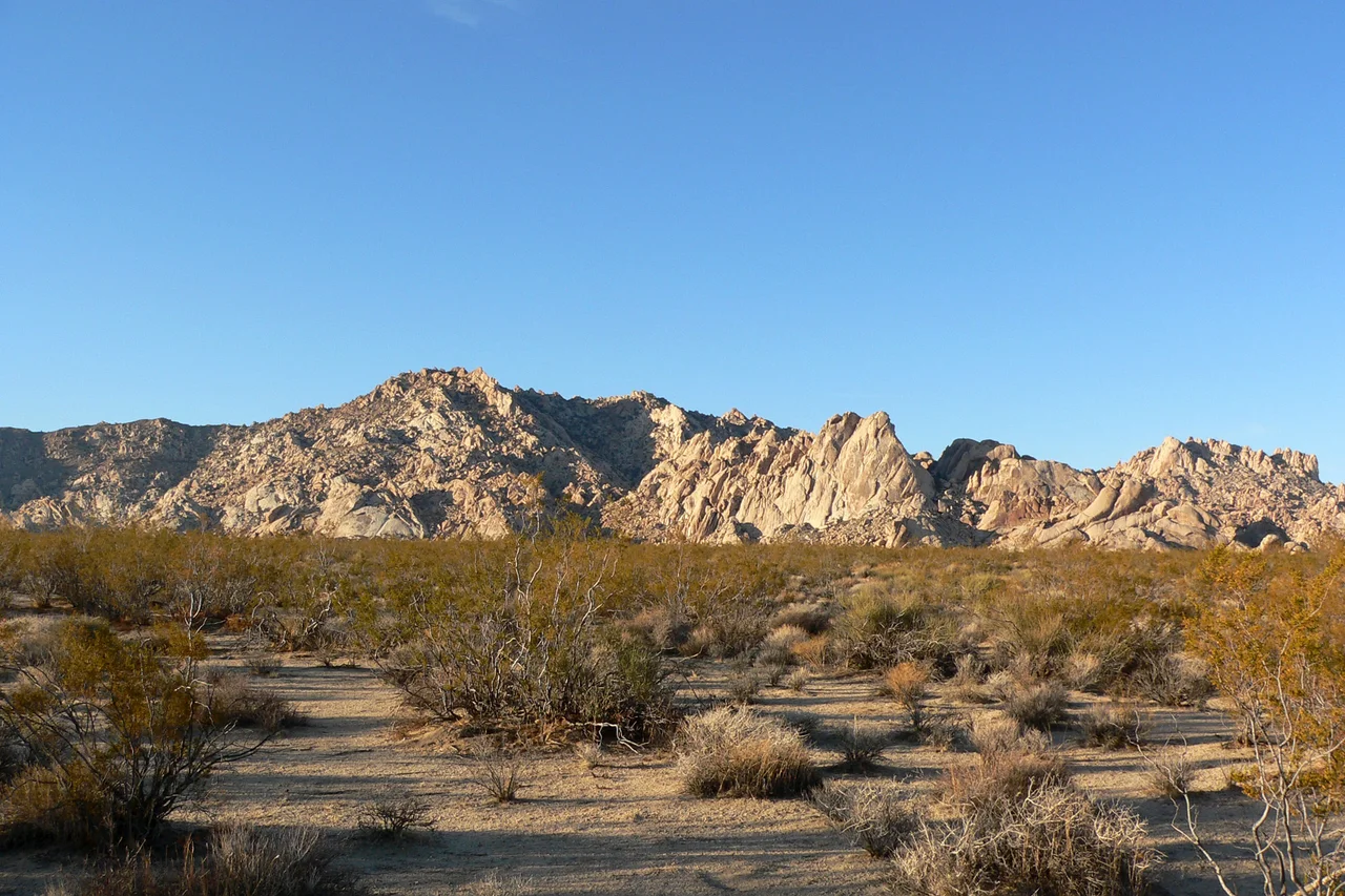
The Granite Mountains extend roughly 10.7 miles from Granite Pass at the southern end to Budweiser Wash at the north. Granite Peak, the range's high point, reaches 6,766 feet — high enough to receive slightly more precipitation than the surrounding desert, low enough that the difference produces pinyon pine and juniper rather than dramatic forest. The range runs within Mojave National Preserve, the federal designation that protects this section of the eastern Mojave from development.
The geology is more varied than the name suggests. The mountains contain Jurassic and Cretaceous intrusive rocks — granite and related igneous materials that crystallized from magma deep underground and were later exposed by erosion. Older Paleozoic dolomite and limestone appear as roof pendants, remnants of the sedimentary rock that was baked and altered by the intrusion of younger magma below them. The two rock types record different chapters in the range's geological history, separated by hundreds of millions of years.
Three Mines, No Commercial Success
Mining operations in the Granite Mountains produced names but not profits. The Comanche Mine, the Silver Lobe Mine, and the Iron Victory Mine each represented the optimism of prospectors who believed the range's geology concealed extractable wealth. None of them achieved commercial viability. The mines opened, extracted modest quantities of ore, and closed — leaving behind adits, tailings, and the infrastructure of failed enterprise that dots the California desert.
This pattern was common enough throughout the Mojave that the failed mine might be considered a standard landscape feature. The geology that makes ranges like the Granite Mountains interesting to geologists does not always produce the concentrated ore deposits that make mining profitable. The prospectors who worked these sites weren't wrong about the rock types — they were wrong about the grades.
Camp Granite and Patton's Desert
Camp Granite was one node in a training network that eventually covered more than 18,000 square miles of the California, Arizona, and Nevada desert. Patton's Desert Training Center prepared hundreds of thousands of soldiers for the North Africa campaign by subjecting them to conditions similar to what they would face in the Western Desert. The eastern Mojave, with its extreme heat, minimal water, and open terrain, provided the closest available American analog.
The camp's location against the Granite Mountains offered some tactical variety — troops could practice mountain operations on the range while conducting desert maneuvers in the surrounding flats. By the standards of the wartime desert, Camp Granite was a temporary installation: temporary in the sense that everything was designed to be dismantled when the need had passed, which it did after the North Africa campaign concluded in 1943.
What the Preserve Protects
Mojave National Preserve encompasses the Granite Mountains within a larger framework of protected eastern Mojave desert. The preserve designation, established in 1994 as part of the California Desert Protection Act, prevents the kind of development — mining, off-road vehicle use, residential subdivision — that has altered other portions of the Mojave.
The range supports wildlife typical of the mid-elevation Mojave: desert bighorn sheep on the rocky slopes, golden eagles hunting above the ridgelines, rattlesnakes in the rocky debris below the cliffs. The Joshua trees that cover portions of the range are among the easternmost populations of the species, near the edge of their range. From the summit of Granite Peak on a clear day, the view extends across the Mojave in multiple directions — a perspective that Patton's soldiers would have recognized, though they were probably not positioned to appreciate it.
From the Air
Located at 34.821°N, 115.759°W in eastern San Bernardino County within Mojave National Preserve. The range runs roughly north-south for about 10 miles and is visible from cruising altitude as a distinct elevated terrain feature. Granite Peak at 6,766 feet is the highest point. Nearest airport: Needles Airport (EED), approximately 40 miles east.
Nearby Stories
- Mojave Trails National Monument 4.9 km away
- Lavic Lake Volcanic Field 18 km away
- Giant Rock 33 km away
- London Bridge (Lake Havasu City) 90 km away
- The PEPCON Disaster 101 km away
- The Trona Pinnacles: California's Most Alien Landscape 105 km away
- MGM Grand Fire 122 km away
- Boulder City and Hoover Dam 128 km away