
Great Glen Fault
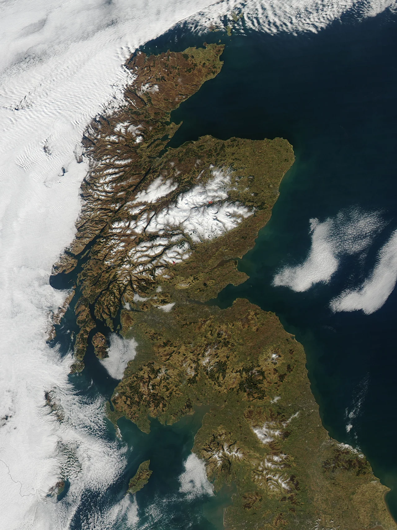
Look at a map of Scotland from the air. A long straight slash runs from southwest to northeast, from Loch Linnhe up through Loch Lochy, Loch Oich and Loch Ness, ending near Inverness. That is not coincidence. That is the Great Glen Fault, a wound in the crust about 430 million years old, and it does not stop where the Scottish coast does. It runs offshore northwest into the seabed, surfaces again in Newfoundland as the Cabot Fault, and continues across the Gulf of St. Lawrence. The single fault was torn in two when the Mid-Atlantic Ridge opened 200 million years ago.
Born in a Continental Collision
At the close of the Silurian period, around 430 million years ago, two ancient continents called Laurentia and Baltica drove together in the Caledonian orogeny. The collision built mountains across what would eventually be Scotland, Scandinavia and parts of Newfoundland. As the crust crumpled, it cracked sideways. The Great Glen Fault and a fan of related faults to either side, including the Strathconon and Strathglass faults to the northwest and the Laggan, Tyndrum and Ericht-Laidon faults to the southeast, all slipped left-laterally as the rocks adjusted. The total displacement may exceed the length of the fault itself on mainland Scotland. Geologists are still arguing about the exact figure.
A Glen Carved by Ice
Once the fault existed, erosion did the rest. Rock on either side weathered at different rates, and during the Quaternary glaciations, advancing ice exploited the line of weakness, scouring out a steep-sided valley from coast to coast. Glaciers deepened the troughs that meltwater later filled, producing the three long ribbon lakes of Loch Lochy, Loch Oich and Loch Ness. Loch Ness alone holds more freshwater than every lake in England and Wales combined. The Great Glen became, by pure geological accident, one of the most useful transport routes in Britain: a flat-floored corridor running diagonally across the most mountainous country in the British Isles.
Telford's Long Cut
Humans noticed the convenience early. In 1803 the engineer Thomas Telford was commissioned to link the three lochs with a canal, providing a sea-to-sea passage that would let ships avoid the dangerous waters around Cape Wrath and the Pentland Firth. The Caledonian Canal was finally completed in 1822. Twenty-nine locks lift boats up from Loch Linnhe at Fort William, across the watershed, and down again into the Moray Firth at Inverness. Telford was, in effect, exploiting a strike-slip fault for commercial shipping. The canal still operates today, mostly carrying pleasure boats.
Is It Still Moving?
Geologists disagree about whether the fault remains active. Some researchers describe it as a reactivated strike-slip fault within continental crust, still accumulating tectonic strain. Others, including the seismologist Roger Musson, see no clear evidence of present-day activity and place the 1901 Inverness earthquake on a secondary fault rather than the main line. Moderate tremors have been recorded along the glen over the past 150 years, none destructive. When the Kessock Bridge was built across the Beauly Firth to carry the A9 out of Inverness, engineers built seismic buffers into the structure anyway. The fault may be sleeping. No one is willing to bet that it is dead.
The Fault That Crossed an Ocean
The most striking thing about the Great Glen Fault is not that it cuts through Scotland but that it once kept going. Before the Atlantic Ocean existed, the same fault ran westward into rocks that are now Newfoundland and called the Cabot Fault. When North America and Europe pulled apart along the Mid-Atlantic Ridge, the fault was sheared. You can still trace its continuation through northwestern Ireland as the Leannan Fault, through Lough Swilly and Donegal Bay and Clew Bay. Northeast it links to the Walls Boundary Fault and disappears under Mesozoic rocks beyond Shetland. The Great Glen, the long lakes, the canal, the legendary monster all sit on top of a scar that the Atlantic could not erase.
From the Air
The Great Glen Fault runs from roughly 56.7 N, 5.4 W at Loch Linnhe to 57.6 N, 4.0 W near Inverness, a straight southwest-to-northeast line about 100 km long. From cruising altitude in clear weather it appears as an unmistakable diagonal slash across the Highlands, the three long lochs lined up like beads. Inverness (EGPE) sits at the northeastern end. Fort William's small strip (EGEF, Plockton/Glenforsa nearby for GA) sits near the southwestern. The Caledonian Canal threads the entire glen. Mountain wave activity is common over the surrounding ridges in strong west winds.
Nearby Stories
- Cannich wildfire 1 km away
- Corrour railway station 3.9 km away
- Highland Folk Museum 7.7 km away
- Lochalsh 11 km away
- Tomatin distillery 14 km away
- Battle of Glen Shiel 15 km away
- Falls of Bruar 17 km away
- Strontian 20 km away