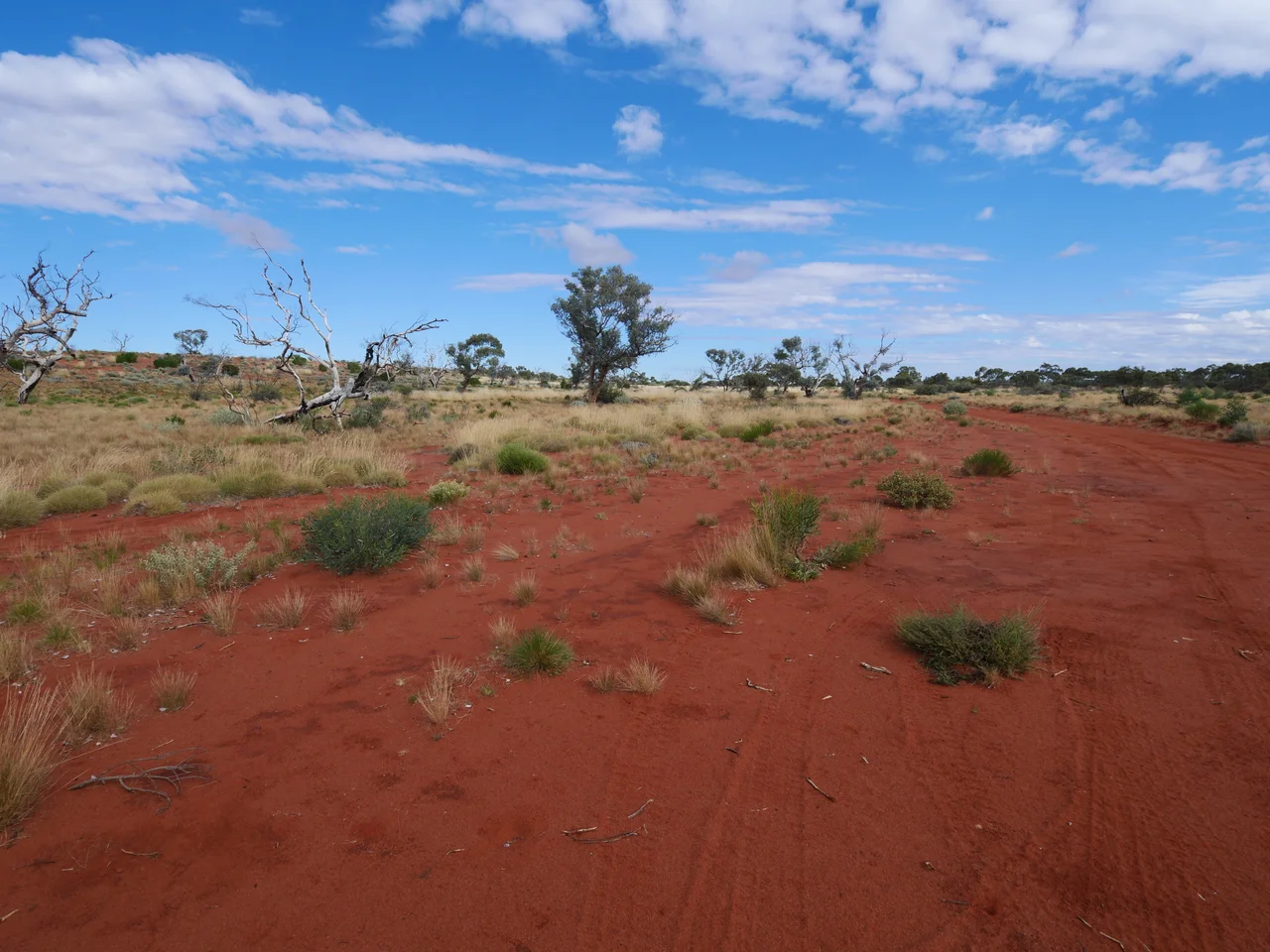

Great Victoria Desert
Ernest Giles had gone seventeen days without water when the desert finally relented. His party had pushed 520 kilometres across the dunes in 1875, men and animals failing, before they stumbled onto a soak that saved their lives. Giles named it Queen Victoria Spring, and the vast, waterless country that had nearly killed him he called the Great Victoria Desert, after the same distant monarch. It was a European's name for a place that already had a thousand older ones - because for the people who had lived here for millennia, this was not a desert to be survived. It was simply home.
The Largest Desert on the Continent
The Great Victoria Desert is the biggest in Australia, a sprawl of roughly 348,750 square kilometres stretching more than 700 kilometres from the Eastern Goldfields of Western Australia to the Gawler Ranges of South Australia. It is not the flat nothing the word desert suggests. It is a restless mix of long red sandhills and grassland plains, salt lakes that flash white under the sun, and gibber plains - stretches of ground packed so tight with pebbles they look paved. Rain is rare and unreliable, but the sky is not always calm: the desert sees fifteen to twenty thunderstorms in an average year, towering and violent, dumping water that vanishes almost as fast as it falls. Summer days climb into the thirties and beyond; winter nights can be sharp and cold.
Life Built for Drought
Only the toughest things grow here. Hardy spinifex grasses spread in spiny clumps between the dunes, scattered with mulga and desert eucalypts like the marble gum, Eucalyptus gongylocarpa. The animals are masters of scarcity. Emus and red kangaroos range the open country, but the desert's real specialists are smaller and stranger: the great desert skink digging its communal burrows, the endangered sandhill dunnart, and the southern marsupial mole, a blind, gold-furred creature that effectively swims through the sand. The water-holding frog waits out the dry years sealed underground in a cocoon of its own skin. Overhead and underfoot live the predators - the dingo, free here on the northern side of the great Dingo Fence, and the perentie, Australia's largest monitor lizard, big enough to stop a traveller in their tracks.
The Oldest Inhabitants
Long before Giles, this was Aboriginal country, and it remains so. The desert is the homeland of peoples including the Pitjantjatjara, the Mirning, the Kogara, and the Spinifex People - Pila Nguru - whose connection to this land reaches back many thousands of years. The story here is not one of disappearance but of endurance and return: Aboriginal populations across the region have been growing, and communities are actively keeping culture alive, with young desert people working through programs like Wilurarra Creative to carry language, art and law forward. When the Spinifex People sought legal recognition of their country in 2000, they made their case partly through paintings - vast canvases mapping their homeland - and won native title over tens of thousands of square kilometres. The desert that explorers crossed in terror has always been, to its first peoples, a place of belonging.
Roads, Surveyors, and a Poisoned Edge
For all its isolation, the desert is threaded by a few brutally rough tracks - the Connie Sue Highway and the Anne Beadell Highway among them, both cut by the surveyor Len Beadell in the 1950s and 60s and named, in his sentimental way, for his daughter and his wife. But Beadell's roads served a darker purpose too. They opened the country for the British nuclear weapons tests carried out at Maralinga and Emu Field, on the desert's southern edge, in the 1950s and early 1960s. Those tests drove Aboriginal people from their land and left ground contaminated with plutonium-239 and other long-lived radioactive material - a wound the desert still carries. It is a hard counterpoint to the desert's otherwise untouched character, a reminder that even the most remote places were not beyond the reach of the twentieth century.
A Wilderness Largely Intact
Set against that scar is an unusual fact: the Great Victoria Desert is one of the least-disturbed large landscapes left on the continent. Too dry for farming, it was mostly spared the clearing and grazing that reshaped so much of Australia, and roughly 31 percent of it now sits within protected areas - nature reserves, conservation parks, and a network of Indigenous Protected Areas managed by traditional owners themselves. Recognised as a distinct ecoregion by the World Wildlife Fund, the desert holds its dunes, its spinifex, and its remarkable specialised wildlife in something close to their original state. New species still turn up here - the Central Ranges taipan was first described as recently as 2007. In an age when wild places are vanishing, this enormous red expanse remains, against all odds, mostly itself.
From the Air
The Great Victoria Desert is centred near 29.15°S, 129.26°E, straddling the Western Australia-South Australia border and covering some 348,750 square kilometres. From altitude it reads as endless parallel red dunes streaked with spinifex, broken by white salt lakes and the occasional gibber plain - a landscape almost entirely without towns, roads, or lights. Navigation aids are scarce: the faint lines of the Anne Beadell and Connie Sue Highways are among the only human features, along with the remote Ilkurlka roadhouse and the Spinifex community of Tjuntjuntjara. There are essentially no en-route alternates over the interior; the practical edges are Forrest (YFRT) on the Nullarbor to the south and Kalgoorlie-Boulder (YPKG) to the west. Carry maximum fuel and survival gear. Visibility is usually superb, but watch for sudden afternoon thunderstorms and blowing dust. Note that much of the desert is Aboriginal land and former nuclear test areas near Maralinga remain hazardous - do not plan ground access without permits and current advice.
Nearby Stories
- Serpentine Lakes 15 km away
- Mamungari Conservation Park 25 km away
- Vokes Hill Corner to Cook Road 45 km away
- Ilkurlka Community, Western Australia 125 km away
- Archie Barton 149 km away
- Reid, Western Australia 165 km away
- Anne Beadell Highway 199 km away
- Forrest Airport 202 km away