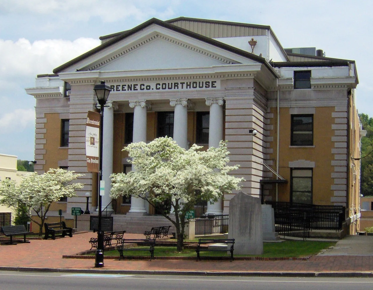

Greene County, Tennessee
On June 8, 1861, Greene County voted 2,691 to 744 against leaving the Union. Tennessee left anyway. Within five months, a railroad bridge near the Greene County village of Mosheim was burned by Unionist saboteurs in the East Tennessee bridge-burning conspiracy of November 1861. Several of the conspirators — Jacob Hensie, Henry Fry, Jacob and Henry Harmon, and the local potter Christopher Alex Haun — were captured by Confederate forces and executed. Greene County had been Unionist long before the war and stayed Unionist after it; the last Democratic presidential candidate to carry the county was Franklin Roosevelt in 1936. This is the kind of place that produces complicated figures. Andrew Johnson started his career here. So did Davy Crockett. The county still farms tobacco, still goes to the Ebenezer Methodist congregation that has been worshipping since the 1780s, and still occupies the same valleys the Cherokee leased to Jacob Brown in 1771.
From Nolichucky Settlement to Greene County
In the early 1770s, the merchant Jacob Brown leased land along the Nolichucky River from the Cherokee, then bought it outright in 1775. Brown's Nolichucky Settlement aligned itself with the Watauga Association, centered in modern Elizabethton, and became part of Washington County, North Carolina, after the Revolution. In 1783, the Nolichucky Settlement and several adjacent communities split off to form Greene County, named for Major General Nathanael Greene, the Rhode Island Quaker who took command of the Continental Army's Southern Department in 1780 and turned the southern war around. At the time of its founding, Greene County was actually part of the extralegal State of Franklin — an attempted breakaway state that lasted from 1784 to 1788 before North Carolina reasserted control. John Crockett, father of Davy, settled near Limestone, where Davy was born on August 17, 1786, in the brief Franklin years. The Crockett story begins in this county before it begins anywhere else.
Ridge, Valley, and Bald Mountains
Greene County covers 624 square miles in upper East Tennessee, almost entirely within the Ridge-and-Valley Appalachians — long narrow ridges running northeast-southwest, separated by similarly aligned valleys. Bays Mountain forms much of the northern border with Hawkins County. The southeastern corner climbs into the Bald Mountains, a Blue Ridge subrange straddling the North Carolina state line where Camp Creek Bald reaches 4,844 feet and Gravel Knob rises somewhere above 4,840 feet (its exact elevation has never been precisely measured). The Nolichucky River drains the southern half of the county, impounded south of Greeneville by Nolichucky Dam to create Davy Crockett Lake. The Appalachian Trail crosses the county along the Bald Mountains crest, and the Cherokee National Forest covers much of the southeastern uplands. Rocky Fork State Park, opened in 2012, protects an additional stretch of high country along the same ridge.
Bridges, Burnings, and the Unionist War
When the Civil War came, East Tennessee did not move with the rest of the state. The second session of the East Tennessee Convention met in Greeneville after the June 1861 secession referendum and called for forming a separate Union-aligned state. That proposal failed, but the spirit behind it persisted. In November 1861, organized Unionist groups across East Tennessee burned five Confederate railroad bridges in a single night, attempting to cut the Confederacy's main north-south rail link. The Mosheim bridge in Greene County was one of them. Confederate troops captured several of the participants and hanged them — including Christopher Alex Haun, a potter from Greene County whose stoneware is now collected as some of the finest in early Tennessee craft. The executions were meant to terrorize Unionists into compliance. The county voted Republican in nearly every presidential election that followed, and still does.
Tusculum, Tobacco, and Two Presidents
Greene County is the home of Tusculum University, whose lineage traces to 1794 — making it the oldest institution of higher education in Tennessee. The Ebenezer Methodist Church near Chuckey holds the state's oldest Methodist congregation. The Earnest Farms Historic District includes the state's second-oldest continuously cultivated farm, Elmwood, worked by the same family lineage since the 1770s. Tobacco remains the dominant crop on these farms — a cash crop that survived dairy attempts, suburban encroachment, and federal quota changes. The county also produced two figures who shaped American history at the national level: Davy Crockett, born in Limestone in 1786, and Andrew Johnson, the seventeenth president, whose tailor shop, homestead, and grave are preserved in Greeneville. The mix is characteristic — a small rural county that has repeatedly produced people who ended up arguing about the meaning of America in Washington and Philadelphia.
The County Today
The 2020 census counted 70,152 residents, making Greene County the population center of upper East Tennessee outside the Tri-Cities. Greeneville, the county seat, sits at the intersection of US 11E and US 321. Tusculum, just east of Greeneville, is the county's other incorporated city. Two-thirds of residents live in rural areas; agriculture, manufacturing, and healthcare anchor the economy. Two hospitals — both formerly Takoma Regional and Laughlin Memorial, now Greeneville Community Hospital East and West campuses under Ballad Health — serve the region. The county's small unincorporated communities still keep their old names: Afton, Camp Creek, Chuckey, DeBusk, Mohawk, Mosheim, Rheatown, Romeo, Warrensburg. Each of them is a few square miles of farmland and a crossroads, but each is also a place a family has been from for two centuries.
From the Air
Greene County, Tennessee, centers near 36.17 N, 82.85 W in upper East Tennessee, covering 624 square miles between the Bays Mountain ridge to the north and the Bald Mountains crest along the North Carolina border to the south. Greeneville, the county seat, sits at about 1,580 feet elevation. Best viewed from cruising altitudes of 5,000 to 8,000 feet to take in the parallel ridges and valleys characteristic of the Ridge-and-Valley province. Greeneville Municipal Airport (0A9) is the local field; Tri-Cities Airport (KTRI) lies about 22 nm north-northeast; McGhee Tyson (KTYS) in Knoxville is roughly 60 nm west-southwest. The Appalachian Trail crosses the southeast corner along the Bald Mountains crest, with peaks above 4,800 feet within 15 nm of Greeneville. The Nolichucky River drains the southern half of the county. Expect valley winds channeling along the northeast-southwest ridge alignment and rapid afternoon thunderstorm development in summer.
Nearby Stories
- Black Mountains (North Carolina) 11 km away
- Holston Mountain 13 km away
- Amis House (Rogersville, Tennessee) 15 km away
- Mitchell County, North Carolina 16 km away
- The Titanic Museum: The Ship That Docked in Tennessee 24 km away
- Richmond Hill Inn 34 km away
- Cumberland Gap 39 km away
- 2016 Great Smoky Mountains Wildfires 57 km away