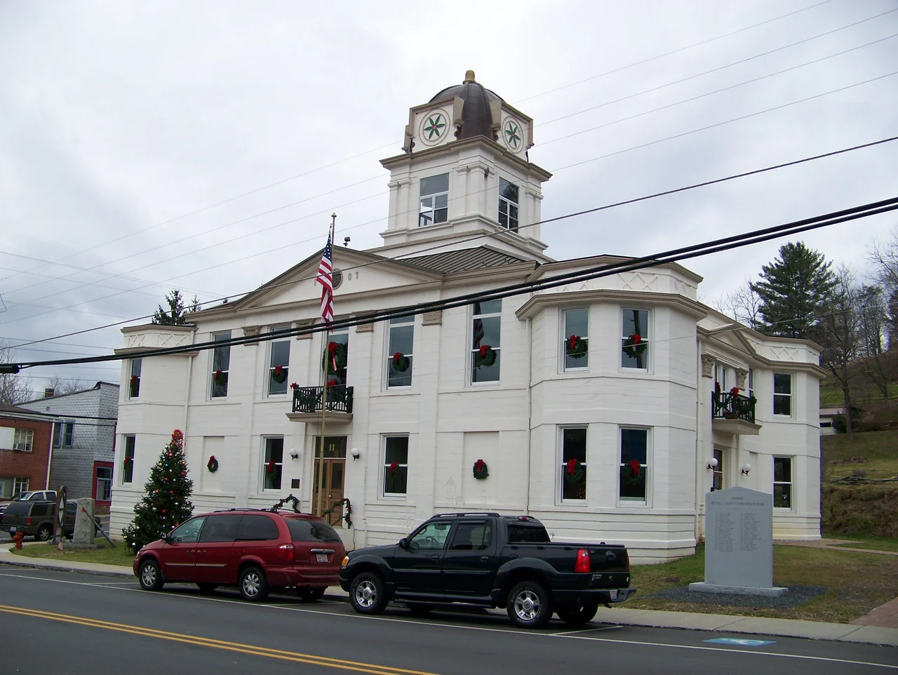

Mitchell County, North Carolina
In 1857, the geology professor Elisha Mitchell climbed a peak in the Black Mountains for the last time. He was, by then, 63 years old and engaged in a bitter scientific dispute with one of his former students, the Congressman Thomas Lanier Clingman, about which peak was the tallest east of the Mississippi. Mitchell had measured the mountain repeatedly over the decades; Clingman insisted his own peak was higher. Mitchell went to verify his measurements one more time. He never came back. They found his body at the base of a waterfall. The mountain proved his measurement correct, and the state of North Carolina named the peak, and eventually a county, in his honor.
The Mineral City of the World
Spruce Pine sits in the middle of one of the most geologically rich pieces of ground in the world. The Spruce Pine pegmatite district has been mined since the late nineteenth century for mica, feldspar, and quartz, and the quartz here is so pure and so abundant that virtually every semiconductor produced anywhere on Earth contains some of it. When you read a story about the global supply of high-purity quartz being concentrated in one small region, this is the region. Sibelco North America and The Quartz Corp USA still operate mines here, two of the largest employers in the county. The town's nickname, Mineral City of the World, is not provincial boosterism. It is reasonably accurate. Without the quartz coming out of these mountains, the silicon chips in modern electronics would be substantially harder to make.
Penland and the Crafts
In 1923, Lucy Morgan began organizing Appalachian women in the small community of Penland into a weaving cooperative, giving them a way to sell their craft and earn cash income. By 1929, outside students were joining local women for intensive sessions, and Penland School of Crafts was formally established. The school survived the Depression and grew. Today Penland is one of the oldest and most prestigious professional crafts schools in the United States, with programs in clay, drawing, glass, iron, metals, photography, printmaking and letterpress, textiles, wood, and books and paper. Working artists come from around the world to take residencies and intensive sessions in studios scattered across the school's wooded grounds. The school's existence has shaped the cultural identity of an entire region, turning Mitchell County into a place where craft is both heritage and contemporary practice.
1923 and the Sundown County
From about 1899 onward, Mitchell County operated a sundown policy that effectively prevented Black Americans from living or working within its boundaries. The policy lapsed in the early 1920s as the new state highway system, including what is now US 19E, brought Black convict laborers and mine workers into the county. In September 1923, a white mob in Spruce Pine, formed in response to an accusation made by a 75-year-old white woman against a Black escaped convict laborer named John Goss, forced nearly all of the county's Black residents onto train cars and out of the county. Governor Cameron Morrison declared martial law and dispatched the National Guard. By the time soldiers arrived, the Black community had already been expelled. The Guard occupied Spruce Pine for two weeks. The episode marked the first time martial law was declared in the United States in response to a mass act of racial violence. Eighty-six members of the mob were eventually indicted; most pleaded guilty to minor charges. John Goss was arrested elsewhere, tried in Mitchell County after a five-minute jury deliberation, and executed by electrocution. This is part of Mitchell County's history. It deserves to be remembered as honestly as the rhododendrons and the quartz.
The Roan and the Rhododendron
Bakersville, the county seat, calls itself the Gateway to Roan Mountain, and the title is earned. Roan Mountain itself straddles the Mitchell-Tennessee line, a high grassy bald running for miles along the ridgeline at over 6,000 feet, the longest stretch of grassy bald in the entire Appalachian range. In late June, the Catawba rhododendron blooms across the slopes in what is genuinely the world's largest natural rhododendron garden. The annual North Carolina Rhododendron Festival in Bakersville celebrates the bloom; the North Carolina Mineral and Gem Festival a month later celebrates the underground wealth. Between them they capture the county's two essential identities: the beauty above ground and the riches below it.
Flight Context
Centered at 36.01 degrees north, 82.16 degrees west, in the Toe River Valley of western North Carolina. The county borders Tennessee to the northwest and is bisected by the North Toe River. Roan Mountain (6,285 feet) on the Tennessee line is a dominant terrain feature. Sections of the Blue Ridge Parkway and the Appalachian Trail run through the county. Spruce Pine-Avery County Airport (7A8) is the local field. Tri-Cities Regional (KTRI) lies about 35 nautical miles north across the state line; Asheville Regional (KAVL) about 45 nautical miles southwest. Recommended altitude 8,500 to 10,500 feet MSL for the high ridges. Look for the long grassy bald of the Roan to the north and the cluster of mining operations near Spruce Pine. Watch for mountain wave on west winds and rapid afternoon convection.
From the Air
Coordinates 36.01N, 82.16W. The county sits in the Toe River Valley with the Roan Highlands defining the northern boundary. Roan Mountain reaches 6,285 ft MSL. Nearest airport 7A8 (Avery County) at Spruce Pine; KTRI (Tri-Cities) 35 nm N; KAVL (Asheville Regional) 45 nm SW. Recommended altitude 8,500-10,500 ft MSL. Watch for the distinctive grassy bald of the Roan and for industrial dust plumes near the Spruce Pine mining operations.
Nearby Stories
- Marion, North Carolina 7.6 km away
- Sycamore Shoals 21 km away
- Earnest Farms Historic District 29 km away
- Hickory Museum of Art 31 km away
- Battle of Ramsour's Mill 36 km away
- Amis House (Rogersville, Tennessee) 38 km away
- Pisgah National Forest 39 km away
- Galax, Virginia 77 km away