
Black Mountains (North Carolina)
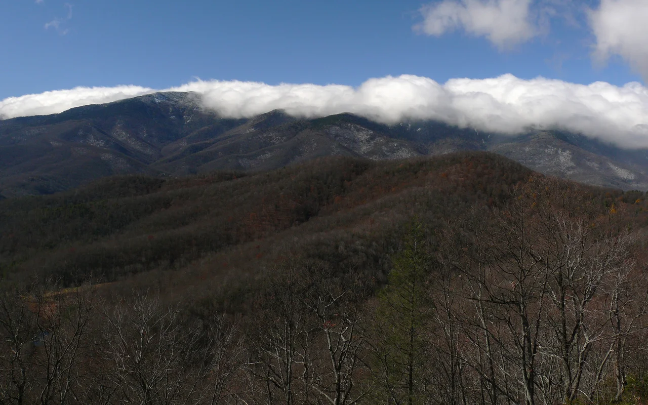
From the Catawba River valley near Marion, the eastern wall of the Black Mountains rises 4,500 feet almost straight up. Drivers on Interstate 40 see it as a long, dark ridgeline that does not look like the rest of the Appalachians — and they are right. The crest is only fifteen miles long, but eighteen peaks within that span climb above 6,300 feet. The very highest, Mount Mitchell, reaches 6,684 feet — the tallest mountain in the eastern United States. The range takes its name from the dense red spruce and Fraser fir forest that coats the upper slopes year-round, dark against the lighter deciduous forest below. To climb the Blacks is to walk from southern Appalachian hardwood up into something that looks and smells more like coastal Maine, all within a few miles of elevation.
A Cloud Forest, Pretending to Be Canada
The spruce-fir forest atop the Blacks is not boreal, despite the resemblance. Botanists now describe it more accurately as a high-elevation cloud forest — one of about ten such islands marooned on Southern Appalachian summits after the last ice age retreated 16,000 years ago. As the climate warmed, hardwoods returned to the lower slopes, and the spruce and fir retreated upward to whatever altitude stayed cool and wet enough. Today the forest above 5,500 feet is dominated by red spruce and the endemic Fraser fir, a tree that exists nowhere else in the world. Below that, northern hardwoods give way to a richer Appalachian hardwood community of yellow poplar, oak, hickory, and maple. The northern flying squirrel, an endangered species more typical of New England, still nests in the high firs. So do peregrine falcons. Brook trout, native to colder northern latitudes, hold on in the streams at the base.
Mitchell, Clingman, and a Fatal Argument
Through the early nineteenth century, Mount Washington in New Hampshire was thought to be the highest summit in the eastern United States. North Carolina professor Elisha Mitchell set out in 1835 with a crude barometer to test the claim against the Blacks. After several expeditions, he measured a summit at 6,476 feet, settling the question — the Appalachians' high point was here, not in New England. His former student Thomas Lanier Clingman, by then a pro-secession politician, returned in 1855 and measured a different peak called Black Dome at 6,941 feet, claiming it as the true high point. The two men fought a long public argument in the newspapers about which mountain Mitchell had actually climbed in 1844. In 1857, Mitchell returned alone to settle it. He slipped at dusk and fell into a gorge along Sugar Camp Fork, dying near the waterfall that now carries his name. The legendary guide Tom Big Tom Wilson found his body eleven days later. Mitchell was buried atop Black Dome on donated land. By 1858 the summit had been renamed in his honor, and Clingman — outlived by public sympathy — turned his attention to the Smokies. The peak Clingman did get named for him there, Clingmans Dome, was restored to its original Cherokee name Kuwohi on September 18, 2024.
The Logging Years
Between 1908 and 1915, northern lumber firms — Dickey and Campbell, Brown Brothers, Carolina Spruce, Champion Fibre — bought timber rights to most of the Black Mountains and built narrow-gauge railroads up the slopes. World War I drove demand for red spruce, prized for aircraft framing because of its strength-to-weight ratio. Crews cut almost everything above the northern hardwood line. Where they did not cut, fire swept through the brush and slash they left behind. Photographs from 1915 show a landscape of stumps and ash where one of the oldest forests in eastern North America had stood. The destruction was so visible from the valleys below that Governor Locke Craig and state forester John Simcox Holmes lobbied for protection. The state legislature approved the first land purchase for Mount Mitchell State Park in 1915 — North Carolina's first state park. The Pisgah National Forest followed in 1916. The spruce and fir have come back, slowly, but the crest you see today is largely a second growth that has spent a century catching up.
Cherokee Country, Then Not
For most of the eighteenth century, the Black Mountains marked the eastern edge of Cherokee hunting territory. Excavations at Swannanoa Gap just south of the range have turned up evidence of habitation reaching back to the Archaic period, roughly 8,000 to 1,000 BC, with continuous use through the Woodland and Mississippian eras. The Mississippian town of Joara lay near present-day Morganton. Hernando de Soto's expedition passed through the North Toe River valley in May 1540, and Juan Pardo crossed at Swannanoa Gap in October 1567. By 1785, Cherokee leaders had been pressed into ceding the Black Mountains to the United States, and Euro-American farmers moved into the Cane and South Toe river valleys within a year. The land that had supported Cherokee hunting and trade became cattle range, then tobacco, then ginseng country sold at markets in Asheville. The eastern Cherokee survived elsewhere — the Qualla Boundary lies to the southwest — but the Blacks themselves were no longer theirs.
What the Air Looks Like Now
By the late 1990s, the famous long views from Mount Mitchell had collapsed to less than ten miles on most days, choked by sulfur and nitrogen pollution drifting in from coal-fired power plants. The balsam woolly adelgid was killing Fraser firs the acid rain had already weakened. North Carolina's Clean Smokestacks Act of 2002 changed both. Nitrogen oxide emissions fell from over 245,000 tons a year in 1998 to under 25,000 by 2014. Sulfur dioxide dropped 64 percent. Average visibility on the summit is back to about 39 miles. Predator beetles are being released against the hemlock woolly adelgid threatening the lower slopes. Individual Fraser firs resistant to the adelgid have been identified, raising the possibility that the high spruce-fir forest can eventually be rebuilt by its own surviving genes. The range that Mitchell died measuring is, for the first time in a century, getting healthier.
From the Air
The Black Mountains form a 15-mile J-shaped crest centered near 35.765 N, 82.265 W in Yancey and Buncombe counties, North Carolina. Mount Mitchell at 6,684 feet is the highest point in the eastern United States. The crest hosts 18 summits above 6,300 feet, including Mount Craig (6,647 ft), Balsam Cone, Big Tom, Mount Gibbes, and Clingmans Peak. Best viewed from west or south at cruising altitudes of 8,000 to 12,000 feet on clear days — the dark spruce-fir crest is visually distinct from surrounding hardwood ridges. Asheville Regional Airport (KAVL) lies about 25 nm southwest; Marion-Morganton (KMRN) about 20 nm southeast; Tri-Cities (KTRI) about 50 nm north-northeast. Mountain weather builds rapidly here — cumulus and afternoon thunderstorms are common in summer, severe rime icing in winter. Density altitude and downdrafts around the crest demand respect. The Blue Ridge Parkway threads the southern flank and connects to Mount Mitchell via NC-128.
Nearby Stories
- Avery County, North Carolina 16 km away
- Earnest Farms Historic District 19 km away
- Rutherford County, North Carolina 20 km away
- Hickory Museum of Art 21 km away
- Pisgah National Forest 23 km away
- Historic Campbell Building 24 km away
- Moravian Falls, North Carolina 36 km away
- Andrew Johnson National Cemetery 47 km away