
Holston Mountain
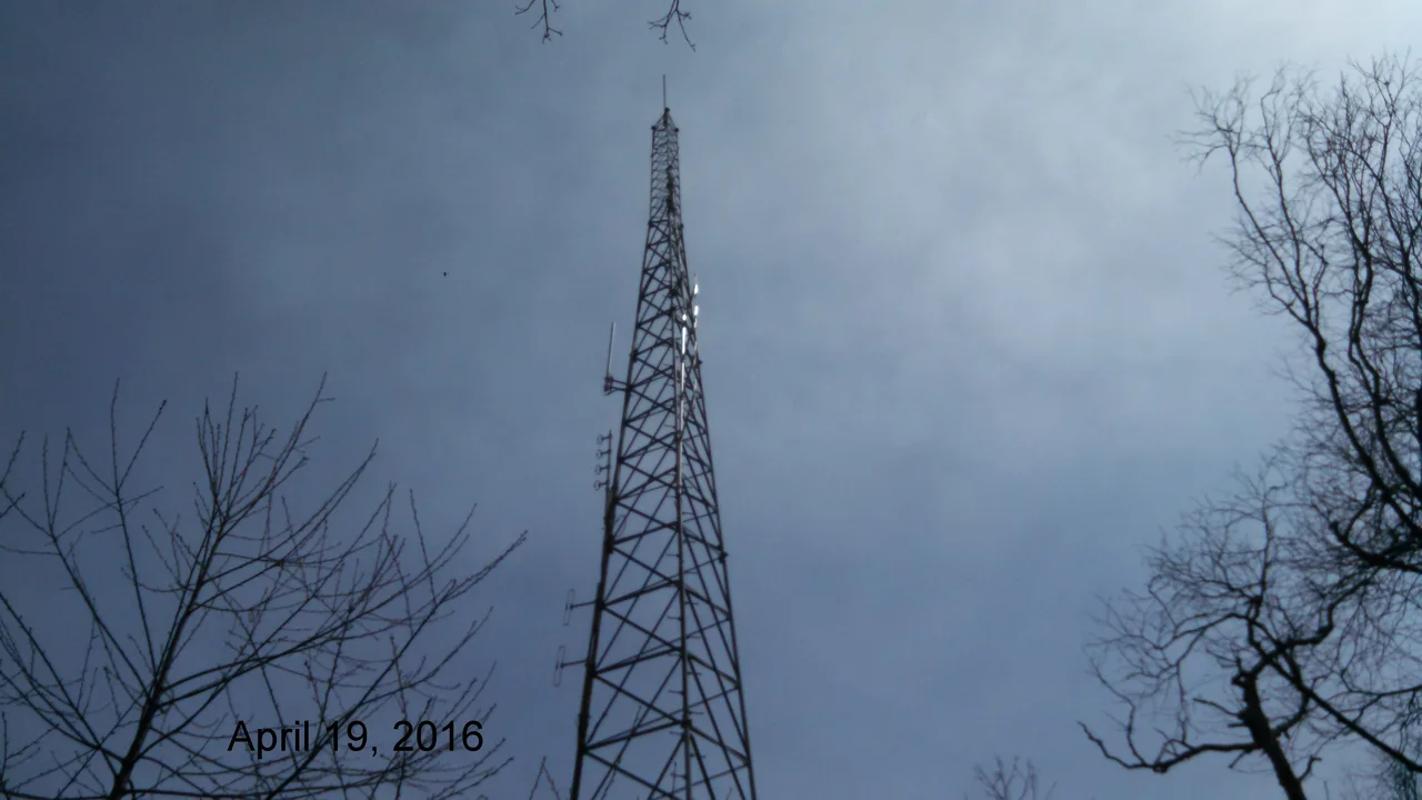
On Rye Patch Knob, a single steel tower reaches 341 feet into the air. From its base on a ridge 4,260 feet above sea level, the antenna tip touches 4,533 feet - the highest man-made structure in Tennessee, Virginia, and Kentucky. It's a television transmitter for WCYB Channel 5, broadcasting from the highest visible point that faces nearly every city in upper East Tennessee and southwest Virginia. Holston Mountain has been doing this job since the 1950s, when the first broadcasters realized one ridge could light up six valleys.
Named for a Common Settler
In 1746, a man named Stephen Holston - descendant of a Swedish immigrant from the colony of New Sweden - moved west and built a cabin near the headwaters of a small creek. The next year, surveyors mapping the area called the creek Holston's Creek, simply because Stephen Holston lived on it. Pioneers followed the creek downstream, where tributaries swelled it into a river, and the name stayed. The placename scholar George R. Stewart marveled at this: "Thus one of the largest streams of that region came to bear the name of a common settler." The mountain, in turn, took its name from the river. Nearby Clinch River got the same treatment from another unknown hunter.
28 Miles of Ridge
Holston Mountain is the textbook Appalachian ridge - a 28-mile spine running southwest to northeast, covering about 268 square miles in Tennessee's Ridge and Valley region. The Cherokee National Forest manages most of its slopes. Four named summits stand above 4,000 feet: Holston High Point at 4,280 feet, Rye Patch Knob at 4,260, Rich Knob at 4,240, and Holston High Knob at 4,136, where an old fire tower built by the Cherokee National Forest has been converted to a communications mast. South Holston Lake lies on the northwest flank, and Stoney Creek Valley falls away to the southeast. The Appalachian Trail traverses the upper northeast end, dropping into Damascus, Virginia, on its way toward Mount Rogers - Virginia's high point.
The Antenna Farm
Five television stations transmit from Holston Mountain into the Tri-Cities market. WCYB Channel 5 broadcasts from Rye Patch Knob. WJHL Channel 11 (Johnson City) and WKPT Channel 19 (Kingsport) share an antenna farm a mile southwest, on the slope of Holston High Point - their towers standing side by side at 4,370 and 4,366 feet above sea level. Three FM Class C radio stations - WTFM 98.5, WXBQ 96.9, WETS 89.5 - join them on the same southwest slope, along with several smaller FM transmitters scattered across the ridge. Federal, state, and county agencies run microwave relays from the same antennas. The broadcasters built here in the 1950s because before cable, the highest visible point with a clear shot at the valley meant the strongest signal.
Plane Crashes and Blue Hole Falls
The same height that made Holston a broadcasting prize has cost lives. On October 1, 1976, a German military RF-4C Phantom reconnaissance plane on a training flight from Shaw Air Force Base crashed near the crest of Holston Mountain, killing both crewmen - First Lieutenant Kurt Schnurer and Cadet Werner Michel Berger. On September 1, 2007, a small plane carrying five Jehovah's Witnesses ministers from East Tennessee went down in the Cherokee National Forest shortly after takeoff; the wreckage was spotted from another aircraft about a mile and a half below the antenna farm. Below the antennas, Panhandle Road climbs from State Highway 91 in Carter County for three miles before turning into a track full of washouts and steep drop-offs - the last three miles are at the driver's risk. A foot trail off Panhandle Road descends to Blue Hole Falls, a 45-foot cascade hidden in mountain laurel.
From the Air
Holston Mountain runs along 36.43N, 82.13W in upper East Tennessee, with Holston High Point reaching 4,280 ft MSL. The mountain hosts a FAA aircraft navigational beacon on its summit. Recommended viewing altitude 6,500-8,000 ft - the antenna tower complex on Rye Patch Knob reaches 4,533 ft and is a recognizable cluster from the air. Nearest commercial airport is Tri-Cities Regional (KTRI) about 13 nautical miles southwest. U.S. Route 421 crosses the ridge at Low Gap. Expect mountain wave and rotor in westerly flow; the long ridge orientation generates significant terrain effects. Watch for guy wires and unlit towers if descending near the ridge.
Nearby Stories
- David Crockett Birthplace State Park 3.6 km away
- Big Stone Gap, Virginia 20 km away
- Avery County, North Carolina 21 km away
- Emory and Henry University 23 km away
- Hawkins County, Tennessee 30 km away
- Moravian Falls, North Carolina 37 km away
- Tazewell County, Virginia 44 km away
- North Wilkesboro Speedway 57 km away