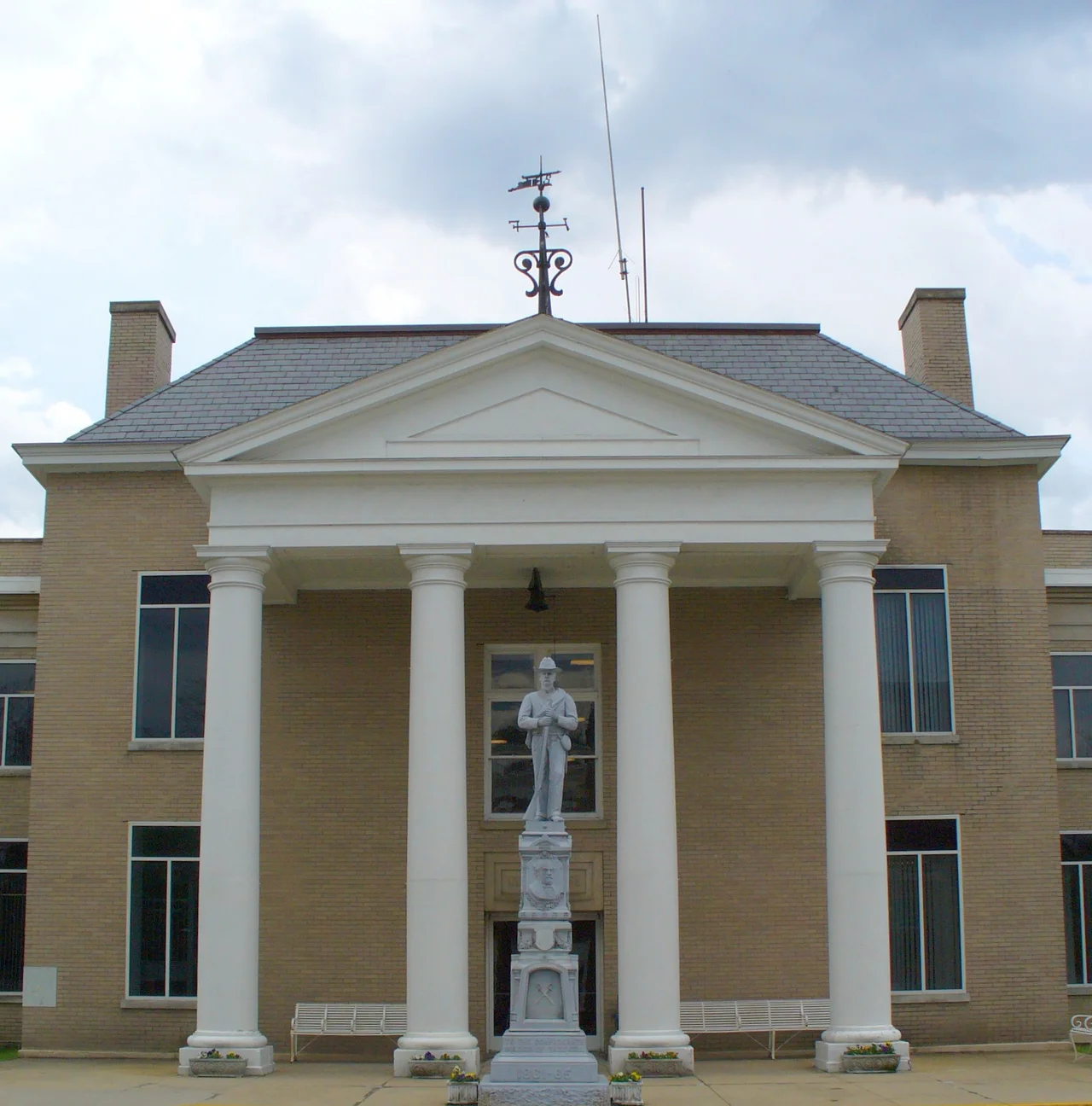

Tazewell County, Virginia
Near the summit of Paintlick Mountain, somebody carved figures into the rock long before anyone in Europe had heard of Virginia. The petroglyphs are extraordinarily rare for the eastern United States, where soft sandstone and 10,000 years of weather have erased most of what indigenous people left behind. Paintlick endured because the mountain wanted it to. So did Tazewell County, the southwestern Virginia county that wraps its 520 square miles around the headwaters of four watersheds and one of the strangest landforms in the Appalachians: Burke's Garden, a bowl-shaped valley that geologists call a doubly plunging anticline and that everyone else just calls God's Thumbprint.
First Permanent Settlement
Thomas and John Witten arrived in the spring of 1771 and built cabins at Crab Orchard. They were the first permanent European settlers in what would become Tazewell County, though the Cherokee and Shawnee had been hunting these high valleys for as long as anyone remembered. The county itself was created on December 20, 1799, carved from Wythe and Russell counties. It was named for Henry Tazewell, a U.S. Senator from Virginia who had died earlier that year — a choice that helped get the bill passed when his son Littleton Waller Tazewell, a delegate originally opposed to the new county, came around after the renaming. Jeffersonville became the county seat the following year, and on February 29, 1892, the town renamed itself Tazewell.
Burke's Garden
If you were going to design a hidden valley, you would design Burke's Garden. The bowl sits at roughly 3,100 feet, surrounded on every side by Garden Mountain rising another 1,500 feet above the valley floor. The rim is unbroken save for a single narrow gap, and the result is a landform so isolated that George Vanderbilt tried to buy it in the 1880s for his Biltmore estate. The farmers wouldn't sell. So Vanderbilt built in North Carolina instead, and Burke's Garden stayed exactly what it had been: some of the richest dairy and grazing land in the Appalachians, ringed by a fence the size of a small mountain range. The geology is the result of a collapsed anticline, where soft underlying rock eroded away after the overlying sandstone cracked. The Tehuelche of Patagonia would have understood the principle. So would any farmer with three feet of topsoil.
The Pocahontas Boom
After the Civil War, railroads pushed into the Clinch Valley and found coal and iron in commercial quantities. The Pocahontas Coalfield made Richlands a boomtown in the early 1890s, and at its peak the Richlands Hotel was said to rival the best in New York. Saloons multiplied, money flowed, and then the boom ended. The hotel closed and was converted to other uses. The mining camps that the railroad had built — Boissevain, Jewell Ridge, Pocahontas itself — settled into the long slow decline that has shaped Appalachian coal communities ever since. The Pocahontas Coalfield powered the U.S. Navy through two world wars. Its low-sulfur bituminous was so consistent and clean-burning that fleet boilers ran on almost nothing else for decades.
Four Rivers Begin Here
Tazewell County sits high enough on the Appalachian spine that four major watersheds begin within its boundaries. The Upper Clinch rises here and flows southwest toward Tennessee. The Middle New flows north into the New River Gorge. The North Fork Holston drains south into the Tennessee Valley. The Tug runs west to become the Big Sandy, eventually marking the border between Kentucky and West Virginia. And the Bluestone River — protected for part of its course as a Wild and Scenic River in West Virginia — begins on the county's north side. Stand at the right place in Tazewell and a raindrop falling on your hat might find its way to the Gulf of Mexico, or the Atlantic via the Ohio and Mississippi, depending on which side of your head it landed on.
The Lassie Country
Paramount Pictures filmed its 1994 Lassie here, the studio drawn by the same pastoral folds of Burke's Garden and the Clinch Valley that have always made Tazewell County look more like an idealized America than the actual one. The county is part of the Bluefield, WV-VA Micropolitan Statistical Area, which means its economic life still pulses with the larger town across the West Virginia line. Population was 40,429 at the 2020 census, down from a peak driven by the coal boom. The roads through Tazewell are some of the most scenic in southwestern Virginia, and the Back of the Dragon along Route 16 — 32 miles of switchbacks across three mountains — has become a destination for motorcyclists who treat the curves the way pilgrims treat shrines.
From the Air
Tazewell County centers near 37.13 N, 81.56 W, occupying southwestern Virginia between Bluefield and the Cumberland Plateau. Tazewell County Airport (KJFZ) sits north of Richlands at 2,684 feet elevation. From cruising altitude, look for Burke's Garden — an almost perfectly oval green bowl ringed by Garden Mountain in the county's southeast, visible from FL250 in clear weather and unmistakable on satellite imagery. The Clinch River threads through the county's north. Mercer County Airport (KBLF) lies 25 nm east. Ridge-induced turbulence common on west-northwest winds; the county's terrain ranges from 1,800 to 4,400 feet.
Nearby Stories
- Buchanan County, Virginia 15 km away
- Pulaski County, Virginia 19 km away
- Washington County, Virginia 22 km away
- Matewan Historic District 30 km away
- Monroe County, West Virginia 31 km away
- Beckley, West Virginia 42 km away
- Emory and Henry University 43 km away
- Chang and Eng Bunker 55 km away