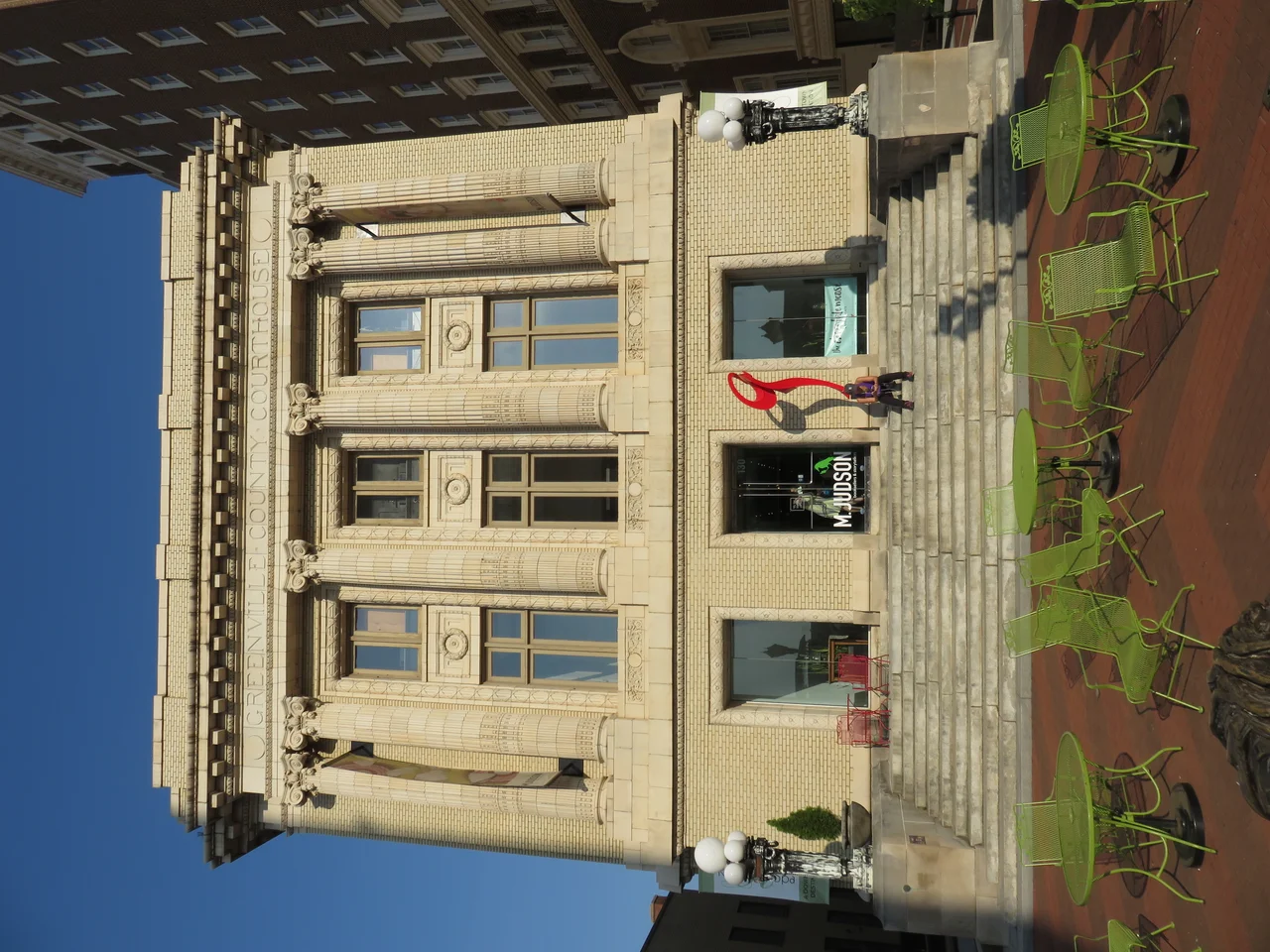

Greenville County, South Carolina
Eugenia Duke ran a sandwich shop in Greenville during World War I. Her sandwiches were popular among soldiers at the local army camp because of her homemade mayonnaise: tangier than commercial brands, yellower from extra egg yolks, with no added sugar. By 1917 the demand for the mayonnaise itself had outstripped the demand for the sandwiches, and she was selling it by the jar. Duke's Mayonnaise was born. More than a hundred years later the company still has its headquarters in Greenville County, and you can still find Eugenia's original recipe in every jar. The county that made it possible has changed almost beyond recognition. But the things that built modern Greenville, ingenuity, manufacturing, and a knack for the next thing, are easier to spot when you know how it all started.
Named for the General Who Saved the South
Greenville County was created in 1786 and named for Nathanael Greene, the Rhode Island-born Quaker turned Continental Army general whose southern campaign of 1780 and 1781 broke British control of the Carolinas. The naming was deliberate. The new county sat on land that had until very recently belonged to the Cherokees, who had sided with the British during the Revolution. American victory at battles like Kings Mountain and Cowpens, both in nearby counties, had ended Cherokee resistance and opened up the upcountry to white settlement. The county was originally part of the larger Ninety-Six District, then briefly part of the Washington District, then the Pendleton District, before becoming Greenville District in 1800 and finally Greenville County in 1868. The shifting names reflect a young state still figuring out how to organize itself.
The Textile Crescent
After the Civil War, formerly enslaved people gained legal freedom, cotton farming expanded, and the textile industry exploded in the Greenville area. The completion of the Southern Railway in 1893 connected local mills to national markets. Within a generation, dozens of cotton mills lined the Reedy River and the smaller tributaries of the upstate Piedmont, and the so-called Greenville Textile Crescent became one of the densest concentrations of textile manufacturing in the country. Farm families came down out of the Appalachians for mill work, settling in company-owned villages clustered around each mill. Brandon, Monaghan, Mills Mill, Conestee, Judson, Woodside, Slater, the names are now mostly attached to lofts, breweries, and parks, but they marked off a working class geography that defined upstate South Carolina for most of the twentieth century. World War I brought Camp Sevier to Taylors, training thousands of National Guard soldiers and pulling the county deeper into the national economy.
From Mills to Microchips
World War II brought another textile boom and then, beginning in the 1960s, the textile industry collapsed as American manufacturers offshored production to cheaper labor markets. The transition that followed is the story of how Greenville reinvented itself. Local business leaders like Charles E. Daniel and Roger Milliken, both major industrialists, pushed hard to attract new manufacturing. Donaldson Air Force Base, deactivated in the early 1960s, was converted into an industrial park, now Donaldson Center Airport. Greenville-Spartanburg International Airport opened in the same era. BMW announced in 1992 that it would build its first U.S. plant in nearby Spartanburg County, but the supply chain spread across Greenville County. Michelin established its North American headquarters here. General Electric built a giant gas turbine plant in the early 1970s, now part of GE Vernova. Lockheed Martin runs a major aerospace facility. By 2022 Greenville County's GDP had reached $40.6 billion, roughly $72,000 per capita, with unemployment running between 2 and 3 percent. The textile mills are mostly closed. The county now has a larger economy than several U.S. states.
Politics, Population, Place
Greenville County voted Republican in every presidential election from 1960 onward, and in all but one election since 1952. It was one of the first South Carolina counties where Republicans broke the long Democratic monopoly on state and local offices. In 2020 something interesting happened: Joe Biden became the first Democrat to receive over 100,000 votes in the county, and Donald Trump's margin of victory shrank to 18.2 percent, the lowest for any Republican since 1980. Biden came within 320 votes of being only the second Democrat in 64 years to win 40 percent of the county. The county's population had reached 525,534 by the 2020 census, making it South Carolina's most populous, growing faster than the state average. Roughly 88 percent of residents now live in urban areas. The geography itself ranges from the flat farmland in the south to the Blue Ridge Mountains in the north, where Caesars Head and Jones Gap State Park preserve some of the most dramatic scenery in the eastern United States. The Mountain Bridge Wilderness, Paris Mountain State Park, and Poinsett Bridge Heritage Preserve all lie within county boundaries. Greenville-Spartanburg International, Greenville Downtown, and Donaldson Center give the county three working airports. Amtrak still stops at the Greenville Station. The Reedy River runs through downtown Greenville, where it falls over a small cascade that the city has built one of America's most photographed pedestrian bridges around. Things keep changing.
From the Air
Located at 34.89 degrees North, 82.37 degrees West in the Upstate region of South Carolina. The county stretches from the flat Piedmont in the south up to the Blue Ridge Escarpment, with Caesars Head rising above 3,200 feet on the North Carolina border. Nearest airports: Greenville Downtown (KGMU) near the city center, Greenville-Spartanburg International (KGSP) on the eastern county line, Donaldson Center (KGYH) on the southwestern edge. Best viewed at 5,500 to 7,500 feet AGL; the dense urban core around Greenville, the band of suburbs extending north and east, and the abrupt rise of the Blue Ridge in the north create clear visual zones from cruising altitude.
Nearby Stories
- Battle of Musgrove Mill 6.9 km away
- Carl Sandburg Home National Historic Site 13 km away
- Stumphouse Mountain Tunnel 17 km away
- Forest City, North Carolina 20 km away
- Chiquola Mill Massacre 20 km away
- Battle of Blackstock's Farm 26 km away
- Great Smoky Mountains National Park 65 km away
- Tree That Owns Itself 84 km away