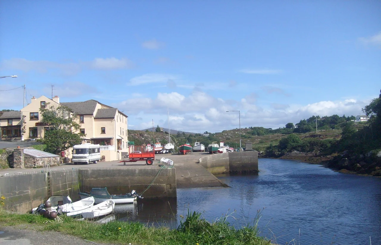

Gweedore
It is sometimes called one of the most densely populated rural areas in Europe, which sounds like a contradiction until you drive through it. Gweedore - *Gaoth Dobhair*, "the aqueous estuary" - is not a town. It is a parish, a Gaeltacht, and a state of mind spread across sixteen miles of west Donegal coastline. The houses are scattered everywhere: pebble-dashed bungalows and farmhouses set into hillsides, hugging the road, looking out over the Atlantic, with the conical mass of Mount Errigal looming over everything from the east. Some 4,065 people live here, and the predominant language they speak with each other is Irish. The schools teach in Irish. The priest preaches in Irish. The roadside ads, by law, are in Irish. This is the largest Irish-speaking district remaining in the country.
An Aqueous Estuary
The name *Gaoth Dobhair* breaks into two old words. *Gaoth* here does not mean wind, as it does in modern Irish; it is an older sense meaning an inlet or arm of the sea. *Dobhar* is an archaic word for water - the same root as in Welsh *dŵr*. The Crolly River cuts through the southern boundary of the parish and forms a sea inlet known as An Ghaoth, the body of water that gives Gweedore its name. The parish stretches sixteen miles north from Crolly to Bloody Foreland - *Cnoc Fola*, named for the colour the cliffs turn when the setting sun catches them - and nine miles east-west from the slopes of Errigal at Dunlewey to the Atlantic at Magheraclogher. Within that area sit Bunbeg, Derrybeg, Brinlack, Dunlewey, parts of Crolly, and dozens of smaller townlands that locals can recite by heart.
The Land War
Gweedore's most populated centuries were also its most desperate. The Plantation of Ulster after 1609 pushed Irish-speaking farmers off fertile land in the Lagan Valley to the rocky boglands of west Donegal, and Gweedore was where many of them stopped because they could go no further. In the 19th century, under landlords like Lord George Hill and his son Arthur, conditions in the parish became notorious. Father James McFadden, parish priest from 1875 to 1901, took on the landlords through the Land League and the Plan of Campaign. The crisis came on Sunday 3 February 1889, when Royal Irish Constabulary District Inspector William Limbrick Martin arrived at Teach Phobail Mhuire church in Derrybeg to arrest Father McFadden after Mass. He drew his sword and rushed the priest. The congregation rushed him. He was killed on the church steps. Forty-three parishioners were arrested. The young lawyer Tim Healy defended them - and wrote about the case forty years later in his memoirs.
Bád Eddie and Bloody Foreland
On Magheraclogher Strand sits a rusting hulk that the locals call Bád Eddie - "Eddie's Boat" - the wreck of the *Cara na Mara* ("Friend of the Sea"), which came ashore for minor repairs in 1977 and never left. The tides have shifted around it for nearly fifty years. Photographers love it. At the northern tip of the parish, Bloody Foreland rises 314 metres above the Atlantic. Its Irish name *Cnoc Fola* - "the hill of blood" - is purely descriptive: at sunset the cliffs of red granite turn a colour that looks startlingly like fresh blood. From the top on a clear evening, you can see Tory Island offshore, Gola and Inishinny much closer, and the whole long sweep of the Donegal coast running south to the Rosses.
Clannad's Pub
Leo's Tavern in Meenaleck, run by Leo Brennan and his wife Baba, is the most famous family pub in Ireland - though calling it that undersells the surrounding family. In 1970, Leo's children Máire, Pól, and Ciarán, together with their twin uncles Pádraig and Noel Duggan, formed a folk-rock band and took their name from *clann as Dobhar* - family from Gweedore. Clannad would sell more than fifteen million records over the next four decades. Leo's youngest daughter, Eithne, briefly joined the band in 1980 before going solo as Enya; her solo record sales have since exceeded eighty million, making her the best-selling Irish solo artist in history. Mairéad Ní Mhaonaigh of Altan grew up in the same parish; her father Proinsias had been a founding member of the local theatre company in 1932. Walk into Leo's any night and locals will still be playing tunes that the Brennan children grew up hearing.
Bilingual Lives
Almost everyone in Gweedore is bilingual, and the result is a hybrid spoken language that lexicographers have studied with fascination. English verbs get Gaelicised by adding the Irish suffix *-ailte* or *-eáilte* - so *wreckailte* means "tired" or "wrecked", as in "I'm wreckailte after the day." Coláiste Bun an Inbhir and the other Irish summer colleges fill the parish every July and August with thousands of teenagers from Dublin, Belfast, and beyond, all sent to live with Irish-speaking families to improve their fluency. The state radio service RTÉ Raidió na Gaeltachta broadcasts two daily programmes and hourly regional news from its studios in Derrybeg. The University of Galway opened an Irish-medium third-level campus here in 2004. The language has not survived in Gweedore as a museum piece. It has survived because it has kept finding ways to do new things.
From the Air
Gweedore covers roughly 55.00-55.16°N, 8.18-8.40°W in west Donegal. Donegal Airport (EIDL) sits at the parish's southern edge at Carrickfinn, the only airport in County Donegal. Mount Errigal (751 m), Donegal's tallest peak, rises sharply 5 nm east-southeast of Bunbeg, with its distinctive white quartzite cone visible from far at sea. The dense scatter of houses across the bogland is unmistakable from the air. Bloody Foreland and Tory Island lie at the parish's northern edge. Best viewed at 2,000-5,000 ft AGL on clear days.
Nearby Stories
- Flight of the Earls 12 km away
- Lifford 16 km away
- SS Devonian (1900) 20 km away
- Donegal Castle 23 km away
- German submarine U-155 (1941) 24 km away
- German submarine U-1233 54 km away
- Easky 63 km away
- RMS Empress of Britain (1930) 69 km away