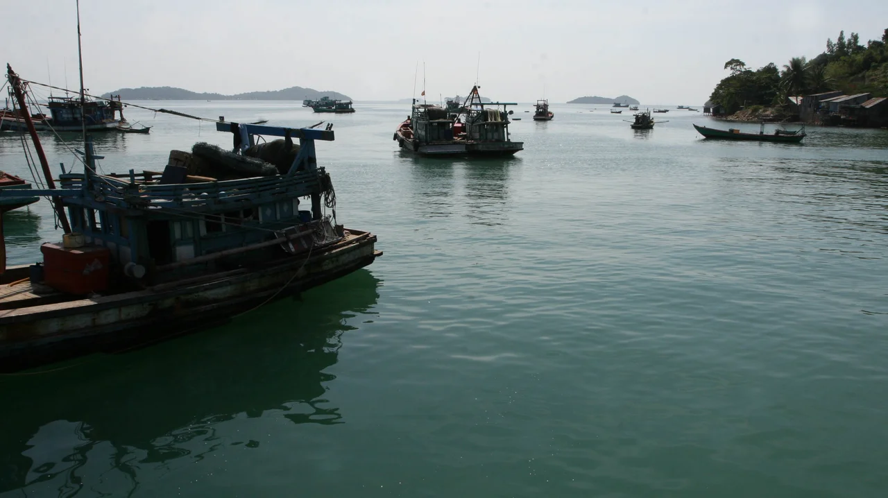

Hà Tiên Islands
Hải Tặc means pirates, and nobody has ever bothered to soften it. On paper this archipelago is Tiên Hải commune, a scatter of low green islands belonging to Hà Tiên in Vietnam's An Giang province. In practice everyone calls it Quần đảo Hải Tặc, the Pirate Islands, and mid-twentieth-century maps of the Gulf of Thailand printed the same idea in French: Îles des Pirates. The name is not tourist-board whimsy grafted on after the fact. It is a description of what actually happened out here for the better part of two centuries.
Sixteen, or Possibly Fourteen
Count the islands and you get sixteen. Some sources insist on fourteen, and the argument turns on how generous you feel about what qualifies as an island rather than a rock with ambitions. None of them rises higher than 100 metres. Together they amount to roughly 11 square kilometres of land, scattered across a rectangle of sea about 5 kilometres by 7, and the largest of them - the only one with a real community on it - is Hòn Đốc. Underfoot the rock is Cretaceous shale and sandstone, which is a geologist's way of saying the ground does not hold water. Fresh water has always been the limiting fact of life here. The archipelago lies about 11 nautical miles off the coast at Hà Tiên, under 10 from the Vietnamese mainland, and 16 east of the big island of Phú Quốc: close enough to the shipping lanes to matter, far enough from anyone's authority to be useful.
The Vacuum That Made Them Famous
In the eighteenth century Hà Tiên was the finest port in the Gulf of Siam, a Chinese-founded principality that had thrown in its lot with the Nguyễn lords. Mạc Thiên Tứ governed it from 1735 into what historians still call its golden age - fortifications, a bureaucracy, a market town, trade moving through the Mekong Delta long before Saigon or Bangkok amounted to much. Then in 1771 the Siamese king Taksin besieged Hà Tiên and took it. Mạc Thiên Tứ fled to Gia Định, returned two years later on Nguyễn support, lost everything again to the Tây Sơn in 1777, and died in a Thonburi prison in 1780 by his own hand. Order left with him. Piracy filled the gap, and the islands offered exactly what raiders needed: broken shorelines to hide behind, channels to ambush from, and a clear view of merchantmen running the China trade. Even after the French took Hà Tiên, the raids continued.
A Stone Facing West
The islands kept the pirate name straight through the twentieth century, including on the maps of South Vietnam, which is a rare instance of a government declining to rebrand. On 28 July 1958 a military mission from the Army of the Republic of Vietnam came ashore, and a sovereignty stele was afterwards raised on the western side of Hòn Đốc. It stands there still. Small stones in contested waters do a great deal of quiet work, and this one has outlasted the state that put it up - a marker planted by a republic that no longer exists, still making its claim into the Gulf. Fishermen pass it every morning without a glance. That is usually how monuments end up: not venerated, just permanent.
Twenty-Two Thousand Tons
Only six or seven of the islands are inhabited at all. When the Vietnamese government formally established the town of Hà Tiên in 1998, it counted 1,055 people out here; by early 2012 that had grown to nearly 1,800 across more than 420 households. Almost all of them fish. In 2011 the archipelago landed 22,000 tons of marine products, and per capita income ran around 48 million đồng - roughly 2,300 US dollars, which in a Vietnamese island commune is a decent living. The old dry-season water crisis, the one written into the sandstone, was finally solved by a freshwater reservoir. Meanwhile the provincial government of Kiên Giang began leasing islands for marine ecotourism in 2007 and 2008, betting that the pirate name would sell. In 2025 Kiên Giang itself was folded into An Giang province, and the islands changed administrative parents without changing a thing about the water.
What the Name Is Worth Now
There is a particular pleasure in a place that never bothered to clean up its reputation. Vietnamese newspapers have been writing buried-treasure stories about the archipelago for years - one 2011 feature called it simply the island that hides gold - and the legend keeps the boats coming. What is actually here is subtler and more interesting. A working fishing community on a handful of shale islands. A stele raised by a government that no longer exists. A reservoir that finally beat the geology. And a name that tells you exactly what these waters were for during the long stretch when nobody was in charge of them.
From the Air
Centred at 10.295°N, 104.326°E in the Gulf of Thailand, roughly 20 nautical miles east of Phú Quốc. Best viewed from 2,000-4,000 ft, where the whole archipelago fits inside a single windscreen: sixteen low islands, none above 100 m, spread across about 5 by 7 km of shallow water, with Hòn Đốc the largest and the only one showing settlement, dock and boat traffic. The Vietnamese mainland coast at Hà Tiên lies about 10 nm northeast, and the Cambodian border and the Kep Archipelago sit just up the coast to the northwest. Nearest airports are Phú Quốc International (VVPQ), about 21 nm southwest, and Rạch Giá (VVRG) to the east. Southwest monsoon from roughly May to October brings haze, low cloud and heavy convective showers; the dry season delivers the clean visibility that shows the reef edges and the pale shallows between islands.
Nearby Stories
- Kampot 9.8 km away
- Lê Văn Duyệt 18 km away
- Kbal Chhay Waterfall 18 km away
- An Thoi Naval Base 24 km away
- Tonle Sap–Mekong Peat Swamp Forests 26 km away
- Koh Ta Kiev 27 km away
- Ba Chuc Massacre 28 km away
- Tho Chau Islands 84 km away