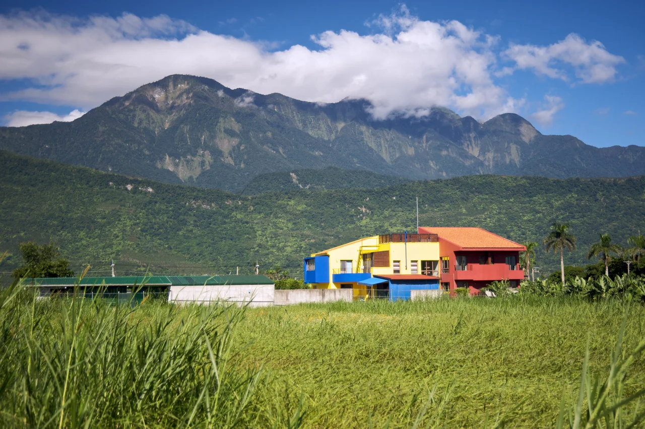

Hai'an Range
Two tectonic plates are currently arguing, and eastern Taiwan is the disputed territory. The Philippine Sea Plate moves northwest at roughly 8 centimeters per year, pressing against the Eurasian Plate in a collision that began millions of years ago and shows no sign of resolution. The Hai'an Range — the Coastal Mountain Range — is one of the consequences: a spine of mountains that runs along Taiwan's eastern shore, still rising, still compressing, still geologically unsettled in ways the scenery only partially reveals.
A Range With Oceanic Roots
The Coastal Mountain Range is geologically unlike the rest of Taiwan's mountains. Where the Central Mountain Range to the west is built largely from metamorphic and sedimentary rocks pushed up by the continent's edge, the Hai'an Range originated as the Luzon Arc — a chain of volcanic islands that formed above a subduction zone in the open Pacific. As the Philippine Sea Plate carried these volcanic islands northwestward into the Eurasian margin, they accreted onto Taiwan's eastern edge rather than subducting beneath it.
The result is a mountain range whose basement is ancient Miocene volcanic rock, overlain by a thick sedimentary sequence — four to six kilometers deep — deposited in deep to shallow marine environments over millions of years. The range is essentially a former island arc now sutured to the side of a continent. Its highest point, Xingangshan, reaches 1,682 meters. No volcanoes are currently active within the range, but the tectonic forces that created it are very much ongoing.
The Valley Between the Ranges
West of the Hai'an Range, between it and the Central Mountain Range, lies the Huadong Valley — one of the most dramatic geographic features in all of Taiwan. This long, flat-floored trough is not a river valley in the ordinary sense; it is a rift created directly by the collision of the two plates, a zone of crustal weakness and active faulting that runs for much of the island's length. Rivers flow through it, and farms occupy its floor, but the underlying ground is in constant slow motion.
The Hai'an Range is converging with the Central Mountain Range at an average rate of 2.3 centimeters per year. To put that in perspective: in a human lifetime, the two ranges move closer by roughly a meter and a half. The peaks themselves rise at about 3 millimeters per year — a pace that sounds negligible until you calculate what it means across geological time. These are not old, settled mountains. They are actively becoming.
Rice Paddies and Rugged Terrain
From a human perspective, the Hai'an Range functions primarily as a wall. It separates the inhabited rift valley from the Pacific coast, concentrating settlement on the valley floor and limiting east-west movement to a handful of passes and coastal roads. The mountains are forested, steep, and receive heavy rainfall on both slopes — conditions that have kept large-scale development at bay.
The communities at the base of the range, from Hualien County south through Taitung County, are among the most culturally distinct in Taiwan. Indigenous Amis and Bunun communities have lived here for centuries, farming the valley floors and fishing the rivers that drain the mountains. The landscape they inhabit — paddies against a mountain backdrop, rivers threading between peaks and sea — has made the Huadong region one of Taiwan's most photographed corridors, celebrated precisely for the juxtaposition of cultivated flatland and wild vertical terrain.
Small Basins, Hidden Corners
Despite its overall ridge-and-slope character, the Hai'an Range contains several small intermontane basins where flat land briefly appears within the mountains themselves. The largest of these is Taiyuan Basin, a relatively protected area where settlement and agriculture have taken hold amid otherwise rugged topography. These pockets of flatness in the hills have historically served as refuges and waypoints, places where communities could establish themselves slightly apart from the main valley corridor.
The range's coastline, where it meets the Pacific on its eastern face, is equally dramatic — a cliffed shore where mountains descend directly to the ocean, broken occasionally by small coves and river mouths. The Huadong Coastal Reserve protects stretches of this shoreline, preserving habitats shaped by the same tectonic restlessness that built the mountains behind them.
From the Air
The Hai'an Range (Coastal Mountain Range) runs along Taiwan's eastern coast between approximately 23.0°N and 24.0°N, centered near 23.3°N, 121.4°E. From the air, the range appears as a distinct dark ridge separating the broad, pale-green patchwork of the Huadong Valley to the west from the Pacific Ocean shoreline to the east. The valley floor is unmistakably flat and agricultural; the range itself is steep, heavily forested, and deeply cut by rivers. Hualien Airport (RCYU) sits at the northern end of this corridor near the coast. Recommended viewing altitude is 3,000–4,000 meters for a full perspective on the valley-range-ocean geometry. Note the active faulting along the valley floor — the landscape is subtle from altitude, but the straight valley edges reveal the underlying plate boundary.
Nearby Stories
- Fengbin 5.7 km away
- Old Donghe Bridge 17 km away
- Xitou Nature Education Area 20 km away
- Lulin Observatory 21 km away
- Chung Li-ho Museum 37 km away
- Twin Forts of Romblon 1162 km away
- Sibuyan Island 1211 km away
- Sinking of MV Sewol 1246 km away